State Line, Mississippi
| State Line, Mississippi | |
|---|---|
| Town | |
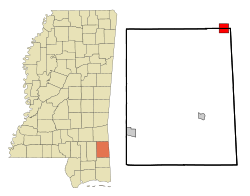 Location of State Line, Mississippi | |
 State Line, Mississippi Location in the United States | |
| Coordinates: 31°26′16″N 88°28′34″W / 31.43778°N 88.47611°WCoordinates: 31°26′16″N 88°28′34″W / 31.43778°N 88.47611°W | |
| Country | United States |
| State | Mississippi |
| Counties | Greene, Wayne |
| Area | |
| • Total | 4.30 sq mi (11.1 km2) |
| • Land | 4.27 sq mi (11.1 km2) |
| • Water | 0.03 sq mi (0.08 km2) |
| Elevation | 253 ft (77 m) |
| Population (2000) | |
| • Total | 555 |
| • Density | 130.1/sq mi (50.2/km2) |
| Time zone | Central (CST) (UTC-6) |
| • Summer (DST) | CDT (UTC-5) |
| ZIP code | 39362 |
| Area code(s) | 601 |
| FIPS code | 28-70320 |
| GNIS feature ID | 0678229 |
State Line is a town in Greene and Wayne counties, Mississippi. The population was 555 at the 2000 census.
History
A post office was established in 1856, and the town incorporated in 1875. State Line was located on the Mobile and Ohio Railroad, built through Mississippi in the 1850s. The next station north was in Eret.[1]
Geography
State Line is located at 31°26′16″N 88°28′34″W / 31.43778°N 88.47611°W (31.437799, -88.476104).[2] The town is on the county line between Wayne County on the north and Greene County on the south, with the town's area approximately equally in both.[3] In the 2000 census, 327 of the town's 555 residents (58.9%) lived in Greene County and 228 (41.1%) in Wayne County.[4]
According to the United States Census Bureau, the town has a total area of 4.30 square miles (11.1 km2), of which 4.27 square miles (11.1 km2) is land and 0.03 square miles (0.078 km2) (0.70%) is water.[5]
Demographics
| Historical population | |||
|---|---|---|---|
| Census | Pop. | %± | |
| 1880 | 97 | — | |
| 1900 | 379 | — | |
| 1910 | 363 | −4.2% | |
| 1930 | 358 | — | |
| 1940 | 542 | 51.4% | |
| 1950 | 492 | −9.2% | |
| 1960 | 653 | 32.7% | |
| 1970 | 598 | −8.4% | |
| 1980 | 484 | −19.1% | |
| 1990 | 395 | −18.4% | |
| 2000 | 555 | 40.5% | |
| 2010 | 565 | 1.8% | |
| Est. 2015 | 556 | [6] | −1.6% |
As of the census[8] of 2000, there were 555 people, 197 households, and 148 families residing in the town. The population density was 130.1 people per square mile (50.2/km²). There were 230 housing units at an average density of 53.9 per square mile (20.8/km²). The racial makeup of the town was 42.70% White, 56.94% African American, and 0.36% from two or more races.
There were 197 households out of which 39.1% had children under the age of 18 living with them, 41.1% were married couples living together, 29.9% had a female householder with no husband present, and 24.4% were non-families. 21.8% of all households were made up of individuals and 9.6% had someone living alone who was 65 years of age or older. The average household size was 2.82 and the average family size was 3.29.
In the town the population was spread out with 34.4% under the age of 18, 11.4% from 18 to 24, 26.8% from 25 to 44, 16.8% from 45 to 64, and 10.6% who were 65 years of age or older. The median age was 28 years. For every 100 females there were 82.6 males. For every 100 females age 18 and over, there were 72.5 males.
The median income for a household in the town was $22,500, and the median income for a family was $27,083. Males had a median income of $26,563 versus $20,625 for females. The per capita income for the town was $9,030. About 28.4% of families and 33.6% of the population were below the poverty line, including 46.9% of those under age 18 and 25.4% of those age 65 or over.
Education
The Wayne County portion of State Line is served by the Wayne County School District. The Greene County portion is served by the Greene County School District.
References
- ↑ Howe, Tony. "State Line, Mississippi". Mississippi Rails. Retrieved March 2014. Check date values in:
|access-date=(help) - ↑ "US Gazetteer files: 2010, 2000, and 1990". United States Census Bureau. 2011-02-12. Retrieved 2011-04-23.
- ↑ American FactFinder Reference Map
- ↑ "Subcounty population estimates: Mississippi 2000-2006" (CSV). United States Census Bureau, Population Division. 2007-06-28. Retrieved 2007-07-21.
- ↑ "Census 2000 U.S. Gazetteer Files: Places". United States Census. Retrieved 2011-02-09.
- ↑ "Annual Estimates of the Resident Population for Incorporated Places: April 1, 2010 to July 1, 2015". Retrieved July 2, 2016.
- ↑ "Census of Population and Housing". Census.gov. Retrieved June 4, 2015.
- ↑ "American FactFinder". United States Census Bureau. Retrieved 2008-01-31.
Municipalities and communities of Greene County, Mississippi, United States | ||
|---|---|---|
| Cities | 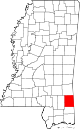 | |
| Unincorporated communities | ||
| Footnotes | ‡This populated place also has portions in an adjacent county or counties | |
Municipalities and communities of Wayne County, Mississippi, United States | ||
|---|---|---|
| Cities |  | |
| Towns | ||
| CDPs | ||
| Other unincorporated communities |
| |
| Ghost town | ||
| Footnotes | ‡This populated place also has portions in an adjacent county or counties | |