Stratton, Nebraska
| Stratton, Nebraska | |
|---|---|
| Village | |
|
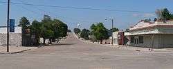
Downtown Stratton: Bailey Street, looking north | |
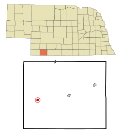 Location of Stratton, Nebraska | |
| Coordinates: 40°8′55″N 101°13′39″W / 40.14861°N 101.22750°WCoordinates: 40°8′55″N 101°13′39″W / 40.14861°N 101.22750°W | |
| Country | United States |
| State | Nebraska |
| County | Hitchcock |
| Area[1] | |
| • Total | 0.43 sq mi (1.11 km2) |
| • Land | 0.43 sq mi (1.11 km2) |
| • Water | 0 sq mi (0 km2) |
| Elevation | 2,802 ft (854 m) |
| Population (2010)[2] | |
| • Total | 343 |
| • Estimate (2012[3]) | 340 |
| • Density | 797.7/sq mi (308.0/km2) |
| Time zone | Central (CST) (UTC-6) |
| • Summer (DST) | CDT (UTC-5) |
| ZIP code | 69043 |
| Area code(s) | 308 |
| FIPS code | 31-47395[4] |
| GNIS feature ID | 0833855[5] |
Stratton is a village in Hitchcock County, Nebraska, United States. The population was 343 at the 2010 census.
History
Stratton sprang up in about 1881 as a depot on the Chicago, Burlington and Quincy Railroad.[6][7] It was named for Mary Stratton, an original owner of the town site.[8]
Geography
Stratton is located at 40°8′55″N 101°13′39″W / 40.14861°N 101.22750°W (40.148653, -101.227529).[9]
According to the United States Census Bureau, the village has a total area of 0.43 square miles (1.11 km2), all of it land.[1]
Demographics
| Historical population | |||
|---|---|---|---|
| Census | Pop. | %± | |
| 1890 | 326 | — | |
| 1900 | 225 | −31.0% | |
| 1910 | 367 | 63.1% | |
| 1920 | 509 | 38.7% | |
| 1930 | 663 | 30.3% | |
| 1940 | 630 | −5.0% | |
| 1950 | 628 | −0.3% | |
| 1960 | 492 | −21.7% | |
| 1970 | 481 | −2.2% | |
| 1980 | 499 | 3.7% | |
| 1990 | 427 | −14.4% | |
| 2000 | 396 | −7.3% | |
| 2010 | 343 | −13.4% | |
| Est. 2015 | 338 | [10] | −1.5% |
2010 census
As of the census[2] of 2010, there were 343 people, 168 households, and 99 families residing in the village. The population density was 797.7 inhabitants per square mile (308.0/km2). There were 217 housing units at an average density of 504.7 per square mile (194.9/km2). The racial makeup of the village was 95.0% White, 0.9% Native American, 0.3% Asian, 0.3% from other races, and 3.5% from two or more races. Hispanic or Latino of any race were 0.9% of the population.
There were 168 households of which 19.6% had children under the age of 18 living with them, 49.4% were married couples living together, 6.0% had a female householder with no husband present, 3.6% had a male householder with no wife present, and 41.1% were non-families. 40.5% of all households were made up of individuals and 25% had someone living alone who was 65 years of age or older. The average household size was 2.04 and the average family size was 2.72.
The median age in the village was 52.5 years. 19.8% of residents were under the age of 18; 4.7% were between the ages of 18 and 24; 16.6% were from 25 to 44; 27.1% were from 45 to 64; and 31.8% were 65 years of age or older. The gender makeup of the village was 49.0% male and 51.0% female.
2000 census
As of the census[4] of 2000, there were 396 people, 174 households, and 116 families residing in the village. The population density was 882.8 people per square mile (339.8/km²). There were 205 housing units at an average density of 457.0 per square mile (175.9/km²). The racial makeup of the village was 97.98% White, 1.26% Native American, 0.25% Asian, and 0.51% from two or more races. Hispanic or Latino of any race were 0.51% of the population.
There were 174 households out of which 24.7% had children under the age of 18 living with them, 59.8% were married couples living together, 5.7% had a female householder with no husband present, and 32.8% were non-families. 31.6% of all households were made up of individuals and 23.6% had someone living alone who was 65 years of age or older. The average household size was 2.28 and the average family size was 2.85.
In the village the population was spread out with 22.7% under the age of 18, 4.5% from 18 to 24, 18.4% from 25 to 44, 25.0% from 45 to 64, and 29.3% who were 65 years of age or older. The median age was 47 years. For every 100 females there were 102.0 males. For every 100 females age 18 and over, there were 87.7 males.
As of 2000 the median income for a household in the village was $25,375, and the median income for a family was $32,656. Males had a median income of $18,500 versus $17,250 for females. The per capita income for the village was $15,139. About 8.4% of families and 12.7% of the population were below the poverty line, including 20.0% of those under age 18 and 9.9% of those age 65 or over.
Notable people
Jim Lankas, American football player.[12]
References
- 1 2 "US Gazetteer files 2010". United States Census Bureau. Retrieved 2012-06-24.
- 1 2 "American FactFinder". United States Census Bureau. Retrieved 2012-06-24.
- ↑ "Population Estimates". United States Census Bureau. Retrieved 2013-05-29.
- 1 2 "American FactFinder". United States Census Bureau. Retrieved 2008-01-31.
- ↑ "US Board on Geographic Names". United States Geological Survey. 2007-10-25. Retrieved 2008-01-31.
- ↑ Burr, George L. (1921). History of Hamilton and Clay Counties, Nebraska, Volume 1. S.J. Clarke Publishing Company. p. 118.
- ↑ "Stratton, Hitchcock County". Center for Advanced Land Management Information Technologies. University of Nebraska. Retrieved 12 August 2014.
- ↑ "Profile for Stratton, NE". ePodunk. Retrieved 12 August 2014.
- ↑ "US Gazetteer files: 2010, 2000, and 1990". United States Census Bureau. 2011-02-12. Retrieved 2011-04-23.
- ↑ "Annual Estimates of the Resident Population for Incorporated Places: April 1, 2010 to July 1, 2015". Retrieved July 2, 2016.
- ↑ "Census of Population and Housing". Census.gov. Retrieved June 4, 2015.
- ↑ Jim Lankas at Pro-Football-reference.com
Municipalities and communities of Hitchcock County, Nebraska, United States | ||
|---|---|---|
| Villages | ||
| Unincorporated community | ||
| Footnotes | ‡This populated place also has portions in an adjacent county or counties | |