Stuart Highway
| Stuart Highway Northern Territory–South Australia | |
|---|---|
 | |
| General information | |
| Type | Highway |
| Length | 2,834 km (1,761 mi) |
| Route number(s) |
|
| Former route number |
|
| Major junctions | |
| North end |
Daly Street, Darwin, Northern Territory 12°27′17″S 130°50′21″E / 12.4546°S 130.8392°E |
| |
| South end |
32°28′49″S 137°45′10″E / 32.4802°S 137.7529°E |
| Location(s) | |
| Major settlements | Katherine, Daly Waters, Tennant Creek, Alice Springs, Coober Pedy |
| Highway system | |
|
Highways in Australia National Highway • Freeways in Australia Highways in the Northern Territory Highways in South Australia | |
| |
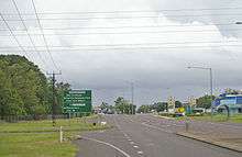
The Stuart Highway is one of Australia's major highways. It runs from Darwin, Northern Territory, in the north, via Tennant Creek and Alice Springs, to Port Augusta, South Australia, in the south – a distance of 2,834 km (1,761 mi). Its northern and southern extremities are segments of Australia's Highway 1. The principal north-south route through the central interior of mainland Australia, the highway is often referred to simply as "The Track".
The highway is named after Scottish explorer John McDouall Stuart, who was the first European to cross Australia from south to north.[1] The highway approximates the route Stuart took.
Route


Northern Territory
The Northern Territory section of the Stuart Highway starts from the edge of the Darwin Central Business District at Daly Street and continues as a dual-carriageway to the Arnhem Highway in Howard Springs. The highway continues 317 km (197 mi) south passing the Kakadu Highway to the Victoria Highway at Katherine. The route number changes from National 1 to National 87. The highway then continues 673 km (418 mi) south passing the Roper Highway, the Carpentaria Highway and the Buchanan Highway to the Barkly Highway at Tennant Creek. The highway continues 508 km (316 mi) south into Alice Springs passing the Plenty Highway. It passes through the Macdonnell Ranges and finally crosses the South Australia/Northern Territory border south of Kulgera.[2] The highway was only fully sealed in the mid-1980s as part of Australia's bicentenary roadworks programme. There are no police patrolling the majority of this remote highway and until the end of 2006 there was no speed limit outside towns and other built-up areas on the Northern Territory part.[3] The bulk of the Northern Territory's population not living in Darwin lies along its track.
South Australia

At the Northern Territory/South Australia border the route number changes from National 87 to National A 87. The Stuart Highway passes through the Far North region to Port Augusta. The highway passes through the Woomera Prohibited Area where travellers may not leave the road. The highway continues south-east towards Adelaide.
There are petrol and other facilities (meals, toilets, etc.) available at reasonable intervals (usually around 200 km (120 mi)) and more frequent rest stops. Some of the rest stops are located at scenic points with information boards, but others are little more than a picnic table and a rubbish bin in the middle of nowhere.
Junctions
| State/Territory | LGA | Location | km | mi | Destinations | Notes |
|---|---|---|---|---|---|---|
| Northern Territory | Darwin | Darwin | 0 | 0.0 | Daly Street, | |
| Litchfield | Humpty Doo | 40 | 25 | |||
| Livingstone | 48 | 30 | ||||
| Victoria Daly | Pine Creek | 226 | 140 | |||
| Katherine | Katherine | 320 | 200 | |||
| | 370 | 230 | ||||
| Roper Gulf | Mataranka | 420 | 260 | |||
| Daly Waters | 620 | 390 | ||||
| Dunmarra | ||||||
| Barkly | Threeways, north of Tennant Creek | 965 | 600 | |||
| Burt Plain | 1,431 | 889 | ||||
| Alice Springs | Alice Springs | 1,499 | 931 | |||
| Erldunda | 1,700 | 1,100 | ||||
| NT/SA border | ||||||
| South Australia | unincorporated area | Marla | ||||
| Coober Pedy | Coober Pedy | |||||
| Port Augusta | Port Augusta West | 32°28′49″S 137°45′10″E / 32.4802°S 137.7529°E | ||||
| 1.000 mi = 1.609 km; 1.000 km = 0.621 mi | ||||||
Speed limits
There was no absolute speed limit in the Northern Territory before 1 January 2007 but maximum speed limits are now posted on some road sections. Drivers, previously, were simply required to drive at a safe speed to suit the conditions. Thus, the Northern Territory section of the Stuart Highway had no speed limits at all.[4] The Northern Territory traffic laws were updated from 1 January 2007 to be similar to the rest of Australia. This included placing a speed limit on all roads (130 km/h or 81 mph on major highways such as the Stuart Highway) and significantly increasing penalties for speeding.[5][6]
The South Australian Section is signposted as 110 km/h (68 mph) outside built-up regions, between Port Augusta and the Northern Territory border.
In October 2013 the NT Government announced a trial period of reverting to an open speed limit on the 200 km (120 mi) stretch between Alice Springs and Barrow Creek, beginning 1 February 2014.[7][8] In September 2015, following the conclusion of the trial, a 276 km (171 mi) stretch of the highway had its speed limits permamently derestricted.[9]
As of 21 November 2016, a speed limit has been reinstated, with the maximum speed now being 130 km/h (81 mph)[10]
Cannonball Run
In 1994 the first and only Cannonball Run in Australia ran from Darwin to Yulara and back again. Based on similar events in the United States, this event ended in tragedy when an out of control Ferrari F40[11] crashed into a checkpoint south of Alice Springs, resulting in the death of the two event officials manning the checkpoint as well as the two competitors.[12] The remainder of the race had a 180 km/h (112 mph) speed limit imposed to prevent further accidents.
Flying Doctors
The Royal Flying Doctor Service uses the highway as an emergency landing strip and sections of the highway are signed to that effect. These sections of highway have been specially selected and prepared for the landing of aircraft which only takes place after the piece of road has been closed by the police.
Disappearance
The highway became the centre of media attention during 2001 after the disappearance and suspected murder of English tourist Peter Falconio while travelling on the road.[13]
World Solar Challenge
Stuart Highway is the highway taken in the World Solar Challenge. The 2013 Bridgestone World Solar Challenge will welcome 42 teams from 24 countries to Australia to take part in what is the world’s largest solar electric vehicle event. The World Solar Challenge starts in Darwin in the Northern Territory and travels the Stuart Highway to Port Augusta and then via Highway 1 to the finish in the City of Adelaide in South Australia – 3000 km. The elite Challenger class is conducted in a single stage from Darwin to Adelaide. Once the teams have left Darwin they must travel as far as they can until 5pm in the afternoon where they make camp in the desert wherever they happen to be. Other classes have different requirements, but all teams must be fully self-sufficient.
During the journey there are 7 mandatory check points where observers are changed and team managers may update themselves with the latest information on the weather and their own position in the field. Here teams may perform the most basic of maintenance only – checking and maintenance of tyre pressure and cleaning of debris from the vehicle.
There are also undisclosed check points which may be imposed by the event officials to ensure regulatory compliance.[14]
See also
- Highways in Australia
- List of highways in the Northern Territory
- List of highways in South Australia
References
- Citations
- ↑ Exploring the Stuart Highway: further than the eye can see, 1997, p. 6
- ↑ "Stuart Highway" (Press release). Australian Towns, Cities and Highways. Retrieved 11 April 2008.
- ↑ Chris Burns (19 November 2004). "Minister Opposes Speedometer Limits" (Press release). Government of the Northern Territory. Retrieved 11 June 2006.
- ↑ "Section 3 The Driving Rules". Road Users' Handbook (PDF). p. 59. ISBN 0-7245-4869-6. Retrieved 11 June 2006.
- ↑ "Speed limits to be introduced on NT open roads". 7:30 Report. ABC. 2 November 2006. Retrieved 5 January 2007.
- ↑ "Motorists caught breaking new speed limit". ABC. 2 January 2007. Retrieved 5 January 2007.
- ↑ "Open speed limit on trial and under fire". The Australian. 16 October 2013. Retrieved 13 December 2013.
- ↑ "Peak medical bodies unite to condemn Northern Territory trial of unlimited road speeds". ABC. 17 January 2014. Retrieved 27 January 2014.
- ↑ Charlwood, Sam (3 September 2015). "NT speed limits permanently derestricted". Drive. Sydney: Fairfax Media. Retrieved 2016-01-18.
- ↑ Hinchliffe, Mark (3 November 2016). "NT restricts speed despite evidence". Australia: Motorbike Rider. Retrieved 2016-12-04.
- ↑ http://www.motorsportmemorial.org/focus.php?db=ct&n=3380
- ↑ Cass, Rebecca (2001). "Cop swaps crooks for corks (page 17)" (PDF). The Drum, 2001: Farewells. Northern Territory Police, Fire and Emergency Services. Archived from the original (pdf) on 7 September 2006. Retrieved 12 June 2006.
- ↑ "Search continues for missing British tourist". Lateline. Australian Broadcasting Corporation. 18 July 2001. Retrieved 24 August 2009.
- ↑ http://www.worldsolarchallenge.org/
- Bibliography
- Exploring the Stuart Highway: further than the eye can see. West Beach, South Australia: Tourist Information Distributors Australia, 1997. ISSN 1326-6039
External links
- Driving Guide by Roderick Eime
- Explorers Way Drive from Adelaide to Darwin
Road infrastructure in South Australia | ||
|---|---|---|
| Freeways | ||
| Interstate highways | ||
| State highways | ||
| Arterial roads |
| |
| Outback tracks | ||
Road infrastructure in Northern Territory | ||
|---|---|---|
| National highways | ||
| Highways | ||
| Major urban roads | ||
| Outback tracks and numbered state routes | ||
Coordinates: 22°51′29″S 133°27′48″E / 22.8580°S 133.4632°E