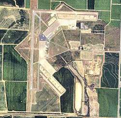
Stuttgart Municipal Airport
| Stuttgart Municipal Airport | |||||||||||||||
|---|---|---|---|---|---|---|---|---|---|---|---|---|---|---|---|
|
2006 USGS aerial image | |||||||||||||||
| IATA: SGT – ICAO: KSGT – FAA LID: SGT | |||||||||||||||
| Summary | |||||||||||||||
| Airport type | Public | ||||||||||||||
| Owner | City of Stuttgart | ||||||||||||||
| Serves | Stuttgart, Arkansas | ||||||||||||||
| Location | Roc Roe Township, Prairie County | ||||||||||||||
| Elevation AMSL | 224 ft / 68 m | ||||||||||||||
| Coordinates | 34°35′58″N 091°34′30″W / 34.59944°N 91.57500°W | ||||||||||||||
| Map | |||||||||||||||
 KSGT Location | |||||||||||||||
| Runways | |||||||||||||||
| |||||||||||||||
| Statistics (2008) | |||||||||||||||
| |||||||||||||||
- for the airport's World War II history, see Stuttgart Army Airfield
Stuttgart Municipal Airport (IATA: SGT, ICAO: KSGT, FAA LID: SGT) is in Prairie County, Arkansas.[1] It is eight miles north of Stuttgart, which owns the airport[1] and is the county seat of Arkansas County. The FAA's National Plan of Integrated Airport Systems for 2009–2013 categorized as a general aviation facility.[2]
History
Stuttgart Municipal Airport dates to 1942 when it was built by the United States Army Air Forces. It was used as an advanced twin-engine flying school and glider training.[3] With the end of World War II, Stuttgart Army Airfield was declared excess and closed on 5 August 1946.[3] It was conveyed though the War Assets Administration (WAA) to the City of Stuttgart to establish a municipal airport.[3]
Airline flights (Trans-Texas DC-3s) ended in 1958-59.
Facilities
Stuttgart Municipal Airport covers 2,560 acres (1,040 ha) at an elevation of 224 feet (68 m). It has two runways: 9/27 is 5,002 by 150 feet (1,525 x 46 m) concrete; 18/36 is 6,015 by 100 feet (1,833 x 30 m) asphalt.[1]
In the year ending June 30, 2008 the airport had 40,200 aircraft operations, average 110 per day: 87% general aviation, 7.5% military, and 5.5% air taxi. 34 aircraft were then based at the airport: 82% single-engine, 12% multi-engine, 3% jet and 3% helicopter.[1]
Motorsports
A 3-mile (4.8 km) SCCA road course used the runways, with the first race in 1959. The last sports car race was in 1978. A drag strip, Stuttgart Dragway, existed from 1970 to 1972.[4]
References
- 1 2 3 4 5 FAA Airport Master Record for SGT (Form 5010 PDF). Federal Aviation Administration. Effective 3 June 2010.
- ↑ National Plan of Integrated Airport Systems for 2009–2013: Appendix A: Part 1 (PDF, 1.33 MB). Federal Aviation Administration. Updated 15 October 2008.
- 1 2 3 Stuttgart Army Air Field, Encyclopedia of Arkansas History and Culture
- ↑ NA Motorsports: Stuttgart AFB
External links
- Stuttgart Municipal Airport
- Google Maps Page of Stuttgart AFB. Features layout of 2.6-mile (4.2 km) road course.
- FAA Terminal Procedures for SGT, effective December 8, 2016
- Resources for this airport:
- FAA airport information for SGT
- AirNav airport information for KSGT
- ASN accident history for SGT
- FlightAware airport information and live flight tracker
- NOAA/NWS latest weather observations
- SkyVector aeronautical chart, Terminal Procedures
