Sugartit, Kentucky
| Sugartit, Kentucky | |
|---|---|
| Former settlement | |
 Sugartit, Kentucky | |
| Coordinates: 38°58′22″N 84°39′46″W / 38.97278°N 84.66278°WCoordinates: 38°58′22″N 84°39′46″W / 38.97278°N 84.66278°W | |
| Country | United States |
| State | Kentucky |
| County | Boone |
| Elevation | 794 ft (242 m) |
| Time zone | Eastern (EST) (UTC-5) |
| • Summer (DST) | EDT (UTC-4) |
| GNIS feature ID | 504705[1] |
Sugartit (also known as Gunpowder)[2] is a former community in Boone County, Kentucky, United States. It was located at the intersection of U.S. Route 42 and Kentucky Route 237 between the cities of Florence and Union.[3] Sugartit has been noted for its unusual place name.[4]
According to one account, the community received its name when the local men would spend all day at its general store and return home late for dinner; their wives would remark that they "had to have a sugartit at the store".[2] The community no longer exists; the last surviving structure was the Sugartit Asphalt factory.[5]
References
- ↑ "Sugartit". Geographic Names Information System. United States Geological Survey.
- 1 2 Tenkotte, Paul A.; James C. Claypool (2009). Encyclopedia of Northern Kentucky. University Press of Kentucky.
- ↑ State Primary Road System: Boone County (PDF) (Map). Kentucky Transportation Cabinet. 2011. Retrieved June 20, 2012.
- ↑ Strecker, Zoe; Finch, Jackie Sheckler (1 July 2009). Kentucky Off the Beaten Path. Rowman & Littlefield. p. 11. ISBN 978-0-7627-5790-9.
- ↑ "Union, Kentucky: Town Name Sugartit". RoadsideAmerica.com. Retrieved June 20, 2012.
Municipalities and communities of Boone County, Kentucky, United States | ||
|---|---|---|
| Cities | 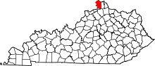 | |
| CDPs | ||
| Unincorporated Communities | ||
| Ghost town | ||
| Footnotes | ‡This populated place also has portions in an adjacent county or counties. | |
This article is issued from Wikipedia - version of the 11/1/2016. The text is available under the Creative Commons Attribution/Share Alike but additional terms may apply for the media files.