Verona, Kentucky
| Verona, Kentucky | |
|---|---|
| Census-designated place (CDP) | |
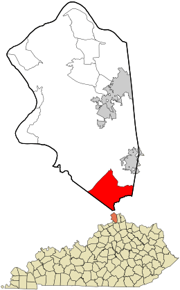 Location within Boone County and the state of Kentucky | |
| Coordinates: 38°49′5″N 84°39′38″W / 38.81806°N 84.66056°WCoordinates: 38°49′5″N 84°39′38″W / 38.81806°N 84.66056°W | |
| Country | United States |
| State | Kentucky |
| County | Boone |
| Area | |
| • Total | 12.3 sq mi (31.9 km2) |
| • Land | 12.2 sq mi (31.7 km2) |
| • Water | 0.08 sq mi (0.2 km2) |
| Elevation | 900 ft (300 m) |
| Population (2010) | |
| • Total | 1,455 |
| • Density | 119/sq mi (45.9/km2) |
| Time zone | Eastern (EST) (UTC-5) |
| • Summer (DST) | EDT (UTC-4) |
| ZIP code | 41092 |
| Area code(s) | 859 |
| FIPS code | 21-79464 |
| GNIS feature ID | 0506026 |
Verona is an unincorporated community and census-designated place (CDP) in Boone County, Kentucky, United States. The population was 1,455 at the 2010 census.[1]
Geography
The Verona CDP occupies the southern corner of Boone County, bordered by Interstate 71 to the northwest, by the Gallatin County line to the southwest, and by the Grant County line, following Bullock Pen Creek, to the south. The original hamlet of Verona is located at the intersection of Kentucky Routes 14 and 16, but the CDP includes a larger rural area surrounding the hamlet. It is 6 miles (10 km) northeast along Routes 14/16 to Walton and 27 miles (43 km) north to downtown Cincinnati.
According to the United States Census Bureau, Verona has a total area of 12.3 square miles (31.9 km2), of which 12.2 square miles (31.7 km2) is land and 0.077 square miles (0.2 km2), or 0.76%, is water.[1]
References
- 1 2 "Geographic Identifiers: 2010 Demographic Profile Data (G001): Verona CDP, Kentucky". U.S. Census Bureau, American Factfinder. Retrieved November 21, 2013.
Municipalities and communities of Boone County, Kentucky, United States | ||
|---|---|---|
| Cities |  | |
| CDPs | ||
| Unincorporated Communities | ||
| Ghost town | ||
| Footnotes | ‡This populated place also has portions in an adjacent county or counties. | |