Boone County, Kentucky
| Boone County, Kentucky | |
|---|---|
 The old Boone County courthouse in Burlington | |
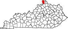 Location in the U.S. state of Kentucky | |
 Kentucky's location in the U.S. | |
| Founded | 1798 |
| Named for | Daniel Boone |
| Seat | Burlington |
| Largest city | Florence |
| Area | |
| • Total | 256 sq mi (663 km2) |
| • Land | 246 sq mi (637 km2) |
| • Water | 10 sq mi (26 km2), 3.9% |
| Population | |
| • (2010) | 118,811 |
| • Density | 349/sq mi (135/km²) |
| Congressional district | 4th |
| Time zone | Eastern: UTC-5/-4 |
| Website |
www |
Boone County is a county located in the U.S. state of Kentucky. As of the 2010 census, the population was 118,811,[1] making it the fourth-most populous county in Kentucky. Its county seat is Burlington.[2] The county was formed in 1798 from part of Campbell County.[3] and was named for frontiersman Daniel Boone.[4]
Boone County is part of the Cincinnati-Middletown, OH-KY-IN Metropolitan Statistical Area. It is the location of the Cincinnati/Northern Kentucky International Airport, which serves Cincinnati and the tri-state area and was the former headquarters of Comair.
History
Native Americans left a large late historic village in Petersburg that contained "at least two periods of habitation dating to 1150 A.D. and 1400 A.D."[5]
An unnamed Frenchman in 1729 drew an area on his chart where Big Bone Lick State Park in modern-day Boone County exists with a French inscription that translates to "where they found the bones of an elephant."[5] Later on, another Frenchman, Charles le Moyne de Longueuil (1687–1755) would be credited with investigating the Big Bone Lick area.[5]
In 1789, 10-year-old John Tanner was captured by Shawnee Indians in Boone County, across from the mouth of the Great Miami River, while his Presbyterian minister father, brother, and their slaves were planting corn.
Boone County was founded in 1798, and named after Daniel Boone.
Margaret Garner
On January 28, 1856, Robert and a pregnant Margaret "Peggy" Garner, together with family members, escaped and fled to Cincinnati, Ohio, along with several other slave families. Seventeen people were reported to have been in their party. In the coldest winter in 60 years, the Ohio River had frozen. The group crossed the ice just west of Covington, Kentucky at daybreak, and escaped to Cincinnati, then divided to avoid detection. They set out for Joseph Kite's house in Cincinnati.[6]
Margaret Garner would become famous for slitting her own daughter's throat (Mary) to prevent her from going back into slavery when Archibald K. Gaines and his posse, along with Federal Marshals, caught up to the fleeing slaves at Joseph Kite's house.[6]
Margaret Garner was first owned by, and may have been the daughter of, the plantation owner John Pollard Gaines himself.[7] In December 1849, the plantation was sold along with all the slaves to John P. Gaines' younger brother, Archibald K. Gaines.[7] The Gaines family lived on a farm called Maplewood in Boone County, Kentucky, just west of Richwood Presbyterian Church, of which Archibald K. Gaines was a member.[8] 3 of Margaret Garner's children, including Mary, the daughter whose throat Margaret Garner slashed, were likely the children of Archibald K. Gaines, the only adult white male at Maplewood. The timing suggests they were each conceived after his wife had become pregnant and was unavailable to him.[9]
Margaret Garner's story was the inspiration for the novel Beloved (1987) by Nobel Prize winner Toni Morrison (that later was adapted into a film of the same name starring Oprah Winfrey), as well as for her libretto for the early 21st century opera Margaret Garner (2005), composed by Richard Danielpour.
Geography
According to the U.S. Census Bureau, the county has a total area of 256 square miles (660 km2), of which 246 square miles (640 km2) is land and 10 square miles (26 km2) (3.9%) is water.[10] Its location along the Ohio River was key to its early development, as the river was the major transportation route.
Adjacent counties
- Hamilton County, Ohio (north)
- Kenton County (east)
- Grant County (south)
- Gallatin County (southwest)
- Switzerland County, Indiana (west)
- Ohio County, Indiana (west)
- Dearborn County, Indiana (northwest)
Demographics
| Historical population | |||
|---|---|---|---|
| Census | Pop. | %± | |
| 1800 | 1,534 | — | |
| 1810 | 3,608 | 135.2% | |
| 1820 | 6,542 | 81.3% | |
| 1830 | 9,075 | 38.7% | |
| 1840 | 10,034 | 10.6% | |
| 1850 | 11,185 | 11.5% | |
| 1860 | 11,196 | 0.1% | |
| 1870 | 10,696 | −4.5% | |
| 1880 | 11,996 | 12.2% | |
| 1890 | 12,246 | 2.1% | |
| 1900 | 11,170 | −8.8% | |
| 1910 | 9,420 | −15.7% | |
| 1920 | 9,572 | 1.6% | |
| 1930 | 9,595 | 0.2% | |
| 1940 | 10,820 | 12.8% | |
| 1950 | 13,015 | 20.3% | |
| 1960 | 21,940 | 68.6% | |
| 1970 | 32,812 | 49.6% | |
| 1980 | 45,842 | 39.7% | |
| 1990 | 57,589 | 25.6% | |
| 2000 | 85,991 | 49.3% | |
| 2010 | 118,811 | 38.2% | |
| Est. 2015 | 127,712 | [11] | 7.5% |
| U.S. Decennial Census[12] 1790-1960[13] 1900-1990[14] 1990-2000[15] 2010-2013[1] | |||
As of the census[16] of 2000, there were 85,991 people, 31,258 households, and 23,443 families residing in the county. The population density was 349 per square mile (135/km2). There were 33,351 housing units at an average density of 135 per square mile (52/km2). The racial makeup of the county was 95.15% White, 1.52% Black or African American, 0.23% Native American, 1.29% Asian, 0.03% Pacific Islander, 0.75% from other races, and 1.03% from two or more races. 1.98% of the population were Hispanic or Latino of any race.
There were 31,258 households out of which 39.80% had children under the age of 18 living with them, 61.60% were married couples living together, 9.80% had a female householder with no husband present, and 25.00% were non-families. 20.20% of all households were made up of individuals and 6.20% had someone living alone who was 65 years of age or older. The average household size was 2.73 and the average family size was 3.17.
In the county the population was spread out with 28.70% under the age of 18, 8.50% from 18 to 24, 33.50% from 25 to 44, 21.30% from 45 to 64, and 8.10% who were 65 years of age or older. The median age was 33 years. For every 100 females there were 97.70 males. For every 100 females age 18 and over, there were 94.70 males.
The median income for a household in the county was $53,593, and the median income for a family was $61,114. Males had a median income of $42,105 versus $27,414 for females. The per capita income for the county was $23,535. About 4.40% of families and 5.60% of the population were below the poverty line, including 6.40% of those under age 18 and 7.70% of those age 65 or over.
Economy
Boone County is the location of the Cincinnati/Northern Kentucky International Airport, which includes the headquarters of DHL Express, Southern Air and Delta Private Jets.[17][18]
Major attractions
The Creation Museum (Petersburg), operated by the apologetics ministry Answers in Genesis, as well as Big Bone Lick State Park, "birthplace of American paleontology," are located in Boone County.[19]
Communities
Cities
Census-designated places
- Burlington (county seat)
- Oakbrook
Unincorporated communities
See also
- Abner Gaines House
- Big Bone Lick State Park
- Boone County Arboretum
- Dinsmore Homestead
- East Bend, Kentucky
- National Register of Historic Places listings in Boone County, Kentucky
- Richwood Presbyterian Church
References
- 1 2 "State & County QuickFacts". United States Census Bureau. Retrieved March 5, 2014.
- ↑ "Find a County". National Association of Counties. Archived from the original on 2011-05-31. Retrieved 2011-06-07.
- ↑ Collins, Lewis (1882). Collins' Historical Sketches of Kentucky: History of Kentucky, Volume 2. Collins & Company. p. 26.
- ↑ The Register of the Kentucky State Historical Society, Volume 1. Kentucky State Historical Society. 1903. p. 34.
- 1 2 3 "Archived copy". Archived from the original on August 11, 2014. Retrieved October 4, 2014.
- 1 2 "Margaret Garner Incident (1856) | The Black Past: Remembered and Reclaimed". The Black Past. Retrieved 2016-04-12.
- 1 2 Steven Weisenburger, "A Historical Margaret Garner", Michigan Opera Theatre, accessed 20 Apr 2009
- ↑ "Richwood, Kentucky". Nkyviews.com. Retrieved 2016-04-12.
- ↑ Steven Weisenburger, "A Historical Margaret Garner", Michigan Opera Theatre, accessed 20 Apr 2009. "Bertram Wyatt-Brown reminds us, Southern men commonly referred to their pregnant wives' last trimester or so when they were sexually unavailable as "the gander months" because it was supposedly natural, and to some extent informally countenanced, for them to seek intimate "comfort" with unmarried women or with enslaved women, if they owned any."
- ↑ "2010 Census Gazetteer Files". United States Census Bureau. August 22, 2012. Retrieved August 12, 2014.
- ↑ "County Totals Dataset: Population, Population Change and Estimated Components of Population Change: April 1, 2010 to July 1, 2015". Retrieved July 2, 2016.
- ↑ "U.S. Decennial Census". United States Census Bureau. Archived from the original on May 11, 2015. Retrieved August 12, 2014.
- ↑ "Historical Census Browser". University of Virginia Library. Retrieved August 12, 2014.
- ↑ "Population of Counties by Decennial Census: 1900 to 1990". United States Census Bureau. Retrieved August 12, 2014.
- ↑ "Census 2000 PHC-T-4. Ranking Tables for Counties: 1990 and 2000" (PDF). United States Census Bureau. Retrieved August 12, 2014.
- ↑ "American FactFinder". United States Census Bureau. Archived from the original on 2013-09-11. Retrieved 2008-01-31.
- ↑ "Career Area." Comair. Retrieved on May 19, 2009.
- ↑ "Contact Us." Delta Private Jets. Retrieved on October 3, 2010.
- ↑ "HomeTownLocator". Hometownlocator.com. Retrieved 2006-06-10.
External links
- Boone County government's website
- Historical Images and Texts of Boone County, Kentucky
- Boone County Library's Local History website
- Kentucky Historical Markers in Boone County
Municipalities and communities of Boone County, Kentucky, United States | ||
|---|---|---|
| Cities | | |
| CDPs | ||
| Unincorporated Communities | ||
| Ghost town | ||
| Footnotes | ‡This populated place also has portions in an adjacent county or counties. | |

Coordinates: 38°58′N 84°44′W / 38.97°N 84.73°W