Sultanbeyli
| Sultanbeyli | |
|---|---|
| district | |
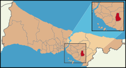 Location of Sultanbeyli in Istanbul | |
 Sultanbeyli Location of Sultanbeyli in Istanbul | |
| Coordinates: 41°11′00″N 28°59′00″E / 41.18333°N 28.98333°ECoordinates: 41°11′00″N 28°59′00″E / 41.18333°N 28.98333°E | |
| Country | Turkey |
| City | Istanbul |
| Government | |
| • Mayor | Hüseyin Keskin (AKP) |
| • Governor | Mehmet Ceylan |
| Area[1] | |
| • District | 23.61 km2 (9.12 sq mi) |
| Elevation | 130 m (430 ft) |
| Population (2012)[2] | |
| • District | 302,388 |
| • District density | 13,000/km2 (33,000/sq mi) |
| Time zone | EET (UTC+2) |
| • Summer (DST) | EEST (UTC+3) |
| Area code(s) | 0-216 |
| Website |
www |
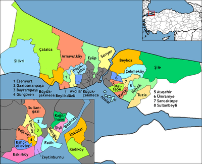
Sultanbeyli (pronounced [sulˈtanbejli]) is a working class suburb of Istanbul, Turkey on the Asian side, inland from Kartal and Pendik. It has a population of 298,143 as of 2011, more than triple the 1990 figure of 82,298. The mayor is Hüseyin Keskin of the AKP. Its neighbours are Sancaktepe from west, Pendik from east and Kartal from northwest.
History
Until recently Sultanbeyli was farmland. During the 1940s and 1950s large land holdings of the Ottoman period were parcelized for the settlement Turkishs migrants from Bulgaria. A village was built in the 1950s on one of the main highways connecting Istanbul to hinterland. It was part of Kartal district till 1992.
See also
References
- ↑ "Area of regions (including lakes), km²". Regional Statistics Database. Turkish Statistical Institute. 2002. Retrieved 2013-03-05.
- ↑ "Population of province/district centers and towns/villages by districts - 2012". Address Based Population Registration System (ABPRS) Database. Turkish Statistical Institute. Retrieved 2013-02-27.
This article is issued from Wikipedia - version of the 9/28/2016. The text is available under the Creative Commons Attribution/Share Alike but additional terms may apply for the media files.