Sumter County, Georgia
| Sumter County, Georgia | |
|---|---|
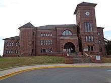 Sumter County Courthouse in Americus | |
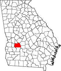 Location in the U.S. state of Georgia | |
 Georgia's location in the U.S. | |
| Founded | December 26, 1831 |
| Named for | Thomas Sumter |
| Seat | Americus |
| Largest city | Americus |
| Area | |
| • Total | 493 sq mi (1,277 km2) |
| • Land | 483 sq mi (1,251 km2) |
| • Water | 10 sq mi (26 km2), 2.0% |
| Population (est.) | |
| • (2015) | 30,779 |
| • Density | 68/sq mi (26/km²) |
| Congressional district | 2nd |
| Time zone | Eastern: UTC-5/-4 |
| Website |
www |
Sumter County is a county located in the west central portion of the U.S. state of Georgia. As of the 2010 census, the population was 32,819.[1] The county seat is Americus.[2] The county was created on December 26, 1831.
Sumter County is part of the Americus, GA Micropolitan Statistical Area.
History
Foundation and antebellum years
Sumter County was established by an act of the state legislature on December 26, 1831, four years after the Creek Indians vacated the region when the state acquired the territory from them in the 1825 Treaty of Indian Springs. Sumter, the state's eightieth county, was created after population increases by a division of Lee County, now situated to its south. The county was named for former General and United States senator Thomas Sumter (1734–1832) of South Carolina.[3] when the county was organized, Sumter was ninety-seven years old and the last surviving general of the American Revolution (1775–83).
Shortly thereafter, a committee chose a central site for the county seat and laid out what would become the town of Americus. Many of the county's earliest white residents acquired their land through an 1827 state land lottery. Like many other white settlers, they quickly developed their property for cotton cultivation. Since the invention of the cotton gin at the end of the 18th century, short-staple cotton was the type of choice throughout the Black Belt of the South.
The rich black soil, combined with ready market access via the Flint River (bordering the county on the east) or the Chattahoochee River (farther west), made Sumter among the state's most prosperous Black Belt counties by the 1840s and 1850s. Cotton agriculture was economically dependent on enslaved African Americans. By the 1850 census, the demographic makeup of the county had become 6,469 whites, 3,835 slaves, and 18 free people of color. By the 1860 census, there were 4,536 whites, 4,890 slaves and 2 free people of color.
Civil War years
During the American Civil War (1861–65), the small village named Andersonville, nine miles (14 km) north of Americus on the county's northern edge, was selected by Confederate authorities as the site for a prisoner-of-war camp. The Andersonville prison was built in neighboring Macon County and became the largest such prison in the South. During the camp's fourteen months of operations, some 45,000 Union prisoners suffered some of the worst conditions and highest casualties of any of the camps. Today the Andersonville National Historic Site serves as a memorial to all American prisoners of war throughout the nation's history. The 495-acre (2.00 km2) park lies in both Macon and Sumter counties and consists of the historic prison site and the National Cemetery, which originally was reserved for the Union dead.
Into modernity
Other areas of the county have attracted national attention in the twentieth century for very different reasons. In 1942 two Baptist ministers chose a farm in the western part of the county as the location for a Christian commune named Koinonia, where black and white workers lived and worked together for nearly fifty years, generating some hostility among local residents during its early years.
Sumter County counts a U.S. president among its native sons. Jimmy Carter was born and raised on a peanut farm in Plains, a small community on the county's western edge. His election to the presidency in 1976 brought the small town considerable attention from journalists and tourists, which it continues to receive as the former president and his wife, and much of their family, still make Plains their home. Carter's birthplace and childhood home has been designated a National Historic Site and is open for tours.
The headquarters of Habitat for Humanity International, a nonprofit organization whose mission is to eliminate homelessness, is located in Americus, the home of its founder, Millard Fuller. In addition to Habitat's socially impactful activities, Koinonia Partners publishes a bimonthly newsletter for the Prison and Jail Project promoting prisoner reform and education. Americus is also home to two colleges: Georgia Southwestern State University, a public four-year institution established in 1906, is part of the University System of Georgia. South Georgia Technical College, which stands near Souther Field, was a training base for American and British aviators during World War I (1917–18). Charles Lindbergh learned to fly here and assembled a military surplus "Jenny" aircraft with the help of mechanics at Souther Field. Downtown Americus boasts two prominent examples of historic restoration: the Windsor Hotel, built in 1892, and the Rylander Theatre, which originally opened in 1921.
Geography
According to the U.S. Census Bureau, the county has a total area of 493 square miles (1,280 km2), of which 483 square miles (1,250 km2) is land and 10 square miles (26 km2) (2.0%) is water.[4]
Muckalee Creek flows through Sumter County, which also contains Lake Blackshear and Kinchafoonee Creek.
The western two-thirds of Sumter County, from northeast of Americus to southwest of Leslie, is located in the Kinchafoonee-Muckalee sub-basin of the ACF River Basin (Apalachicola-Chattahoochee-Flint River Basin). The eastern third of the county is located in the Middle Flint River sub-basin of the same ACF River Basin.[5]
Major highways
Adjacent counties
- Macon County (northeast)
- Dooly County (east)
- Crisp County (southeast)
- Lee County (south)
- Terrell County (southwest)
- Webster County (west)
- Marion County (northwest)
- Schley County (north)
National protected areas
Demographics
| Historical population | |||
|---|---|---|---|
| Census | Pop. | %± | |
| 1840 | 5,759 | — | |
| 1850 | 10,322 | 79.2% | |
| 1860 | 9,428 | −8.7% | |
| 1870 | 16,559 | 75.6% | |
| 1880 | 18,239 | 10.1% | |
| 1890 | 22,107 | 21.2% | |
| 1900 | 26,212 | 18.6% | |
| 1910 | 29,092 | 11.0% | |
| 1920 | 29,640 | 1.9% | |
| 1930 | 26,800 | −9.6% | |
| 1940 | 24,502 | −8.6% | |
| 1950 | 24,208 | −1.2% | |
| 1960 | 24,652 | 1.8% | |
| 1970 | 26,931 | 9.2% | |
| 1980 | 29,360 | 9.0% | |
| 1990 | 30,228 | 3.0% | |
| 2000 | 33,200 | 9.8% | |
| 2010 | 32,819 | −1.1% | |
| Est. 2015 | 30,779 | [6] | −6.2% |
| U.S. Decennial Census[7] 1790-1960[8] 1900-1990[9] 1990-2000[10] 2010-2013[1] | |||
2000 census
As of the census[11] of 2000, there were 33,200 people, 12,025 households, and 8,501 families residing in the county. The population density was 68 people per square mile (26/km²). There were 13,700 housing units at an average density of 28 per square mile (11/km²). The racial makeup of the county was 48.22% White, 49.02% Black or African American, 0.30% Native American, 0.59% Asian, 0.02% Pacific Islander, 1.26% from other races, and 0.59% from two or more races. 2.68% of the population were Hispanic or Latino of any race.
There were 12,025 households out of which 34.50% had children under the age of 18 living with them, 44.50% were married couples living together, 22.00% had a female householder with no husband present, and 29.30% were non-families. 25.00% of all households were made up of individuals and 8.90% had someone living alone who was 65 years of age or older. The average household size was 2.64 and the average family size was 3.15.
In the county the population was spread out with 27.80% under the age of 18, 11.90% from 18 to 24, 27.40% from 25 to 44, 20.60% from 45 to 64, and 12.30% who were 65 years of age or older. The median age was 33 years. For every 100 females there were 88.20 males. For every 100 females age 18 and over, there were 81.90 males.
The median income for a household in the county was $30,904, and the median income for a family was $35,379. Males had a median income of $27,828 versus $20,439 for females. The per capita income for the county was $15,083. About 17.60% of families and 21.40% of the population were below the poverty line, including 32.30% of those under age 18 and 16.80% of those age 65 or over.
2010 census
As of the 2010 United States Census, there were 32,819 people, 12,123 households, and 8,153 families residing in the county.[12] The population density was 68.0 inhabitants per square mile (26.3/km2). There were 13,909 housing units at an average density of 28.8 per square mile (11.1/km2).[13] The racial makeup of the county was 51.8% black or African American, 42.2% white, 1.3% Asian, 0.3% American Indian, 0.1% Pacific islander, 3.2% from other races, and 1.2% from two or more races. Those of Hispanic or Latino origin made up 5.2% of the population.[12] In terms of ancestry, 7.3% were American, 6.6% were English, and 5.8% were Irish.[14]
Of the 12,123 households, 35.0% had children under the age of 18 living with them, 39.4% were married couples living together, 23.0% had a female householder with no husband present, 32.7% were non-families, and 27.6% of all households were made up of individuals. The average household size was 2.55 and the average family size was 3.11. The median age was 33.8 years.[12]
The median income for a household in the county was $32,430 and the median income for a family was $41,371. Males had a median income of $33,676 versus $27,247 for females. The per capita income for the county was $17,436. About 21.7% of families and 26.9% of the population were below the poverty line, including 37.8% of those under age 18 and 14.1% of those age 65 or over.[15]
Economy
Sumter remains largely a rural county. According to USDA/Georgia Agricultural Statistics Service 2001 figures, cotton remains its major crop, with up to 35,000 acres (140 km2) under cultivation, followed by wheat, peanuts, and corn, which combined approximately equal the county's acreage in cotton.
Major employers include Cooper Lighting, Georgia Southwestern State University, Magnolia Manor, Phoebe Sumter Medical Center, and Wal-Mart.[16]
Communities
See also
References
- This article incorporates material written by John C. Inscoe of the University of Georgia for the New Georgia Encyclopedia ("NGE"), posted or last updated January 2, 2008. All derived works must credit the NGE and the original author.
- 1 2 "State & County QuickFacts". United States Census Bureau. Retrieved June 26, 2014.
- ↑ "Find a County". National Association of Counties. Retrieved 2011-06-07.
- ↑ Hellmann, Paul T. (May 13, 2013). Historical Gazetteer of the United States. Routledge. p. 216. Retrieved 30 November 2013.
- ↑ "US Gazetteer files: 2010, 2000, and 1990". United States Census Bureau. 2011-02-12. Retrieved 2011-04-23.
- ↑ "Georgia Soil and Water Conservation Commission Interactive Mapping Experience". Georgia Soil and Water Conservation Commission. Retrieved 2015-11-24.
- ↑ "County Totals Dataset: Population, Population Change and Estimated Components of Population Change: April 1, 2010 to July 1, 2015". Retrieved July 2, 2016.
- ↑ "U.S. Decennial Census". United States Census Bureau. Retrieved June 26, 2014.
- ↑ "Historical Census Browser". University of Virginia Library. Retrieved June 26, 2014.
- ↑ "Population of Counties by Decennial Census: 1900 to 1990". United States Census Bureau. Retrieved June 26, 2014.
- ↑ "Census 2000 PHC-T-4. Ranking Tables for Counties: 1990 and 2000" (PDF). United States Census Bureau. Retrieved June 26, 2014.
- ↑ "American FactFinder". United States Census Bureau. Retrieved 2008-01-31.
- 1 2 3 "DP-1 Profile of General Population and Housing Characteristics: 2010 Demographic Profile Data". United States Census Bureau. Retrieved 2015-12-30.
- ↑ "Population, Housing Units, Area, and Density: 2010 - County". United States Census Bureau. Retrieved 2015-12-30.
- ↑ "DP02 SELECTED SOCIAL CHARACTERISTICS IN THE UNITED STATES – 2006-2010 American Community Survey 5-Year Estimates". United States Census Bureau. Retrieved 2015-12-30.
- ↑ "DP03 SELECTED ECONOMIC CHARACTERISTICS – 2006-2010 American Community Survey 5-Year Estimates". United States Census Bureau. Retrieved 2015-12-30.
- ↑ Sumter County at a Glance, The New Georgia Encyclopedia (citing the Georgia Department of Labor (2008)).
Further reading
| Wikisource has the text of an 1879 American Cyclopædia article about Sumter County, Georgia. |
- Jimmy Carter, An Hour Before Daylight: Memories of a Rural Boyhood (New York: Simon and Schuster, 2001).
- Jack F. Cox, History of Sumter County, Georgia (Roswell, Ga.: W. H. Wolfe, 1983).
- Freedomways: A Newsletter of the Prison and Jail Project (Americus, Ga.: Koinonia Partners, 1995– ).
- William Marvel, Andersonville: The Last Depot (Chapel Hill: University of North Carolina Press, 1994).
 |
Marion County | Schley County | Macon County | |
| Webster County | |
Dooly County | ||
| ||||
| | ||||
| Terrell County | Lee County | Crisp County |
Municipalities and communities of Sumter County, Georgia, United States | ||
|---|---|---|
| Cities | | |
| Unincorporated community | ||
| Ghost town | ||
Template:Georgia
Coordinates: 32°02′N 84°12′W / 32.04°N 84.20°W