Taketa, Ōita
| Taketa 竹田市 | ||
|---|---|---|
| City | ||
| ||
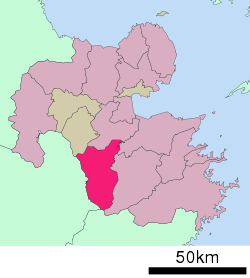 Location of Taketa in Ōita Prefecture | ||
 Taketa Location in Japan | ||
| Coordinates: 32°58′N 131°24′E / 32.967°N 131.400°ECoordinates: 32°58′N 131°24′E / 32.967°N 131.400°E | ||
| Country | Japan | |
| Region | Kyushu | |
| Prefecture | Ōita Prefecture | |
| Government | ||
| • Mayor | Katsuji Syuto (since April 2009) | |
| Area | ||
| • Total | 477.59 km2 (184.40 sq mi) | |
| Population (January 31, 2012) | ||
| • Total | 24,760 | |
| • Density | 52/km2 (130/sq mi) | |
| Symbols | ||
| • Tree | Maple Leaf | |
| • Flower | Miyama Kirishima | |
| • Bird | Cettia diphone | |
| Time zone | Japan Standard Time (UTC+9) | |
| City hall address |
Oji-Aiai 1650, Taketa City, Oita Prefecture (大分県竹田市大字会々1650番地) 878-8555 | |
| Website |
www | |

Taketa (竹田市 Taketa-shi) is a city located in Ōita Prefecture, Japan. The city was founded on March 31, 1954.
As of January 31, 2012, the city has an estimated population of 24,760, with 10,511 households and a population density of 51.84 persons per km². The total area is 477.59 km².
On April 1, 2005, the towns of Kujū, Naoiri and Ogi (all from Naoiri District) were merged into Taketa.
External links
 Media related to Taketa, Ōita at Wikimedia Commons
- Taketa City official website (Japanese)
This article is issued from Wikipedia - version of the 11/6/2015. The text is available under the Creative Commons Attribution/Share Alike but additional terms may apply for the media files.