Tangier-Tetouan
| Tangier-Tetouan طنجة تطوان Tanjah-Tituwahn ⵜⴰⵏⵊⴰ-ⵜⵉⵟⵟⴰⵡⵉⵏ Tanja-Tiṭṭawin | |
|---|---|
| Region | |
.svg.png) Location in Morocco | |
| Coordinates: 35°46′N 5°48′W / 35.767°N 5.800°WCoordinates: 35°46′N 5°48′W / 35.767°N 5.800°W | |
| Country |
|
| Created | 1997 |
| Abolished | September 2015 |
| Capital | Tangier |
| Area | |
| • Total | 11,570 km2 (4,470 sq mi) |
| Population (2014 census) | |
| • Total | 3,157,075 |
| Time zone | WET (UTC+0) |
| • Summer (DST) | WEST (UTC+1) |
Tangier-Tetouan (Berber: Tanja-Tiṭṭawin, ⵜⴰⵏⵊⴰ-ⵜⵉⵟⵟⴰⵡⵉⵏ; Arabic: طنجة تطوان) was formerly one of the sixteen regions of Morocco from 1997 to 2015. It covered an area of 11,570 km²[1] and had a population of 3,157,075.[2] The capital was Tangier. In 2015, it expanded Al Hoceima Province (formerly from the Taza-Al Hoceima-Taounate Region) to form the Region of Tanger-Tetouan-Al Hoceima.
Geography
_-_Air_Photo_by_sebaso.jpg)
Moroccan Mediterranean Coast (West Side) - Air Photo form Bades over El Jebha to Tétouan with Rif mountains, Tangier-Tetouan region (2014)
The region has a coastline to the west on the Atlantic Ocean, on the north to the Strait of Gibraltar and to the east on the Mediterranean Sea. It borders the regions of Gharb-Chrarda-Béni Hssen and Taza-Al Hoceima-Taounate to the south and also has a border to the Spanish exclave of Ceuta.
Administrative divisions
The region is made up into the following provinces and prefectures:
- Tangier Sub-Region
- Prefecture of Tangier-Assilah
- Fahs-Anjra Province
- Tétouan Sub-Region
- Prefecture of M'diq-Fnideq
- Chefchaouen Province
- Larache Province
- Ouezzane Province
- Tétouan Province
References
- ↑ Tangier-Tetouan, Morocco.com, accessed 7 February 2013
- ↑ (2014 census)
Capital: Tangier | ||
| Prefectures and provinces | 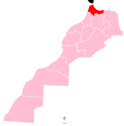 | |
| Cities | ||
| from 2015 | ||
|---|---|---|
| 1997-2015 |
| |
| 1971-1997 |
| |
Regions falling partly (*) or entirely (**) within the disputed territory of Western Sahara | ||
This article is issued from Wikipedia - version of the 7/12/2016. The text is available under the Creative Commons Attribution/Share Alike but additional terms may apply for the media files.