Tatopani, Bagmati
| Tatopani तातोपानी | |
|---|---|
| Village development committee | |
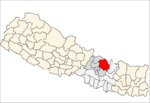
 Tatopani Location in Nepal | |
| Coordinates: 27°59′N 85°56′E / 27.98°N 85.93°ECoordinates: 27°59′N 85°56′E / 27.98°N 85.93°E | |
| Country |
|
| Zone | Bagmati Zone |
| District | Sindhupalchok District |
| Population (1991) | |
| • Total | 3,102 |
| • Religions | Buddhist |
| Time zone | Nepal Time (UTC+5:45) |
Tatopani is a village in Sindhupalchok District in the Bagmati Zone of central Nepal. At the time of the 1991 Nepal census it had a population of 3102 and had 613 houses in the village. Majority people are of ethnic Sherpa and Tamang. Historically and today, it is a huge trading post between Nepal and China. People living here speak Nepali and Tibetan.[1]
2015 Nepal earthquake
The village was affected by the earthquake on 25 April 2015. A joint coordination committee among all political parties in the three constituencies of the Sindhupalchok district was formed to carry out a rescue mission in the village.[2] On 1 May, a Nepali Army rescue helicopter went 65 kilometres to Tatopani from Kathmandu to rescue 40 people.[3]
References
- ↑ "Nepal Census 2001". Nepal's Village Development Committees. Digital Himalaya. Retrieved 2008-08-24.
- ↑ "Death toll in quake-hit Sindhupalchok stands at 1‚820". The Himalayan. The Himalayan. 1 May 2015. Retrieved 1 May 2015.
- ↑ Sriram, Jayant (1 May 2015). "Army finds it tough to reach aid to Nepal villages". The Hindu. The Hindu. Archived from the original on 1 May 2015. Retrieved 1 May 2015.
|archive-url=is malformed: timestamp (help)
This article is issued from Wikipedia - version of the 6/15/2016. The text is available under the Creative Commons Attribution/Share Alike but additional terms may apply for the media files.