Tedrow, Ohio
| Tedrow, Ohio | |
|---|---|
| Census-designated place | |
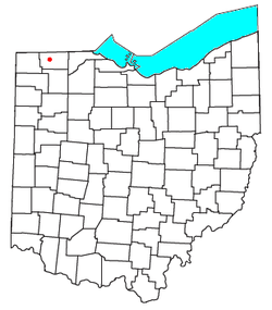 Location of Tedrow, Ohio | |
| Coordinates: 41°36′12″N 84°12′22″W / 41.6033843°N 84.2060594°WCoordinates: 41°36′12″N 84°12′22″W / 41.6033843°N 84.2060594°W | |
| Country | United States |
| State | Ohio |
| County | Fulton |
| Township | Dover |
| Government | |
| • Type | Unincorporated |
| Area | |
| • Total | 0.32 sq mi (0.83 km2) |
| • Land | 0.32 sq mi (0.83 km2) |
| • Water | 0.0 sq mi (0.0 km2) |
| Elevation[1] | 768 ft (234 m) |
| Population (2010) | |
| • Total | 173 |
| • Density | 539/sq mi (208.3/km2) |
| Time zone | Eastern (EST) (UTC-5) |
| • Summer (DST) | EDT (UTC-4) |
| ZIP codes | 43567 |
| Area code(s) | 419 and 567 |
| FIPS code | 39-76358 |
| GNIS feature ID | 1061678[1] |
Tedrow is an unincorporated community and census-designated place (CDP) in southwestern Dover Township, Fulton County, Ohio, United States. It lies at the intersection of the east-west County Road J with the north-south County Roads 17-2 and 17-3, 3 miles (5 km) north and 3.5 miles (5.6 km) west of the northern edge of the city of Wauseon, the county seat of Fulton County. The community lies less than one mile (about 1 km) north of the Ohio Turnpike, although the nearest exit is several miles away.[2]
The 2010 US Census counted 73 households and 173 people living in Tedrow.[3]
History
Spring Hill
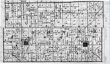
Brush Creek, a tributary of the Tiffin River, rises near Tedrow.[4] The creek is fed by a spring. The spring's clean water made the spot a favorite Indian campground and resting place in their migratory hunting excursions.[5] Thus, Tedrow was first known as "Spring Hill", as is show on a 1858 plat map.
Tedrow Post Office
A post office was established in 1839, and remained in operation until 1917.[6] The community was named for the local Tedrow family.[7]
References
- 1 2 "US Board on Geographic Names". United States Geological Survey. 28 March 2016.
- ↑ DeLorme. Ohio Atlas & Gazetteer. 7th ed. Yarmouth: DeLorme, 2004, p. 25. ISBN 0-89933-281-1.
- ↑ "Geographic Identifiers: 2010 Census Summary File 1 (G001), Tedrow CDP, Ohio". American FactFinder. U.S. Census Bureau. Retrieved July 6, 2016.
- ↑ DeLorme. Ohio Atlas & Gazetteer. 7th ed. Yarmouth: DeLorme, 2004, pp. 25, 35. ISBN 0-89933-281-1.
- ↑ Aldrich, Lewis Cass (1888). History of Henry and Fulton counties, Ohio : with illustrations and biographical sketches of some of its prominent men and pioneers. Syracuse, N. Y.: D. Mason & Co., Publishers. pp. 465–475.
- ↑ "Fulton County". Jim Forte Postal History. Retrieved 25 January 2016.
- ↑ Reighard, Frank H. (1920). A Standard History of Fulton County, Ohio (Volume 1). Lewis Publishing Company. p. 344.
Municipalities and communities of Fulton County, Ohio, United States | ||
|---|---|---|
| City | 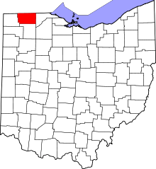 | |
| Villages | ||
| Townships | ||
| CDPs | ||
| Unincorporated communities | ||
| Ghost towns | ||
| Footnotes | ‡This populated place also has portions in an adjacent county or counties | |