Emery, Ohio
| Emery, Ohio | |
|---|---|
| Ghost town | |
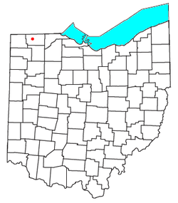 Location of Emery, Ohio | |
| Coordinates: 41°35′25″N 84°11′34″W / 41.590272°N 84.192692°WCoordinates: 41°35′25″N 84°11′34″W / 41.590272°N 84.192692°W | |
| Country | United States |
| State | Ohio |
| County | Fulton |
| Township | Dover |
| Government | |
| • First Postmaster, 1846 | Amos Gay |
| • Postmaster at 1861 reopening | William Waid |
Emery is an ghost town in Dover Township, Fulton County, Ohio, near present-day Tedrow, Ohio.
Location
It was located only a short distance from Spring Hill, about 1.5 miles southwest.[1][2] There are no remaining structures of the town. The Ancestry website states that it was located in the "northwest one-quarter of the southwest one-quarter of Section 4" of Dover Township, which would place it near County Road H (formerly West Unity-Swanton Road) between County Road 17 (formerly Hartman-Inlet Road) and County Road 16 (formerly Lena-Morenci Road).[3] According to the Fulton County Plat Directory, this places Emery possibly in the path of, or just north of, the Ohio Turnpike.[2]
History
On July 11, 1846, Amos Gay, as the first postmaster, opened the Emery post office. It closed January 23, 1861, but reopened later that year on May 23, with William Waid serving as the postmaster. It remained open until August 31, 1903.[3]
A letter from the Civil War era, dated from 1861 and addressed to the Emery Post office, preserved in the Searls Family Papers, is held at Bowling Green State University at the Center for Archival Collections.[4]
Emery is listed in an 1860 business directory,[5] and in an 1870 Post Office directory.[6]
Will and Emma Knapp are listed as residents of Emery, Ohio in a family genealogical record.[7]
Emery also made its way on an 1898 Ohio railroad map, (albeit mistakenly in the place of Spring Hill, apparently a mistake of the mapmaker. Also, the newly mapped railroad, which runs northly from Wauseon towards Oakshade, mistakenly jogs east towards a station at Ottokee, drawn in the actual location of Winameg.)[8]
|


References
- ↑ Tedrow to Emery location Google Maps
- 1 2 Fulton County Plat Directory (Map). 2014. Retrieved 11 April 2016.
- 1 2 Fulton County Ghost Towns Rootsweb.Ancestry.com. Retrieved 11 April 2016
- ↑ Dee, Christine (2004). Ohio’s War: The Civil War in Documents. Ohio University Press. p. 62. Retrieved 11 April 2016.
- ↑ Geo. W. Hawes' Ohio State Gazetteer and Business Directory for 1860-1861. Indianapolis, In: George W. Hawes. 1860. p. 330. Retrieved 11 April 2016.
- ↑ Post Office Directory: Revenues and Classes of Post Offices. United States Post Office Department. 1870. p. 339. Retrieved 11 April 2016.
- ↑ Smith, Fannie Brown (2004). The Brown Tree: Genealogical Record of John Brown (1755-1809) and his Descendants, also the collateral branches of Merrill, Scott and Follett families. St. Paul, Minn.:H. C. Baker. p. 64. Retrieved 11 April 2016.
- 1 2 R.S. Kalyer (1898). Railroad map of Ohio (Map). Retrieved 11 April 2016.
- ↑ J. A. Norton, Ohio commissioner of railroads & telegraphs (1890). Railroad map of Ohio (Map). Retrieved 11 April 2016.
External links
Municipalities and communities of Fulton County, Ohio, United States | ||
|---|---|---|
| City | 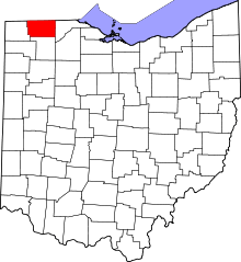 | |
| Villages | ||
| Townships | ||
| CDPs | ||
| Unincorporated communities | ||
| Ghost towns | ||
| Footnotes | ‡This populated place also has portions in an adjacent county or counties | |