Thermo, Greece
| Thermo Θέρμο | |
|---|---|
|
Thermo municipality | |
 Thermo | |
|
Location within the region 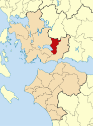 | |
| Coordinates: 38°35′N 21°40′E / 38.583°N 21.667°ECoordinates: 38°35′N 21°40′E / 38.583°N 21.667°E | |
| Country | Greece |
| Administrative region | West Greece |
| Regional unit | Aetolia-Acarnania |
| Districts | 23 |
| Area | |
| • Municipality | 333.7 km2 (128.8 sq mi) |
| Population (2011)[1] | |
| • Municipality | 8,242 |
| • Municipality density | 25/km2 (64/sq mi) |
| Community[1] | |
| • Population | 1,959 (2011) |
| Time zone | EET (UTC+2) |
| • Summer (DST) | EEST (UTC+3) |
| Postal code | 300 08 |
| Area code(s) | 26440 |

Thermo (Greek: Θέρμο, before 1915: Κεφαλόβρυσον Kefalovryson)[2] is a town and a municipality in Aetolia-Acarnania, Greece. It is located in the southeastern part of the regional unit, largely between Lake Trichonida (the largest natural lake in Greece) and the southern border of Evrytania. It has a land area of 333.701 km2 (129 sq mi)[3] and a population of 8,242 inhabitants (2011 census).[1]
Its municipal seat is the town of Thermo (pop. 1,959). Its largest other towns are Analipsis (pop. 734), Petrochori (444), Sitaralona (664), Myrtea (729), and Koniska (326). The nearby village of Mega Dendron was the birthplace of Cosmas of Aetolia.
Thermo took its name from the ancient city Thermos, that was located near the present town.
Subdivisions
The municipality Thermo consists of the following communities:
- Thermo (Thermo, Koulouria, Mandra, Marathos, Megas Dendros, Taxiarchis)
- Avarikos (Avarikos, Pini)
- Agia Sofia (Agia Sofia, Mavrovoros, Pournara)
- Aetopetra
- Amvrakia
- Analipsis (Analipsis, Kaimena Ampelia, Koftra, Marathoula, Paliouria)
- Argyro Pigadi (Argyro Pigadi, Theotokos)
- Diasellaki
- Diplatanos
- Drymon (Drymon, Agia Triada, Ano Drymon, Koskinas)
- Kaloudi (Kaloudi, Dounaiika, Marathias)
- Kato Chrysovitsa (Kato Chrysovitsa, Diasello, Dosoula, Koutsomilia)
- Kokkinovrysi (Ampelia, Agios Theodoros, Kokkinovrysi)
- Koniska (Koniska, Agios Ioannis, Poulinos)
- Lefko
- Myrtea (Myrtea, Loutra, Palaiomylos, Perevos)
- Nerochori (Nerochori, Meligkova, Misampella)
- Pamfi
- Perkos
- Petrochori (Petrochori, Prionaiika)
- Sitaralona
- Chaliki Amvrakias (Dafni, Ladikou, Nerosyrtis, Chaliki)
- Chrysovitsa (Chrysovitsa, Dokimia, Roggia)
See also
- Thermos (Aetolia) archaeological site
- Aetolian League
References
- 1 2 3 "Απογραφή Πληθυσμού - Κατοικιών 2011. ΜΟΝΙΜΟΣ Πληθυσμός" (in Greek). Hellenic Statistical Authority.
- ↑ Name changes of settlements in Greece
- ↑ "Population & housing census 2001 (incl. area and average elevation)" (PDF) (in Greek). National Statistical Service of Greece.
External links
- Municipality of Thermo (Greek)
| Regional unit of Achaea |  | |
|---|---|---|
| Regional unit of Aetolia-Acarnania | ||
| Regional unit of Elis | ||
| ||