Nafpaktia
| Nafpaktia Ναυπακτία | |
|---|---|
|
Nafpaktia municipality | |
 Nafpaktia | |
|
Location within the region 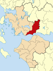 | |
| Coordinates: 38°23′N 21°49′E / 38.383°N 21.817°ECoordinates: 38°23′N 21°49′E / 38.383°N 21.817°E | |
| Country | Greece |
| Administrative region | West Greece |
| Regional unit | Aetolia-Acarnania |
| Area | |
| • Municipality | 876.2 km2 (338.3 sq mi) |
| Population (2011)[1] | |
| • Municipality | 27,800 |
| • Municipality density | 32/km2 (82/sq mi) |
| Time zone | EET (UTC+2) |
| • Summer (DST) | EEST (UTC+3) |

Nafpaktia (Greek: Ναυπακτία), Latinized Naupactia, is the historical name for the region around the port town of Nafpaktos (Naupactus) in Central Greece.
It is also the name of a municipality in the Aetolia-Acarnania regional unit, West Greece region, Greece. The seat of the municipality is the town Nafpaktos.[2] The municipality has an area of 876.209 km2.[3]
Administration
The municipality Nafpaktia was formed at the 2011 local government reform by the merger of the following 6 former municipalities, that became municipal units:[2]
Province
The province of Nafpaktia (Greek: Επαρχία Ναυπακτίας) was one of the provinces of the Aetolia-Acarnania Prefecture. Its territory corresponded with that of the current municipality Nafpaktia.[4] It was abolished in 2006.
Geography
Nafpaktia is one of the most popular mountainous areas in Greece for its scenery, and the availability of outdoor activities such as trekking, biking, horseback-riding, and archery. The approximately 60 villages of the region are built at altitudes of 700 to 1,000 m (2,300–3,300 ft) and are located from 30 to 90 km (19–56 mi) away of Nafpaktos, surrounded by rich vegetation and natural springs.
Elatou is approximately one hour away from Nafpaktos and is built in a pine forest. This small, picturesque settlement is built amphitheatrically, while it only has a few permanent residents. Another popular village is Ano Chora. It used to be called Megali Lobotina, while it has a population of 30. It has narrow cobblestone paths and traditional houses, while there are many guesthouses, which are quite popular in the winter months. Katafygio is also one of the historical villages in mountainous Nafpaktia. The village is built at an altitude of 650 m (2,130 ft), and abstains 33 km (21 mi) from Nafpaktos. Katafygio in the old days was named Amorani.
External links
- Nafpaktia and Nafpaktos
- Nafpaktia
- Katafygion Nafpaktias
- Katafigio Nafpaktias(Mountainous Nafpaktia)
- Paleopirgos (Mountainous Nafpaktia)
References
- ↑ "Απογραφή Πληθυσμού - Κατοικιών 2011. ΜΟΝΙΜΟΣ Πληθυσμός" (in Greek). Hellenic Statistical Authority.
- 1 2 Kallikratis law Greece Ministry of Interior (Greek)
- ↑ "Population & housing census 2001 (incl. area and average elevation)" (PDF) (in Greek). National Statistical Service of Greece.
- ↑ "Detailed census results 1991" (PDF). (39 MB) (Greek) (French)
| Regional unit of Achaea |  | |
|---|---|---|
| Regional unit of Aetolia-Acarnania | ||
| Regional unit of Elis | ||
| ||