Tiffin Township, Defiance County, Ohio
| Tiffin Township, Defiance County, Ohio | |
|---|---|
| Township | |
|
Main Street in Evansport | |
 Location of Tiffin Township in Defiance County | |
| Coordinates: 41°22′58″N 84°23′49″W / 41.38278°N 84.39694°WCoordinates: 41°22′58″N 84°23′49″W / 41.38278°N 84.39694°W | |
| Country | United States |
| State | Ohio |
| County | Defiance |
| Area | |
| • Total | 36.42 sq mi (94.32 km2) |
| • Land | 36.36 sq mi (94.16 km2) |
| • Water | 0.06 sq mi (0.16 km2) |
| Elevation[1] | 712 ft (217 m) |
| Population (2010) | |
| • Total | 1,612 |
| • Density | 44/sq mi (17.1/km2) |
| Time zone | Eastern (EST) (UTC-5) |
| • Summer (DST) | EDT (UTC-4) |
| FIPS code | 39-76772[2] |
| GNIS feature ID | 1086039[1] |

Tiffin Township is one of twelve townships in Defiance County, Ohio, United States. The 2010 census reported 1,612 residents in the township.[3]
Geography
Located in the northeastern part of the county, it borders the following townships:
- Springfield Township, Williams County - north
- Ridgeville Township, Henry County - northeast corner
- Adams Township - east
- Richland Township - southeast
- Noble Township - south
- Delaware Township - southwest corner
- Washington Township - west
- Pulaski Township, Williams County - northwest corner
No municipalities are located in Tiffin Township, although the unincorporated community of Evansport lies on its border with Springfield Township.
Name and history
Tiffin Township was established in 1832, and named for the Tiffin River which flows through it.[4] Statewide, the only other Tiffin Township is located in Adams County.
Government
The township is governed by a three-member board of trustees, who are elected in November of odd-numbered years to a four-year term beginning on the following January 1. Two are elected in the year after the presidential election and one is elected in the year before it. There is also an elected township fiscal officer,[5] who serves a four-year term beginning on April 1 of the year after the election, which is held in November of the year before the presidential election. Vacancies in the fiscal officership or on the board of trustees are filled by the remaining trustees.
Transportation
Two significant highways in Tiffin Township are State Route 15, which travels from northwest to southeast in the southwestern corner of the township; and State Route 66, which travels north-south through the eastern half of the township.[6]
References
- 1 2 "US Board on Geographic Names". United States Geological Survey. 2007-10-25. Retrieved 2008-01-31.
- ↑ "American FactFinder". United States Census Bureau. Retrieved 2008-01-31.
- ↑ "Geographic Identifiers: 2010 Demographic Profile Data (G001): Tiffin township, Defiance County, Ohio". U.S. Census Bureau, American Factfinder. Retrieved December 3, 2015.
- ↑ History of Defiance County, Ohio: Containing a History of the County ; Its Townships, Towns, Etc. ; Military Record ; Portraits of Early Settlers and Prominent Men ; Farm Views ; Personal Reminiscences, Etc. Warner, Beers. 1883. p. 347.
- ↑ §503.24, §505.01, and §507.01 of the Ohio Revised Code. Accessed 4/30/2009.
- ↑ DeLorme. Ohio Atlas & Gazetteer. 7th ed. Yarmouth: DeLorme, 2004, pp. 34-35. ISBN 0-89933-281-1.
External links
Municipalities and communities of Defiance County, Ohio, United States | ||
|---|---|---|
| City | 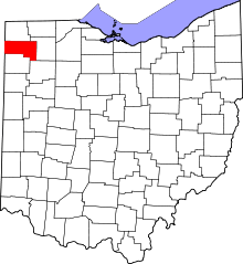 | |
| Villages | ||
| Townships | ||
| Unincorporated communities | ||
| Ghost towns | ||