Defiance, Ohio
| Defiance, Ohio | |
|---|---|
| City | |
|
| |
| Motto: "A Great Place To Live" | |
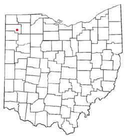 Location of Defiance, Ohio | |
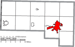 Location of Defiance in Defiance County | |
| Coordinates: 41°16′55″N 84°21′46″W / 41.28194°N 84.36278°WCoordinates: 41°16′55″N 84°21′46″W / 41.28194°N 84.36278°W | |
| Country | United States |
| State | Ohio |
| County | Defiance |
| Government | |
| • Mayor | Michael McCann |
| Area[1] | |
| • Total | 12.13 sq mi (31.42 km2) |
| • Land | 11.62 sq mi (30.10 km2) |
| • Water | 0.51 sq mi (1.32 km2) |
| Elevation[2] | 676 ft (206 m) |
| Population (2010)[3] | |
| • Total | 16,494 |
| • Estimate (2012[4]) | 16,838 |
| • Density | 1,419.4/sq mi (548.0/km2) |
| Time zone | Eastern (EST) (UTC-5) |
| • Summer (DST) | EDT (UTC-4) |
| ZIP code | 43512 |
| Area code(s) | 419 |
| FIPS code | 39-21308[5] |
| GNIS feature ID | 1064519[2] |
| Website | City of Defiance Ohio |
Defiance is a city in and the county seat of Defiance County, Ohio, United States, about 55 miles (89 km) southwest of Toledo in the state's northwestern corner.[6] The population was 16,494 at the 2010 census.
History
The city contains the site of Fort Defiance, built by General "Mad" Anthony Wayne in August 1794, during the Northwest Indian War, at the confluence of the Auglaize and Maumee rivers. General Wayne surveyed the land and declared to General Scott, "I defy the English, Indians, and all the devils of hell to take it."[7] This area became Fort Defiance. Today a pair of cannons outside the city library on the Maumee River overlook the confluence and mark the location of Fort Defiance, along with a mounded outline of the fort walls. The city was named after Fort Defiance.[8]
From Fort Defiance, the U.S. forces moved northeast along the Maumee River to fight the decisive Battle of Fallen Timbers near the current town of Maumee, Ohio. This victory secured for the United States the Northwest Territory, now the states of Ohio, Michigan, Indiana, Illinois, and Wisconsin.
Fort Winchester was built on the same spot during the War of 1812, but it was a larger fort that extended southward somewhat along the Auglaize River. Historical plaques in the sidewalks mark the full extent of Fort Winchester.
In 1822 Defiance was laid out as a town. In 1845 it was made the county seat of the newly created county, and in 1881 it became a city.[9]
Geography
Defiance is located at 41°16′55″N 84°21′46″W / 41.28194°N 84.36278°W (41.281891, -84.362856).[10]
According to the United States Census Bureau, the city has a total area of 12.13 square miles (31.42 km2), of which, 11.62 square miles (30.10 km2) is land and 0.51 square miles (1.32 km2) is water.[1]
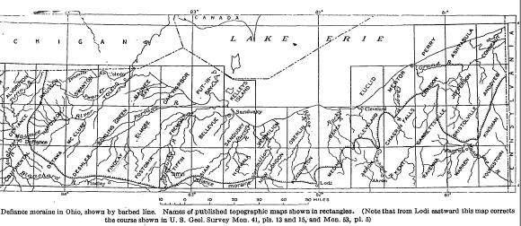
Defiance lends its name to a distinct end moraine from the Wisconsian glaciation. As Cushing et al point out, "The Defiance moraine represents the last notable stand of the glacial front in this region." The moraine varies in width from 2 to 4 miles, and according to Leverett, "it is like a broad wave whose crest stands 20 to 50 feet above the border of the plain outside it."[11][12]
Climate
According to the Midwest Climate Center, Defiance's average January temperatures are a high of 31.2 °F (−0.4 °C) and a low of 17.1 °F (−8.3 °C). Average July temperatures are a high of 84.2 °F (29.0 °C) and a low of 63.3 °F (17.4 °C). There are an average of 16.4 days with highs of 90 °F (32 °C) or higher and an average of 138.8 days with lows of 32 °F (0 °C) or lower. The record high temperature was 107 °F (42 °C) on June 28, 2012.[13] The record low temperature was −26 °F (−32 °C) on January 13, 1912.[14]
Average annual precipitation is 35.60 inches (90.4 cm) with an average of 129.0 days with measurable precipitation. The wettest year was 1990 with 48.63 inches (123.5 cm) and the driest year was 1930 with 19.67 inches (50.0 cm). Normally, July is the wettest month with an average of 3.89 inches (9.9 cm) and February is the driest month with an average of 1.84 inches (4.7 cm). The most precipitation in one month was 12.00 inches (30.5 cm) in June 1981. The most precipitation in 24 hours was 4.63 inches (11.8 cm) on September 18, 1907.[15]
There is an annual average of 21.8 inches (55 cm) of snow in Defiance. There are an average of 16.5 days with measurable snowfall. The most snow in one season was 56.0 inches (142 cm) during 1977-78, including the maximum monthly snowfall of 26.0 inches (66 cm) in January 1978. The most snowfall in 24 hours was 12.0 inches (30 cm) on December 20, 1973.[16]
Demographics
| Historical population | |||
|---|---|---|---|
| Census | Pop. | %± | |
| 1850 | 800 | — | |
| 1860 | 1,399 | 74.9% | |
| 1870 | 2,750 | 96.6% | |
| 1880 | 5,907 | 114.8% | |
| 1890 | 7,694 | 30.3% | |
| 1900 | 7,579 | −1.5% | |
| 1910 | 7,327 | −3.3% | |
| 1920 | 8,876 | 21.1% | |
| 1930 | 8,818 | −0.7% | |
| 1940 | 9,744 | 10.5% | |
| 1950 | 11,265 | 15.6% | |
| 1960 | 14,553 | 29.2% | |
| 1970 | 16,281 | 11.9% | |
| 1980 | 16,783 | 3.1% | |
| 1990 | 16,768 | −0.1% | |
| 2000 | 16,465 | −1.8% | |
| 2010 | 16,494 | 0.2% | |
| Est. 2015 | 16,776 | [17] | 1.7% |
2010 census
As of the census[3] of 2010, there were 16,494 people, 6,663 households, and 4,291 families residing in the city. The population density was 1,419.4 inhabitants per square mile (548.0/km2). There were 7,435 housing units at an average density of 639.8 per square mile (247.0/km2). The racial makeup of the city was 88.1% White, 3.6% African American, 0.3% Native American, 0.4% Asian, 4.8% from other races, and 2.8% from two or more races. Hispanic or Latino of any race were 14.4% of the population.
There were 6,663 households of which 31.4% had children under the age of 18 living with them, 45.3% were married couples living together, 13.9% had a female householder with no husband present, 5.3% had a male householder with no wife present, and 35.6% were non-families. 29.4% of all households were made up of individuals and 11.5% had someone living alone who was 65 years of age or older. The average household size was 2.38 and the average family size was 2.91.
The median age in the city was 37.1 years. 24.1% of residents were under the age of 18; 10.9% were between the ages of 18 and 24; 23.7% were from 25 to 44; 26% were from 45 to 64; and 15.3% were 65 years of age or older. The gender makeup of the city was 48.3% male and 51.7% female.
2000 census
As of the census[5] of 2000, there were 16,465 people, 6,572 households, and 4,422 families residing in the city. The population density was 1,562.4 people per square mile (603.1/km²). There were 7,061 housing units at an average density of 670.0 per square mile (258.7/km²). The racial makeup of the city was 87.15% White, 3.44% African American, 0.32% Native American, 0.39% Asian, 0.05% Pacific Islander, 6.50% from other races, and 2.15% from two or more races. Hispanic or Latino of any race were 12.75% of the population.
There were 6,572 households out of which 33.0% had children under the age of 18 living with them, 50.2% were married couples living together, 12.6% had a female householder with no husband present, and 32.7% were non-families. 27.6% of all households were made up of individuals and 10.3% had someone living alone who was 65 years of age or older. The average household size was 2.43 and the average family size was 2.95.
In the city the population was composed of 25.7% under the age of 18, 11.1% from 18 to 24, 26.8% from 25 to 44, 22.9% from 45 to 64, and 13.6% 65 years of age or older. The median age was 35 years. For every 100 females there were 94.1 males. For every 100 females age 18 and over, there were 90.1 males.
The median income for households was $41,670, and the median income for a family was $49,599. Males had a median income of $37,322, compared to $23,938 for females. The per capita income for the city was $19,790. About 7.4% of families and 8.8% of the population were below the poverty line, including 12.0% of those under age 18 and 7.1% of those age 65 or over.
Economy
Defiance's economy is based on the manufacturing a variety of products. The largest employer is the General Motors Powertrain division, which is the largest automotive iron foundry in North America. In the wake of General Motors filing for Chapter 11 bankruptcy on June 1, 2009, GM announced that it will continue operating the Defiance facility. This spared the city loss of many jobs.
Other products manufactured in Defiance include fiberglass (Johns Manville), auto parts, and farming food products.
Education
Defiance City Schools provide public K-12 education. Schools maintained by local Lutheran and Catholic churches also provide preschool-grade 8 education. Northeastern Local Schools (Tinora) and Ayersville Local Schools also serve rural Defiance, but each is a smaller school district.
There are three high schools in the Defiance area: Defiance (located in Defiance), Tinora (part of Northeastern Local Schools) and Ayersville High Schools. Tinora and Ayersville High Schools are located a few miles from the main city and serve the rural areas of Defiance County to the northeast and southeast, respectively, of Defiance.
Defiance College is a small liberal arts college affiliated with the United Church of Christ and has an enrollment of about 1,000 students. The college is the source of many sports, cultural, and entertainment opportunities that many other similar-sized towns lack.
Parks and recreation
Defiance has several city parks that offer a variety of recreational activities, including baseball and softball diamonds, and playground equipment. These parks include Kingsbury Park and Diehl Park. Kingsbury Park has a public swimming pool.[19]
Independence Dam State Park, 4 miles east of the city on State Highway 424, along the Maumee River, is also a popular recreational site for area residents. The park provides picnic facilities, nature trails, and fishing. There is a reservoir with adjacent trails, along with a track up top. There is also a Frisbee golf course. On the other side, there is a dog park.
Media
Newspaper
- Defiance Crescent-News[20]
Radio
Television
- WDFM-LP, low-powered community television station
Notable people
- Doug Bair, pitcher for seven Major League Baseball teams
- Chad Billingsley, pitcher for the Philadelphia Phillies
- Michelle Burke, television and film actress
- Wild Bill Davison, jazz cornet player
- Alene Duerk, became the first female admiral in the U.S. Navy in 1972.[21][22]
- Alan Francis, 20-time Horseshoe World Champion
- Chet Grant, football player and journalist
- Asel Hagerty (1837-1919) Canadian-born Medal of Honor recipient in the American Civil War, was buried in Defiance.[23]
- Jessicka Havok, pro wrestler
- Sam Hornish Jr., Indianapolis 500 winner and part-time driver in the NASCAR Xfinity Series
- Greg Kampe, men's head basketball coach at Oakland University
- Don Miller, one of the Four Horsemen of Notre Dame
- Jon Niese, pitcher for the Pittsburgh Pirates
- Chad Reineke, pitcher for the Cincinnati Reds
- Terry "Tuff" Ryan, author, daughter of Evelyn Ryan
- Bruce Shingledecker, Alaskan wildlife painter
- H. Allen Smith, humorist
References
- 1 2 "US Gazetteer files 2010". United States Census Bureau. Retrieved 2013-01-06.
- 1 2 "US Board on Geographic Names". United States Geological Survey. 2007-10-25. Retrieved 2008-01-31.
- 1 2 "American FactFinder". United States Census Bureau. Retrieved 2013-01-06.
- ↑ "Population Estimates". United States Census Bureau. Retrieved 2013-06-17.
- 1 2 "American FactFinder". United States Census Bureau. Retrieved 2008-01-31.
- ↑ "Find a County". National Association of Counties. Retrieved 2011-06-07.
- ↑ "Defiance Ohio". Defiance Tourism. Retrieved 2012-07-15.
- ↑ "Profile for Defiance, Ohio, OH". ePodunk. Retrieved 2012-07-15.
- ↑
 One or more of the preceding sentences incorporates text from a publication now in the public domain: Chisholm, Hugh, ed. (1911). "Defiance". Encyclopædia Britannica. 7 (11th ed.). Cambridge University Press. p. 926.
 - ↑ "US Gazetteer files: 2010, 2000, and 1990". United States Census Bureau. 2011-02-12. Retrieved 2011-04-23.
- ↑ Leverett, Frank (1902). Glacial Formations and Drainage Features of the Erie and Ohio Basins, USGS Monograph Vol. XLI. Washington: US Government Printing Office. p. 581-584.
- ↑ Cushing, H.P.; Leverett, Frank; Van Horn, Frank (1931). Geology and Mineral Resources of the Cleveland District, Ohio, USGS Bulletin 818. Washington: US Government Printing Office. p. 63-64,96.
- ↑ Weather History for Defiance, OH | Weather Underground
- ↑ Temperature Summary - 332098 DEFIANCE, OH
- ↑ Precipitation Summary - 332098 DEFIANCE, OH
- ↑ Snowfall Summary - 332098 DEFIANCE, OH
- ↑ "Annual Estimates of the Resident Population for Incorporated Places: April 1, 2010 to July 1, 2015". Retrieved July 2, 2016.
- ↑ "Census of Population and Housing". Census.gov. Retrieved June 4, 2015.
- ↑ Defiance Development and Visitors Bureau
- ↑ http://www.crescent-news.com
- ↑ Tiger. Female Hierarchies. Transaction Publishers. pp. 65–. ISBN 978-1-4128-2353-1.
- ↑ Richard Mayne (January 2000). The Language of Sailing. Taylor & Francis. pp. 5–. ISBN 978-1-57958-278-4.
- ↑ "Asel Hagerty". Retrieved July 19, 2014.
External links
- City website
- Defiance Development & Visitors Bureau
- Defiance Public Library
- Maumee Valley Heritage Corridor
Municipalities and communities of Defiance County, Ohio, United States | ||
|---|---|---|
| City | 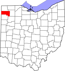 | |
| Villages | ||
| Townships | ||
| Unincorporated communities | ||
| Ghost towns | ||