Timber Lake, South Dakota
| Timber Lake, South Dakota Blečháŋ | |
|---|---|
| City | |
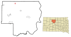 Location in Dewey County and the state of South Dakota | |
| Coordinates: 45°25′43″N 101°4′29″W / 45.42861°N 101.07472°WCoordinates: 45°25′43″N 101°4′29″W / 45.42861°N 101.07472°W | |
| Country | United States |
| State | South Dakota |
| County | Dewey |
| Incorporated | 1911[1] |
| Area[2] | |
| • Total | 0.41 sq mi (1.06 km2) |
| • Land | 0.41 sq mi (1.06 km2) |
| • Water | 0 sq mi (0 km2) |
| Elevation | 2,169 ft (661 m) |
| Population (2010)[3] | |
| • Total | 443 |
| • Estimate (2015)[4] | 483 |
| • Density | 1,080.5/sq mi (417.2/km2) |
| Time zone | Mountain (MST) (UTC-7) |
| • Summer (DST) | MDT (UTC-6) |
| ZIP code | 57656 |
| Area code(s) | 605 |
| FIPS code | 46-63620 |
| GNIS feature ID | 1258560[5] |
| Website | http://www.timberlakesouthdakota.com/ |
Timber Lake (Lakota: blečháŋ;[6] "Tree Lake") is a city in Dewey County, South Dakota, United States. The population was 443 at the 2010 census. It is the county seat of Dewey County.[7]
History
Timber Lake was founded in 1910 with the arrival of the Chicago, Milwaukee, St. Paul and Pacific Railroad into the area.[8] Despite the name, very few trees grew at the lake near the town site.[9]
Geography and climate
Timber Lake is located at 45°25′43″N 101°4′29″W / 45.42861°N 101.07472°W (45.428682, -101.074606).[10]
According to the United States Census Bureau, the city has a total area of 0.41 square miles (1.06 km2), all of it land.[2]
Timber Lake has been assigned the ZIP code 57656 and the FIPS place code 63629.
| Climate data for Timber Lake, South Dakota (1981–2010) | |||||||||||||
|---|---|---|---|---|---|---|---|---|---|---|---|---|---|
| Month | Jan | Feb | Mar | Apr | May | Jun | Jul | Aug | Sep | Oct | Nov | Dec | Year |
| Average high °F (°C) | 27.4 (−2.6) |
31.6 (−0.2) |
42.4 (5.8) |
58.1 (14.5) |
69.0 (20.6) |
77.8 (25.4) |
85.2 (29.6) |
84.6 (29.2) |
74.2 (23.4) |
58.7 (14.8) |
41.1 (5.1) |
28.7 (−1.8) |
56.6 (13.7) |
| Average low °F (°C) | 7.8 (−13.4) |
12.2 (−11) |
21.6 (−5.8) |
32.7 (0.4) |
44.1 (6.7) |
53.6 (12) |
59.7 (15.4) |
57.9 (14.4) |
47.5 (8.6) |
35.1 (1.7) |
21.3 (−5.9) |
10.0 (−12.2) |
33.6 (0.9) |
| Average precipitation inches (mm) | 0.41 (10.4) |
0.59 (15) |
1.15 (29.2) |
1.71 (43.4) |
2.84 (72.1) |
3.30 (83.8) |
2.62 (66.5) |
1.71 (43.4) |
1.44 (36.6) |
1.54 (39.1) |
0.61 (15.5) |
0.48 (12.2) |
18.40 (467.4) |
| Average snowfall inches (cm) | 6.1 (15.5) |
6.8 (17.3) |
7.7 (19.6) |
6.0 (15.2) |
0.2 (0.5) |
0.0 (0) |
0.0 (0) |
0.0 (0) |
0.0 (0) |
1.1 (2.8) |
5.7 (14.5) |
6.4 (16.3) |
40.1 (101.9) |
| Source: NOAA[11] | |||||||||||||
Demographics
| Historical population | |||
|---|---|---|---|
| Census | Pop. | %± | |
| 1920 | 555 | — | |
| 1930 | 572 | 3.1% | |
| 1940 | 512 | −10.5% | |
| 1950 | 552 | 7.8% | |
| 1960 | 624 | 13.0% | |
| 1970 | 625 | 0.2% | |
| 1980 | 660 | 5.6% | |
| 1990 | 517 | −21.7% | |
| 2000 | 443 | −14.3% | |
| 2010 | 443 | 0.0% | |
| Est. 2015 | 483 | [12] | 9.0% |
| U.S. Decennial Census[13] 2015 Estimate[4] | |||
2010 census
As of the census[3] of 2010, there were 443 people, 179 households, and 110 families residing in the city. The population density was 1,080.5 inhabitants per square mile (417.2/km2). There were 208 housing units at an average density of 507.3 per square mile (195.9/km2). The racial makeup of the city was 51.5% White, 43.1% Native American, and 5.4% from two or more races. Hispanic or Latino of any race were 0.5% of the population.
There were 179 households of which 33.5% had children under the age of 18 living with them, 44.7% were married couples living together, 10.1% had a female householder with no husband present, 6.7% had a male householder with no wife present, and 38.5% were non-families. 34.6% of all households were made up of individuals and 16.2% had someone living alone who was 65 years of age or older. The average household size was 2.47 and the average family size was 3.15.
The median age in the city was 34.5 years. 29.6% of residents were under the age of 18; 5.6% were between the ages of 18 and 24; 25.8% were from 25 to 44; 22.8% were from 45 to 64; and 16.3% were 65 years of age or older. The gender makeup of the city was 49.2% male and 50.8% female.
2000 census
As of the census of 2000, there were 443 people, 183 households, and 120 families residing in the city. The population density was 1,086.8 people per square mile (417.2/km²). There were 207 housing units at an average density of 507.8 per square mile (194.9/km²). The racial makeup of the city was 60.72% White, 36.34% Native American, 1.13% Asian, and 1.81% from two or more races.
There were 183 households out of which 29.0% had children under the age of 18 living with them, 50.8% were married couples living together, 9.8% had a female householder with no husband present, and 34.4% were non-families. 31.1% of all households were made up of individuals and 18.0% had someone living alone who was 65 years of age or older. The average household size was 2.42 and the average family size was 3.03.
In the city the population was spread out with 28.2% under the age of 18, 9.0% from 18 to 24, 22.3% from 25 to 44, 21.7% from 45 to 64, and 18.7% who were 65 years of age or older. The median age was 37 years. For every 100 females there were 93.4 males. For every 100 females age 18 and over, there were 91.6 males.
The median income for a household in the city was $27,500, and the median income for a family was $28,000. Males had a median income of $23,750 versus $20,625 for females. The per capita income for the city was $12,047. About 20.8% of families and 23.3% of the population were below the poverty line, including 26.8% of those under age 18 and 19.1% of those age 65 or over.
Newspaper
- The Timber Lake Topic is the local newspaper.
References
- ↑ "SD Towns" (PDF). South Dakota State Historical Society. Retrieved 2010-02-16.
- 1 2 "US Gazetteer files 2010". United States Census Bureau. Archived from the original on January 24, 2012. Retrieved 2012-06-21.
- 1 2 "American FactFinder". United States Census Bureau. Retrieved 2012-06-21.
- 1 2 "Population Estimates". United States Census Bureau. Retrieved June 26, 2016.
- ↑ "US Board on Geographic Names". United States Geological Survey. 2007-10-25. Retrieved 2008-01-31.
- ↑ Ullrich, Jan F. (2014). New Lakota Dictionary (2nd ed.). Bloomington, IN: Lakota Language Consortium. ISBN 978-0-9761082-9-0.
- ↑ "Find a County". National Association of Counties. Archived from the original on May 10, 2015. Retrieved 2011-06-07.
- ↑ Hellmann, Paul T. (May 13, 2013). Historical Gazetteer of the United States. Routledge. p. 999. Retrieved 30 November 2013.
- ↑ Federal Writers' Project (1940). South Dakota place-names, v.1-3. University of South Dakota. p. 63.
- ↑ "US Gazetteer files: 2010, 2000, and 1990". United States Census Bureau. 2011-02-12. Retrieved 2011-04-23.
- ↑ "NOWData - NOAA Online Weather Data". National Oceanic and Atmospheric Administration. Retrieved May 5, 2013.
- ↑ "Annual Estimates of the Resident Population for Incorporated Places: April 1, 2010 to July 1, 2015". Retrieved July 2, 2016.
- ↑ United States Census Bureau. "Census of Population and Housing". Archived from the original on May 11, 2015. Retrieved March 22, 2014.
Municipalities and communities of Dewey County, South Dakota, United States | ||
|---|---|---|
| Cities | 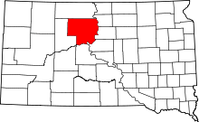 | |
| Town | ||
| CDPs | ||
| Unincorporated communities | ||
| Indian reservations | ||
| Footnotes | ‡This populated place also has portions in an adjacent county or counties | |