Tipton, Oklahoma
| Tipton, Oklahoma | |
|---|---|
| Town | |
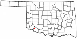 Location of Tipton, Oklahoma | |
| Coordinates: 34°30′12″N 99°8′21″W / 34.50333°N 99.13917°WCoordinates: 34°30′12″N 99°8′21″W / 34.50333°N 99.13917°W | |
| Country | United States |
| State | Oklahoma |
| County | Tillman |
| Area | |
| • Total | 0.7 sq mi (1.7 km2) |
| • Land | 0.7 sq mi (1.7 km2) |
| • Water | 0.0 sq mi (0.0 km2) |
| Elevation | 1,293 ft (394 m) |
| Population (2010) | |
| • Total | 847 |
| • Density | 1,200/sq mi (500/km2) |
| Time zone | Central (CST) (UTC-6) |
| • Summer (DST) | CDT (UTC-5) |
| ZIP code | 73570 |
| Area code(s) | 580 |
| FIPS code | 40-73850[1] |
| GNIS feature ID | 1098922[2] |
Tipton is a town in Tillman County, Oklahoma, United States. The population was 847 at the 2010 census.
Tipton also is home to a home for children, founded in 1928, when Sol Tipton donated a plot of land to the founders. The original Tipton Home was in Canadian, Texas.
Tipton lies on the northern portion of the Tillman Terrace Aquifer, an alluvial aquifer in western Tillman County, associated with the southern extent of the North Fork of the Red River. The farmland surrounding Tipton is noted for high quality soils. "Tipton loam" is considered to be among the most ideal soils in the United States. Much of the farmland is devoted to irrigated cotton. Other crops include Alfalfa, silage corn, and wheat. Truck crops were grown in this area until the 1950s and have made a recent comeback.
It holds the record for the warmest temperature ever recorded for Oklahoma. 120 °F (49 °C) recorded on June 27, 1994.
On May 16, 2015, the town was nearly hit by a violent wedge tornado.
Geography
Tipton is located at 34°30′12″N 99°8′21″W / 34.50333°N 99.13917°W (34.503358, -99.139064).[3]
According to the United States Census Bureau, the town has a total area of 0.6 square miles (1.6 km2), all of it land.
Demographics
| Historical population | |||
|---|---|---|---|
| Census | Pop. | %± | |
| 1910 | 441 | — | |
| 1920 | 727 | 64.9% | |
| 1930 | 1,459 | 100.7% | |
| 1940 | 1,470 | 0.8% | |
| 1950 | 1,172 | −20.3% | |
| 1960 | 1,117 | −4.7% | |
| 1970 | 1,206 | 8.0% | |
| 1980 | 1,475 | 22.3% | |
| 1990 | 1,043 | −29.3% | |
| 2000 | 1,238 | 18.7% | |
| 2010 | 847 | −31.6% | |
| Est. 2015 | 794 | [4] | −6.3% |
As of the census[1] of 2000, there were 916 people, 396 households, and 270 families residing in the town. The population density was 1,403.9 people per square mile (544.1/km²). There were 486 housing units at an average density of 744.9 per square mile (288.7/km²). The racial makeup of the town was 78.71% White, 10.04% African American, 1.75% Native American, 0.11% Asian, 7.75% from other races, and 1.64% from two or more races. Hispanic or Latino of any race were 13.32% of the population.
There were 396 households out of which 29.8% had children under the age of 18 living with them, 52.0% were married couples living together, 12.4% had a female householder with no husband present, and 31.8% were non-families. 31.1% of all households were made up of individuals and 18.7% had someone living alone who was 65 years of age or older. The average household size was 2.31 and the average family size was 2.87.
In the town the population was spread out with 25.2% under the age of 18, 7.3% from 18 to 24, 22.7% from 25 to 44, 23.3% from 45 to 64, and 21.5% who were 65 years of age or older. The median age was 41 years. For every 100 females there were 92.8 males. For every 100 females age 18 and over, there were 85.1 males.
The median income for a household in the town was $24,432, and the median income for a family was $30,735. Males had a median income of $27,353 versus $19,375 for females. The per capita income for the town was $12,217. About 14.1% of families and 19.3% of the population were below the poverty line, including 20.6% of those under age 18 and 19.4% of those age 65 or over.
References
- 1 2 "American FactFinder". United States Census Bureau. Retrieved 2008-01-31.
- ↑ "US Board on Geographic Names". United States Geological Survey. 2007-10-25. Retrieved 2008-01-31.
- ↑ "US Gazetteer files: 2010, 2000, and 1990". United States Census Bureau. 2011-02-12. Retrieved 2011-04-23.
- ↑ "Annual Estimates of the Resident Population for Incorporated Places: April 1, 2010 to July 1, 2015". Retrieved July 2, 2016.
- ↑ "Census of Population and Housing". Census.gov. Retrieved June 4, 2015.
External links
Municipalities and communities of Tillman County, Oklahoma, United States | ||
|---|---|---|
| Cities | 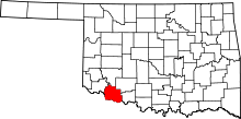 | |
| Towns | ||
| Footnotes | ‡This populated place also has portions in an adjacent county or counties | |