Toyahvale, Texas
| Toyahvale | |
|---|---|
| Unincorporated community | |
 Toyahvale  Toyahvale Location within the state of Texas | |
| Coordinates: 30°56′40″N 103°47′22″W / 30.94444°N 103.78944°WCoordinates: 30°56′40″N 103°47′22″W / 30.94444°N 103.78944°W | |
| Country | United States |
| State | Texas |
| County | Reeves |
| Elevation | 3,323 ft (1,013 m) |
| Time zone | Central (CST) (UTC-6) |
| • Summer (DST) | CDT (UTC-5) |
| ZIP codes | 79786 |
| GNIS feature ID | 1370067 |
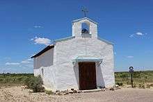
Toyahvale is an unincorporated community in southern Reeves County, Texas, United States. It lies along State Highway 17 and FM 3078 south of the city of Pecos, the county seat of Reeves County. Despite its similar name, Toyahvale is distinct from the town of Toyah, which lies 25 miles (40 km) to the north.[1] Its elevation is 3,323 feet (1,013 m).[2] Although Toyahvale is unincorporated, it has a post office, with the ZIP code of 79786.[3]
Toyahvale's name is a portmanteau: its first half is of a local Indian word for "flowing water", combined with "vale". The community was established after 1884, but its first post office was not opened until 1894; the office closed in 1931, but reopened in 1933. Today, the community lies at the western end of the Pecos Valley Southern Railway and is the location of Balmorhea State Park.[4]
Climate
According to the Köppen Climate Classification system, Toyahvale has a semi-arid climate, abbreviated "BSk" on climate maps.[5]
References
- ↑ Rand McNally. The Road Atlas '08. Chicago: Rand McNally, 2008, p. 99.
- ↑ U.S. Geological Survey Geographic Names Information System: Toyahvale, Texas
- ↑ Zip Code Lookup
- ↑ Toyahvale, Texas, Handbook of Texas Online, 2008-01-18. Accessed 2008-08-11.
- ↑ Climate Summary for Toyahvale, Texas
External links
Municipalities and communities of Reeves County, Texas, United States | ||
|---|---|---|
| Cities | 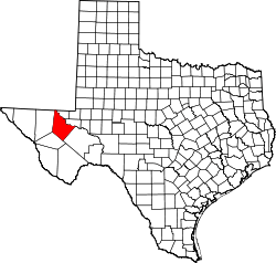 | |
| Town | ||
| CDP | ||
| Unincorporated communities | ||
| Ghost town | ||