Tulelake, California
| Tulelake, California | |
|---|---|
| City | |
| City of Tulelake | |
|
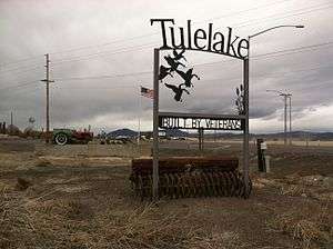
Welcome sign, south Tulelake | |
 Location in Siskiyou County and the state of California | |
 Tulelake, California Location in the United States | |
| Coordinates: 41°57′15″N 121°28′33″W / 41.95417°N 121.47583°WCoordinates: 41°57′15″N 121°28′33″W / 41.95417°N 121.47583°W | |
| Country |
|
| State |
|
| County |
|
| Incorporated | March 1, 1937[1] |
| Area[2] | |
| • Total | 0.412 sq mi (1.067 km2) |
| • Land | 0.410 sq mi (1.061 km2) |
| • Water | 0.002 sq mi (0.006 km2) 0.58% |
| Elevation | 4,035 ft (1,230 m) |
| Population (2010) | |
| • Total | 1,010 |
| • Density | 2,500/sq mi (950/km2) |
| Time zone | Pacific (PST) (UTC-8) |
| • Summer (DST) | PDT (UTC-7) |
| ZIP code | 96134 |
| Area code(s) | 530 |
| FIPS code | 06-80686 |
| GNIS feature ID | 1660040 |
Tulelake (/ˈtuːlileɪk/ TOO-lee-layk) is a city in Northeastern Siskiyou County, California, United States, at an elevation of 4,066 feet (1,239 m) above sea level. The town is named after nearby Tule Lake. The population was 1,010 at the 2010 census, down from 1,020 at the 2000 census.
Development
The first public auction of Tulelake land parcels took place on April 15, 1931. Over 100 lots were sold for prices ranging from $65 to $350. In 1937, the city was incorporated. Today there are over 400 housing units.[3]
Geography
Tulelake is located at 41°57′15″N 121°28′33″W / 41.95417°N 121.47583°W (41.954029, -121.475906).[4] Tulelake is located near the Siskiyou-Modoc County line. At the northwest corner of the Great Basin and Range.
According to the United States Census Bureau, the city has a total area of 0.4 square miles (1.0 km2), 99.42% of it land and 0.58% of it water.
Climate
Tulelake has a steppe climate (BSk) according to the Köppen climate classification system.
| Climate data for Tulelake (1932-2012) | |||||||||||||
|---|---|---|---|---|---|---|---|---|---|---|---|---|---|
| Month | Jan | Feb | Mar | Apr | May | Jun | Jul | Aug | Sep | Oct | Nov | Dec | Year |
| Record high °F (°C) | 62 (17) |
70 (21) |
77 (25) |
84 (29) |
95 (35) |
97 (36) |
101 (38) |
102 (39) |
99 (37) |
90 (32) |
75 (24) |
68 (20) |
102 (39) |
| Average high °F (°C) | 40.7 (4.8) |
45.6 (7.6) |
52 (11) |
59.3 (15.2) |
68.1 (20.1) |
75.8 (24.3) |
84.7 (29.3) |
83.8 (28.8) |
77.6 (25.3) |
65.7 (18.7) |
49.7 (9.8) |
41 (5) |
62 (17) |
| Average low °F (°C) | 20.1 (−6.6) |
22.8 (−5.1) |
25.5 (−3.6) |
29.2 (−1.6) |
36.3 (2.4) |
42 (6) |
45.9 (7.7) |
43.3 (6.3) |
37 (3) |
30.3 (−0.9) |
24.6 (−4.1) |
20.5 (−6.4) |
31.5 (−0.3) |
| Record low °F (°C) | −28 (−33) |
−24 (−31) |
−2 (−19) |
6 (−14) |
16 (−9) |
23 (−5) |
29 (−2) |
24 (−4) |
17 (−8) |
7 (−14) |
−10 (−23) |
−27 (−33) |
−28 (−33) |
| Average precipitation inches (mm) | 1.19 (30.2) |
1.04 (26.4) |
1.04 (26.4) |
0.86 (21.8) |
1.09 (27.7) |
0.91 (23.1) |
0.28 (7.1) |
0.36 (9.1) |
0.47 (11.9) |
0.91 (23.1) |
1.23 (31.2) |
1.39 (35.3) |
10.76 (273.3) |
| Average snowfall inches (cm) | 5.8 (14.7) |
3.8 (9.7) |
3.6 (9.1) |
1.4 (3.6) |
0.1 (0.3) |
0 (0) |
0 (0) |
0 (0) |
0 (0) |
0.1 (0.3) |
2.3 (5.8) |
4.3 (10.9) |
21.3 (54.1) |
| Average precipitation days | 12 | 10 | 10 | 8 | 8 | 5 | 2 | 2 | 3 | 6 | 10 | 11 | 87 |
| Source: WRCC[5] | |||||||||||||
Demographics
| Historical population | |||
|---|---|---|---|
| Census | Pop. | %± | |
| 1940 | 785 | — | |
| 1950 | 1,028 | 31.0% | |
| 1960 | 950 | −7.6% | |
| 1970 | 857 | −9.8% | |
| 1980 | 783 | −8.6% | |
| 1990 | 1,010 | 29.0% | |
| 2000 | 1,020 | 1.0% | |
| 2010 | 1,010 | −1.0% | |
| Est. 2015 | 994 | [6] | −1.6% |
2010
The 2010 United States Census[8] reported that Tulelake had a population of 1,010. The population density was 2,450.5 people per square mile (946.1/km2). The racial makeup of Tulelake was 563 (55.7%) White, 1 (0.1%) African American, 15 (1.5%) Native American, 1 (0.1%) Asian, 0 (0.0%) Pacific Islander, 365 (36.1%) from other races, and 65 (6.4%) from two or more races. Hispanic or Latino of any race were 601 persons (59.5%).
The Census reported that 1,010 people (100% of the population) lived in households, 0 (0%) lived in non-institutionalized group quarters, and 0 (0%) were institutionalized.
There were 347 households, out of which 158 (45.5%) had children under the age of 18 living in them, 177 (51.0%) were opposite-sex married couples living together, 43 (12.4%) had a female householder with no husband present, 20 (5.8%) had a male householder with no wife present. There were 24 (6.9%) unmarried opposite-sex partnerships, and 0 (0%) same-sex married couples or partnerships. 93 households (26.8%) were made up of individuals and 43 (12.4%) had someone living alone who was 65 years of age or older. The average household size was 2.91. There were 240 families (69.2% of all households); the average family size was 3.58.
The population was spread out with 340 people (33.7%) under the age of 18, 102 people (10.1%) aged 18 to 24, 244 people (24.2%) aged 25 to 44, 222 people (22.0%) aged 45 to 64, and 102 people (10.1%) who were 65 years of age or older. The median age was 29.4 years. For every 100 females there were 102.4 males. For every 100 females age 18 and over, there were 100.0 males.
There were 437 housing units at an average density of 1,060.3 per square mile (409.4/km2), of which 173 (49.9%) were owner-occupied, and 174 (50.1%) were occupied by renters. The homeowner vacancy rate was 6.0%; the rental vacancy rate was 12.1%. 473 people (46.8% of the population) lived in owner-occupied housing units and 537 people (53.2%) lived in rental housing units.
2000
As of the census[9] of 2000, there were 1,020 people, 358 households, and 255 families residing in the city. The population density was 2,625.4 people per square mile (1,009.8/km2). There were 459 housing units at an average density of 1,181.4 per square mile (454.4/km2). The racial makeup of the city was 71.76% White, 1.08% African American, 1.27% Native American, 0.29% Asian, 16.86% from other races, and 8.73% from two or more races. Hispanic or Latino of any race were 45.29% of the population.
There were 358 households out of which 42.2% had children under the age of 18 living with them, 54.5% were married couples living together, 12.8% had a female householder with no husband present, and 28.5% were non-families. 25.1% of all households were made up of individuals and 9.5% had someone living alone who was 65 years of age or older. The average household size was 2.85 and the average family size was 3.48.
In the city the population was spread out with 35.8% under the age of 18, 8.1% from 18 to 24, 26.1% from 25 to 44, 18.3% from 45 to 64, and 11.7% who were 65 years of age or older. The median age was 30 years. For every 100 females there were 99.6 males. For every 100 females age 18 and over, there were 96.1 males.
The median income for a household in the city was $23,750, and the median income for a family was $27,750. Males had a median income of $28,088 versus $22,500 for females. The per capita income for the city was $10,244. About 33.7% of families and 34.6% of the population were below the poverty line, including 46.2% of those under age 18 and none of those age 65 or over.
As of July 2005 the population was estimated to be 1,010 (a -1.0% change). There were estimated to be 509 males (49.9%) and 510 females(50.1%). The population is broke up into a variety of ethnic groups; 51.6% were White Non-Hispanic, 45.3% Hispanic, 16.9% Other, 8.7% were two or more races, 3.1% American Indian, and 1.1% African American.
Politics
In the state legislature Tulelake is in the 1st Senate District, represented by Republican Ted Gaines,[10] and the 1st Assembly District, represented by Republican Brian Dahle.[11]
Federally, Tulelake is in California's 1st congressional district, represented by Republican Doug LaMalfa.[12]
Education
There are three schools in the Tulelake Basin Joint Unified School District, two of which are in the town of Tulelake.[13] Newell Elementary, located in the unincorporated town of Newell, California, serves preschool through second grade. Third through sixth grades are taught at Tulelake Elementary, where the mascot is the Gosling, a reflection of area waterfowl. Tulelake High School, located in the town of Tulelake, instructs grades seven through twelve, and its mascot is the Honker, a slang term for the Canada goose.
Transportation
Tulelake has a municipal airport.
Points of interest
Two World War II internment camps were located near Tulelake. The Tulelake camp was an Italian and German prisoner-of-war camp to the east of town, located on Hill Road along Sheepy Ridge. Sheepy Ridge, also referred to as Gillems Bluff, is a small range adjacent to Tule Lake. The other internment camp housed nearly 18,000 Japanese Americans and Japanese alien residents and was in operation from May 1942 to March 1946. The Tule Lake War Relocation Center was one of ten Japanese internment camps in the United States. It was located approximately seven miles southeast of Tulelake. Today the western portion of the camp is occupied by the townsite of Newell.[14]
A goose and duck processing business and pillow factory in Tulelake was featured on an episode of Discovery Channel's series Dirty Jobs.[15]
Mark Twain nicknamed his 2-year-old girl Modoc due to her tantrums and was referring to an incident in 1852 near Tule Lake where that tribe destroyed an entire wagon train.[16]
Notable residents
- Miles Scott, a five-year-old kindergartener and cancer survivor from Tulelake,[17][18] became Batkid in November 2013, as San Francisco transformed to Gotham City in one of the most elaborate and largest Make-A-Wish projects staged, where Batkid foiled criminals and was awarded the key to the city.[19][20]
References
- ↑ "California Cities by Incorporation Date" (Word). California Association of Local Agency Formation Commissions. Retrieved August 25, 2014.
- ↑ U.S. Census
- ↑ http://tule-lake.com/towns/tulelake-california/
- ↑ "US Gazetteer files: 2010, 2000, and 1990". United States Census Bureau. 2011-02-12. Retrieved 2011-04-23.
- ↑ "TULELAKE, CA (049053)". Western Regional Climate Center. Retrieved December 3, 2015.
- ↑ "Annual Estimates of the Resident Population for Incorporated Places: April 1, 2010 to July 1, 2015". Retrieved July 2, 2016.
- ↑ "Census of Population and Housing". Census.gov. Retrieved June 4, 2015.
- ↑ "2010 Census Interactive Population Search: CA - Tulelake city". U.S. Census Bureau. Retrieved July 12, 2014.
- ↑ "American FactFinder". United States Census Bureau. Retrieved 2008-01-31.
- ↑ "Senators". State of California. Retrieved March 10, 2013.
- ↑ "Members Assembly". State of California. Retrieved March 2, 2013.
- ↑ "California's 1st Congressional District - Representatives & District Map". Civic Impulse, LLC. Retrieved March 1, 2013.
- ↑ "Tulelake Basin Joint Unified School District". Retrieved 2012-10-17.
- ↑ Welcome to the Tule Lake Unit of WWII Valor in the Pacific National Monument, National Park Service, U.S. Department of the Interior, September 10, 2014
- ↑ Dirty Jobs - Goose Down Plucker, Discovery Channel, June 15, 2013
- ↑ Twain Had Much To Say About Move Into Hartford House 140 Years Ago, Steve Courtney, The Courant, September 17, 2014
- ↑ Ben Affleck joins past Caped Crusaders Michael Keaton and Christian Bale to praise Batkid Miles Scott. Mail Online, November 15, 2013
- ↑ Holy Empathy! Batkid Lives Superhero Dream In San Francisco, The Two-Way, National Public Radio, November 15, 2013
- ↑ Levenson, Eric, Watch Make-A-Wish Turn San Francisco Into BatKid's 'Gotham City', The Atlantic Wire, November 2013
- ↑ Batkid's origin story: Video shows how Make-a-Wish foundation turned San Francisco into Gotham City, Mail Online, November 15, 2013
External links
- Life inTulelake, California
- Life in Tulelake Basin
- Tulelake Basin Joint Unified School District
- Tulelake Chamber of Commerce
Municipalities and communities of Siskiyou County, California, United States | ||
|---|---|---|
| Cities | 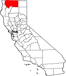 | |
| CDPs | ||
| Unincorporated communities | ||
| Indian reservation | ||
| Ghost towns | ||
| Footnotes | ‡This populated place also has portions in an adjacent county or counties | |