Turbo, Colombia
| Turbo, Colombia | ||
|---|---|---|
| Municipality and town | ||
 | ||
| ||
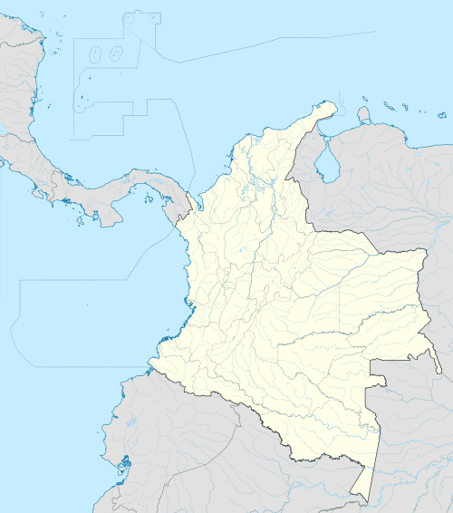
 Location of the municipality and town of Turbo, in the Antioquia Department of Colombia | ||
 Turbo, Colombia Location in Colombia | ||
| Coordinates: 8°6′0″N 76°44′0″W / 8.10000°N 76.73333°WCoordinates: 8°6′0″N 76°44′0″W / 8.10000°N 76.73333°W | ||
| Country |
| |
| Department |
| |
| Subregion | Urabá | |
| Area | ||
| • Metro | 3,055 km2 (1,180 sq mi) | |
| Elevation | 2 m (7 ft) | |
| Population (2016) | ||
| • Municipality and town | 163,525 | |
| • Density | 41.25/km2 (106.8/sq mi) | |
| • Urban | 65,307 | |
| Time zone | Colombia Standard Time (UTC-5) | |
.svg.png)
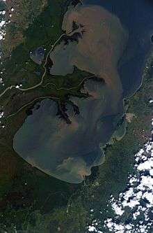
Turbo is a port town in Antioquia Department, Colombia. It is located on the coast of Gulf of Urabá, 340 km. north of Medellín (the department capital and second largest Colombian city). This port city is the capital of the Urabá region of Antioquia, Colombia. The place where Turbo is today was known as Pisisí, but by 1741 people were already talking about Turbo. By a decree on May 11, 1839, the central government spent one thousand pesos for a military service barracks in Turbo. In 1840 the republican president assigned one thousand fanegas of uncultivated lands for the new population. It was established as a municipality in 1847.
Turbo lies near the southeastern tip of the Darién Gap and is the northern terminus of the main route of the Pan American Highway in South America. There is currently no paved road connecting through the region to Yaviza, Panama, where the highway continues through Central and North America.
Geography
Climate
Tropical savanna climates have monthly mean temperature above 18°C (64°F) in every month of the year and typically a pronounced dry season, with the driest month having precipitation less than 60mm (2.36 in) of precipitation. Köppen Climate Classification subtype for this climate is "Aw". (Tropical Savanna Climate). The average temperature for the year in Turbo is 81.0°F (27.2°C). The warmest month, on average, is May with an average temperature of 82.0°F (27.8°C). The coolest month on average is January, with an average temperature of 80.0°F (26.7°C).[1]
| Climate data for Turbo | |||||||||||||
|---|---|---|---|---|---|---|---|---|---|---|---|---|---|
| Month | Jan | Feb | Mar | Apr | May | Jun | Jul | Aug | Sep | Oct | Nov | Dec | Year |
| Record high °C (°F) | 33.2 (91.8) |
35.0 (95) |
36.0 (96.8) |
34.6 (94.3) |
35.2 (95.4) |
34.6 (94.3) |
36.6 (97.9) |
34.6 (94.3) |
34.4 (93.9) |
35.6 (96.1) |
34.4 (93.9) |
34.6 (94.3) |
36.6 (97.9) |
| Average high °C (°F) | 30.7 (87.3) |
30.3 (86.5) |
30.5 (86.9) |
30.9 (87.6) |
31.3 (88.3) |
31.2 (88.2) |
31.5 (88.7) |
31.4 (88.5) |
31.6 (88.9) |
32.0 (89.6) |
31.4 (88.5) |
31.0 (87.8) |
31.1 (88) |
| Daily mean °C (°F) | 27.1 (80.8) |
27.1 (80.8) |
27.2 (81) |
27.4 (81.3) |
27.3 (81.1) |
27.3 (81.1) |
27.2 (81) |
27.2 (81) |
27.2 (81) |
27.2 (81) |
27.2 (81) |
27.1 (80.8) |
27.1 (80.8) |
| Record low °C (°F) | 20.2 (68.4) |
20.0 (68) |
21.0 (69.8) |
20.2 (68.4) |
20.2 (68.4) |
20.4 (68.7) |
20.0 (68) |
18.0 (64.4) |
17.8 (64) |
17.0 (62.6) |
20.2 (68.4) |
20.0 (68) |
17.0 (62.6) |
| Average precipitation mm (inches) | 84 (3.31) |
58 (2.28) |
78 (3.07) |
250 (9.84) |
270 (10.63) |
258 (10.16) |
215 (8.46) |
256 (10.08) |
197 (7.76) |
196 (7.72) |
234 (9.21) |
171 (6.73) |
2,268 (89.29) |
| Average precipitation days | 5 | 6 | 7 | 12 | 16 | 16 | 17 | 17 | 14 | 15 | 13 | 9 | 146 |
| Average relative humidity (%) | 85 | 85 | 85 | 86 | 87 | 87 | 86 | 86 | 86 | 86 | 87 | 81 | 85 |
| Source: Instituto de Hidrologia Meteorologia y Estudios Ambientales [2] | |||||||||||||
References
- ↑ http://www.weatherbase.com/weather/weather.php3?s=26008&cityname=Turbo--United-States-of-America Weatherbase: Historical Weather for Turbo, Colombia (closest city on record to Sapzurro)
- ↑ "Promedios Climatológicos 1971–2000" (in Spanish). Instituto de Hidrologia Meteorologia y Estudios Ambientales. Retrieved December 1, 2015.
Capital: Medellín | |||||||||||||||||||||||||||||||||||
| Regions and municipalities |
| ||||||||||||||||||||||||||||||||||
| Related topics | |||||||||||||||||||||||||||||||||||