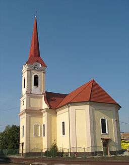
Tvrdošovce
| Tvrdošovce | |
| Tardoskedd | |
| village | |
 | |
| Country | Slovakia |
|---|---|
| Region | Nitra |
| District | Nové Zámky |
| River | Nitra |
| Elevation | 120 m (394 ft) |
| Coordinates | SK 48°05′42″N 18°03′50″E / 48.09500°N 18.06389°ECoordinates: SK 48°05′42″N 18°03′50″E / 48.09500°N 18.06389°E |
| Area | 55.56 km2 (21.452 sq mi) |
| Population | 5,180 (2011) |
| Density | 93/km2 (241/sq mi) |
| Founded | 1221 |
| Mayor | Marián Tóth |
| Timezone | CET (UTC+1) |
| - summer (DST) | CEST (UTC+2) |
| Postal code | 941 10 |
| Area code | +421-35 |
| Car plate | NZ |
  Location in Slovakia | |
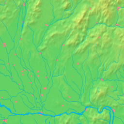  Location in the Nitra Region | |
| Wikimedia Commons: Tvrdošovce | |
| Statistics: MOŠ/MIS | |
| Website: http://www.tvrdosovce.sk/ | |
Tvrdošovce (Hungarian: Tardoskedd) is a large village and municipality in the Nové Zámky District in the Nitra Region of south-west Slovakia.
Geography
The municipality lies at an altitude of 120 metres and covers an area of 55.56 km².
History
In historical records, the village was first mentioned in 1221. After the Austro-Hungarian army disintegrated in November 1918, Czechoslovak troops occupied the area, later acknowledged internationally by the Treaty of Trianon. Between 1938 and 1945 Tvrdošovce once more became part of Miklós Horthy's Hungary through the First Vienna Award. From 1945 until the Velvet Divorce, it was part of Czechoslovakia. Since then it has been part of Slovakia.
Population
It has a population of 5180 people.[1]
Facilities
The village has a small public library, swimming pool, gym and a football pitch.
Photos
%2C_szabadt%C3%A9ri_vas%C3%BAti_m%C3%BAzeum_001.JPG) open air railway museum
open air railway museum%2C_szabadt%C3%A9ri_vas%C3%BAti_m%C3%BAzeum_002.JPG) open air railway museum
open air railway museum%2C_szabadt%C3%A9ri_vas%C3%BAti_m%C3%BAzeum_003.JPG) open air railway museum
open air railway museum
External links
- https://web.archive.org/web/20070513023228/http://www.statistics.sk/mosmis/eng/run.html
- Tvrdošovce – Nové Zámky Okolie
- ↑ http://portal.statistics.sk/files/Sekcie/sek_600/Demografia/Obyvatelstvo/tabulky/pocet_obyvatelov/2011/poc_obyv_2011_n.zip Štatistický úrad Slovenskej republiky – 31. december 2011 (ZIP 128,1 kB)