Tyndall, South Dakota
| Tyndall, South Dakota | |
|---|---|
| City | |
|
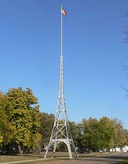
Flagpole in front of Bon Homme County courthouse | |
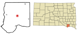 Location in Bon Homme County and the state of South Dakota | |
| Coordinates: 42°59′30″N 97°51′49″W / 42.99167°N 97.86361°WCoordinates: 42°59′30″N 97°51′49″W / 42.99167°N 97.86361°W | |
| Country | United States |
| State | South Dakota |
| County | Bon Homme |
| Incorporated | 1887[1] |
| Area[2] | |
| • Total | 1.58 sq mi (4.09 km2) |
| • Land | 1.58 sq mi (4.09 km2) |
| • Water | 0 sq mi (0 km2) |
| Elevation | 1,421 ft (433 m) |
| Population (2010)[3] | |
| • Total | 1,067 |
| • Estimate (2015)[4] | 1,049 |
| • Density | 675.3/sq mi (260.7/km2) |
| Time zone | Central (CST) (UTC-6) |
| • Summer (DST) | CDT (UTC-5) |
| ZIP code | 57066 |
| Area code(s) | 605 |
| FIPS code | 46-64860 |
| GNIS feature ID | 1258681[5] |
| Website | http://www.tyndallsd.com/ |
Tyndall (pronounced TIN'-duhl[6]) is a city in Bon Homme County, South Dakota, United States. The population was 1,067 at the 2010 census. It is the county seat of Bon Homme County.[7]
History
Tyndall was established in 1879 as the county seat of Bon Homme County.[8] It was named for John Tyndall, a British physicist who had paid a visit to the United States.[9]
Geography
Tyndall is located at 42°59′30″N 97°51′49″W / 42.991775°N 97.863539°W.[10]
According to the United States Census Bureau, the city has a total area of 1.58 square miles (4.09 km2), all of it land.[2]
Tyndall has been assigned the ZIP code 57066 and the FIPS place code 64860.
Demographics
| Historical population | |||
|---|---|---|---|
| Census | Pop. | %± | |
| 1890 | 509 | — | |
| 1900 | 1,167 | 129.3% | |
| 1910 | 1,107 | −5.1% | |
| 1920 | 1,405 | 26.9% | |
| 1930 | 1,287 | −8.4% | |
| 1940 | 1,289 | 0.2% | |
| 1950 | 1,292 | 0.2% | |
| 1960 | 1,262 | −2.3% | |
| 1970 | 1,245 | −1.3% | |
| 1980 | 1,253 | 0.6% | |
| 1990 | 1,201 | −4.2% | |
| 2000 | 1,239 | 3.2% | |
| 2010 | 1,067 | −13.9% | |
| Est. 2015 | 1,049 | [11] | −1.7% |
| U.S. Decennial Census[12] 2015 Estimate[4] | |||
2010 census
As of the census[3] of 2010, there were 1,067 people, 471 households, and 268 families residing in the city. The population density was 675.3 inhabitants per square mile (260.7/km2). There were 531 housing units at an average density of 336.1 per square mile (129.8/km2). The racial makeup of the city was 97.9% White, 0.1% African American, 0.7% Native American, 0.6% from other races, and 0.7% from two or more races. Hispanic or Latino of any race were 1.6% of the population.
There were 471 households of which 23.8% had children under the age of 18 living with them, 46.3% were married couples living together, 7.9% had a female householder with no husband present, 2.8% had a male householder with no wife present, and 43.1% were non-families. 39.9% of all households were made up of individuals and 22.5% had someone living alone who was 65 years of age or older. The average household size was 2.12 and the average family size was 2.88.
The median age in the city was 48.2 years. 21.5% of residents were under the age of 18; 4% were between the ages of 18 and 24; 18.7% were from 25 to 44; 27.5% were from 45 to 64; and 28.2% were 65 years of age or older. The gender makeup of the city was 47.7% male and 52.3% female.
2000 census
As of the census of 2000, there were 1,239 people, 524 households, and 311 families residing in the city. The population density was 783.6 people per square mile (302.8/km2). There were 579 housing units at an average density of 366.2/sq mi (141.5/km2). The racial makeup of the city was 98.22% White, 0.56% African American, 0.56% Native American, 0.16% from other races, and 0.48% from two or more races. Hispanic or Latino of any race were 0.65% of the population.
There were 524 households out of which 24.4% had children under the age of 18 living with them, 50.0% were married couples living together, 5.9% had a female householder with no husband present, and 40.5% were non-families. 36.8% of all households were made up of individuals and 20.8% had someone living alone who was 65 years of age or older. The average household size was 2.22 and the average family size was 2.92.
In the city the population was spread out with 22.8% under the age of 18, 4.9% from 18 to 24, 23.1% from 25 to 44, 21.3% from 45 to 64, and 27.8% who were 65 years of age or older. The median age was 44 years. For every 100 females there were 93.0 males. For every 100 females age 18 and over, there were 89.7 males.
As of 2000 the median income for a household in the city was $28,042, and the median income for a family was $37,500. Males had a median income of $24,219 versus $20,109 for females. The per capita income for the city was $15,086. About 9.6% of families and 17.2% of the population were below the poverty line, including 23.2% of those under age 18 and 21.8% of those age 65 or over.
Notable people
- Josh Ranek - Canadian Football League player.
- Robert Taplett - Marine Corps officer, recipient of the Navy Cross.
- Raleigh Aitchison - Pitcher in Major League Baseball from 1911–1915
References
- ↑ "SD Towns" (PDF). South Dakota State Historical Society. Retrieved 2010-02-16.
- 1 2 "US Gazetteer files 2010". United States Census Bureau. Retrieved 2012-06-21.
- 1 2 "American FactFinder". United States Census Bureau. Retrieved 2012-06-21.
- 1 2 "Population Estimates". United States Census Bureau. Retrieved June 7, 2016.
- ↑ "US Board on Geographic Names". United States Geological Survey. 2007-10-25. Retrieved 2008-01-31.
- ↑ "Broadcast Pronunciation Guide and South Dakota Pronunciations". Associated Press. Retrieved 2009-11-10.
- ↑ "Find a County". National Association of Counties. Retrieved 2011-06-07.
- ↑ Hellmann, Paul T. (May 13, 2013). Historical Gazetteer of the United States. Routledge. p. 1000. Retrieved 30 November 2013.
- ↑ Federal Writers' Project (1940). South Dakota place-names, v.1-3. University of South Dakota. p. 63.
- ↑ "US Gazetteer files: 2010, 2000, and 1990". United States Census Bureau. 2011-02-12. Retrieved 2011-04-23.
- ↑ "Annual Estimates of the Resident Population for Incorporated Places: April 1, 2010 to July 1, 2015". Retrieved July 2, 2016.
- ↑ United States Census Bureau. "Census of Population and Housing". Retrieved July 20, 2014.
Municipalities and communities of Bon Homme County, South Dakota, United States | ||
|---|---|---|
| Cities | 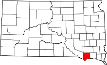 | |
| Town | ||
| CDP | ||
| Unincorporated community | ||