U.S. Route 25E
| |
|---|---|
| Route information | |
| Auxiliary route of US 25 | |
| Length: | 114 mi[1] (183 km) |
| Existed: | November 26, 1926[2] – present |
| Major junctions | |
| South end: |
|
|
| |
| North end: |
|
| Location | |
| States: | Tennessee, Kentucky |
| Counties: |
TN: Cocke, Jefferson, Hamblen, Grainger, Claiborne KY: Bell, Knox, Laurel |
| Highway system | |

U.S. Route 25E is the eastern branch of U.S. Route 25 from Newport, Tennessee, where US 25 splits into US 25E and US 25W, to North Corbin, Kentucky, where the two highways rejoin. The road, however, continues as US 25E for roughly 2 miles (3.2 km) until it joins Interstate 75 in North Corbin.
All of US-25E in Tennessee is now the East Tennessee Crossings Byway, a National Scenic Byway.[3] A portion of US 25E in Tennessee is also designated as Appalachian Development Corridor S. The corridor follows US 25E between I-81 in White Pine and State Route 63 (Corridor F) in Harrogate.[4]
US 25E has been included in the U.S. Highway System since the system's inception in 1926.
Route description
Tennessee
Northbound US 25 and westbound US 70 leave Newport concurrent with one another. At an intersection west of town, US 25 splits into two highways: US 25E, which heads north from this point, and US 25W, which continues west along US 70.
US 25E crosses over Douglas Lake south of Baneberry. Between White Pine and Witt, the highway has an interchange with Interstate 81 (exit 8). North of the Interstate, the road widens out to four lanes, and receives the Appalachian Development designation "Corridor S". US 25E intersects US 11E east of Morristown. It then crosses Cherokee Lake.
Near Bean Station, US 25E joins US 11W. The two roads split 3 miles (4.8 km) west of Bean Station, and US 25E continues northwest to Tazewell.[5]
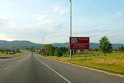
Northwest of Tazewell, the road bridges the Powell River, and then passes through Harrogate. In the town of Cumberland Gap, Tennessee, US 25E serves as the western terminus of US 58. US 25E used that highway en route to the Cumberland Gap prior to 1996, however, it now uses a new highway leading to the Cumberland Gap Tunnel, freeing up a portion of road that US 58 now uses. US 25E then passes through the tunnel, emerging on the other side in Kentucky.
Kentucky

US-25E remains a multilane divided highway for its entire extent in Kentucky.[6] Upon departing the tunnel, the road heads west to the town of Middlesboro, Kentucky, where it intersects Route 74. US-25E turns north at Middlesboro toward Pineville, the county seat of Bell County. In Pineville, the route is the western terminus of US-119.
US-25E departs Pineville and heads northwest, indirectly serving Tinsley via KY 92, crossing into Knox County, and bypassing Flat Lick to the west. The route makes an S-shaped curve, dipping south then turning back northwest as it approaches Barbourville. After serving the east side of Barbourville, the highway passes near Heidrick and runs through Baileys Switch.
Between Baileys Switch and Gray, US-25E gradually turns more east–west. After running through Gray, the route serves as the northern terminus of KY 3041. The road then reunites with US-25W north of Corbin, and the unsuffixed US-25 continues to points north. However, the US-25E designation continues west to Interstate 75, where it ends at Exit 29.[7]
History

Before the Cumberland Gap Tunnel was opened in 1996, US 25E passed through the Cumberland Gap in Virginia. Prior to the U.S. highway system's arrival, Virginia's State Highway 10 began at the Cumberland Gap and proceeded to Bristol.[8] A short spur south to Tennessee was soon added, becoming State Route 107 in the 1923 renumbering and State Route 100 in the 1928 renumbering.[9]
Early U.S. Highway planning assigned the number U.S. Route 411 to SR 10 through Cumberland Gap to Kentucky, and no number to SR 107.[10] By the final 1926 plan, US 411 was truncated to Cumberland Gap, and US 25E ran from Tennessee to Kentucky along SR 10 and SR 107.[2] The State Route numbers were dropped in the 1933 renumbering.
The Cumberland Gap Tunnel opened in 1996, completely bypassing Cumberland Gap and Virginia. U.S. Route 58 was moved to a new alignment, meeting US 25E in Tennessee, and US 25E was decommissioned through Virginia. As it lay within the boundaries of the Cumberland Gap National Historical Park, the National Park Service now controls the former road, and decided to return it to its pre-pavement state. The pavement was torn up, and old US 25E is now a dirt path.[11]
Major intersections
| State | County | Location | mi[7][12][13][14] | km | Exit | Destinations | Notes |
|---|---|---|---|---|---|---|---|
| Tennessee | Cocke | Newport | 0.0 | 0.0 | |||
| Jefferson | | 9.5 | 15.3 | ||||
| White Pine | 11.1 | 17.9 | south end of SR 113 overlap | ||||
| Hamblen | 13.0 | 20.9 | I-81 exit 8 | ||||
| Morristown | 14.8 | 23.8 | |||||
| 15.5 | 24.9 | north end of SR 113 overlap | |||||
| 17.1 | 27.5 | 1 | Interchange | ||||
| 19 | 31 | 1A | College Square Drive/College Park Drive | Interchange | |||
| 19.5 | 31.4 | 2A | Interchange; south end of US 11E / SR 34 overlap | ||||
| 19.8 | 31.9 | 2B | Interchange; north end of US 11E / SR 34 overlap | ||||
| 22.3 | 35.9 | interchange | |||||
| Grainger | Bean Station | 26.2 | 42.2 | ||||
| 29.3 | 47.2 | interchange; south end of US 11W / SR 1 overlap | |||||
| 31.2 | 50.2 | interchange; north end of US 11W / SR 1 overlap | |||||
| | 38.6 | 62.1 | |||||
| Claiborne | | 45.5 | 73.2 | south end of SR 33 overlap | |||
| Tazewell | 50.8 | 81.8 | north end of SR 33 overlap | ||||
| 51.3 | 82.6 | ||||||
| Harrogate | 60.2 | 96.9 | south end of SR 63 overlap | ||||
| 60.4 | 97.2 | north end of SR 63 overlap | |||||
| | 61.2 | 98.5 | interchange | ||||
| Cumberland Gap | 65.9 0.000 | 106.1 0.000 | Cumberland Gap Tunnel | ||||
| Kentucky | Bell | Cumberland Gap NHP | 1.343 | 2.161 | Cumberland Gap National Park Visitor Center & Craft Shop | interchange | |
| Middlesboro | 1.719 | 2.766 | |||||
| 2.781 | 4.476 | ||||||
| | 6.322 | 10.174 | |||||
| | 6.402 | 10.303 | |||||
| Ferndale | 8.313 | 13.378 | |||||
| | 8.900 | 14.323 | |||||
| | 11.604 | 18.675 | |||||
| Pineville | 12.355 | 19.883 | |||||
| 13.460 | 21.662 | ||||||
| 14.200 | 22.853 | ||||||
| | 17.360 | 27.938 | |||||
| | 17.576 | 28.286 | |||||
| Knox | | 19.075 | 30.698 | ||||
| | 20.309 | 32.684 | |||||
| | 21.543 | 34.670 | |||||
| | 21.709 | 34.937 | |||||
| | 22.471 | 36.164 | |||||
| | 24.081 | 38.755 | |||||
| | 25.581 | 41.169 | |||||
| Barbourville | 26.684 | 42.944 | |||||
| 27.418 | 44.125 | ||||||
| 28.470 | 45.818 | ||||||
| 29.439 | 47.377 | south end of KY 11 overlap | |||||
| 29.596 | 47.630 | ||||||
| 30.205 | 48.610 | north end of KY 11 overlap | |||||
| | 30.811 | 49.585 | |||||
| | 31.206 | 50.221 | |||||
| | 32.610 | 52.481 | |||||
| | 33.124 | 53.308 | |||||
| | 34.437 | 55.421 | |||||
| | 40.366 | 64.963 | |||||
| | 42.227 | 67.958 | |||||
| Corbin | 42.872 | 68.996 | |||||
| 44.301 | 71.296 | ||||||
| 44.593 | 71.765 | ||||||
| Laurel | North Corbin | 45.192 | 72.729 | ||||
| 45.703 | 73.552 | ||||||
| 46.805– 46.872 | 75.325– 75.433 | I-75 exit 29 | |||||
| 1.000 mi = 1.609 km; 1.000 km = 0.621 mi | |||||||
Popular culture
The northern section of US 25E from the Kentucky State line to Tazewell, along with the junctioning Tennessee SR-33 between Tazewell and Knoxville, were the inspiration for the song "The Ballad of Thunder Road", in which a moonshiner runs illegal whiskey from Kentucky to Tennessee along this route.
See also
 U.S. Roads portal
 Kentucky portal
 Tennessee portal
References
- ↑ Droz, Robert V. "US Highways: Divided (Split) Routes".
- 1 2 United States System of Highways Adopted for Uniform Marking by the American Association of State Highway Officials (Map). 1:7,000,000. Cartography by U.S. Geological Survey. Bureau of Public Roads. November 11, 1926. OCLC 32889555. Retrieved November 7, 2013.
- ↑ O'Neil, Duay (October 20, 2009). "Hwy 25 East is Now a National Scenic Byway". The Newport Plain Talk.
- ↑ ADHS Approved Corridors and Termini
- ↑ "Eastern Tennessee" (Map). The Road Atlas (2008 Large Scale ed.). Rand McNally. p. 193.
- ↑ Official Highway Map (Map) (2008 ed.). Kentucky Transportation Cabinet.
- 1 2 "HIS Official Milepoint Route Log Report (Laurel County)". Kentucky Transportation Cabinet. Retrieved January 19, 2010.
- ↑ State Highway Commission of Virginia (July 5, 1922). Minutes of the First Meeting of the State Highway Commission Created Under the Acts of 1922 (PDF) (Report). Richmond, VA: Commonwealth of Virginia., Proposed "State Highway System" for Virginia, as Recommended by the State Roads Committee, January 1918
- ↑ "VA 100". Virginia Highways Project.
- ↑ Secretary of Agriculture (November 18, 1925). Report of Joint Board on Interstate Highways, October 30, 1925 (Report). US Department of Agriculture.
- ↑ Cumberland Gap National Historical Park Map (PDF) (Map). National Park Service.
- ↑ Google (January 19, 2010). "U.S. Route 25E" (Map). Google Maps. Google. Retrieved January 19, 2010.
- ↑ "HIS Official Milepoint Route Log Report (Bell County)". Kentucky Transportation Cabinet. Retrieved January 19, 2010.
- ↑ "HIS Official Milepoint Route Log Report (Knox County)". Kentucky Transportation Cabinet. Retrieved January 19, 2010.