Laurel County, Kentucky
| Laurel County, Kentucky | |
|---|---|
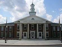 Laurel County courthouse in London | |
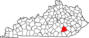 Location in the U.S. state of Kentucky | |
 Kentucky's location in the U.S. | |
| Founded | December 21, 1825 |
| Named for | Mountain laurel trees |
| Seat | London |
| Largest city | London |
| Area | |
| • Total | 444 sq mi (1,150 km2) |
| • Land | 434 sq mi (1,124 km2) |
| • Water | 9.7 sq mi (25 km2), 2.2% |
| Population | |
| • (2010) | 58,849 |
| • Density | 136/sq mi (53/km²) |
| Congressional district | 5th |
| Time zone | Eastern: UTC-5/-4 |
Laurel County is a county in the U.S. state of Kentucky. As of the 2010 census, the population was 58,849.[1] Its county seat is London.[2]
Laurel County is included in the London, KY Micropolitan Statistical Area.
Laurel County, by-the-drink alcohol sales is permitted only in restaurants in the city of London seating at least 50 diners and deriving at least 50% of their total sales from food.
History
Laurel County, the 80th county to be organized in Kentucky, was established by an act of the general assembly, December 21, 1825, from parts of Rockcastle, Clay, Knox and Whitley Counties.[3] Laurel County was named from the Laurel River, noted for dense laurel thickets along its banks.[4]
Laurel County was the location of the Battle of Wildcat Mountain, a pivotal yet little known battle during the American Civil War that kept Confederate armies from advancing on Big Hill, a major stronghold during the war.
After a fire damaged the courthouse in 1958, a new structure was completed in 1961.[5]
The first Kentucky Fried Chicken was started in Laurel County in Colonel Harland Sanders hometown of North Corbin. Due to the history of chicken in the county, The World Chicken Festival is celebrated every year in Laurel County, drawing crowds of up to 250,000 people over the four-day festival.
Geography
According to the U.S. Census Bureau, the county has a total area of 444 square miles (1,150 km2), of which 434 square miles (1,120 km2) is land and 9.7 square miles (25 km2) (2.2%) is water.[6] Part of Laurel River Lake is in Laurel County.
Adjacent counties
- Jackson County (northeast)
- Clay County (east)
- Knox County (southeast)
- Whitley County (south)
- McCreary County (southwest)
- Pulaski County (west)
- Rockcastle County (northwest)
National protected area
- Daniel Boone National Forest (part)
Demographics
| Historical population | |||
|---|---|---|---|
| Census | Pop. | %± | |
| 1830 | 2,206 | — | |
| 1840 | 3,079 | 39.6% | |
| 1850 | 4,145 | 34.6% | |
| 1860 | 5,488 | 32.4% | |
| 1870 | 6,016 | 9.6% | |
| 1880 | 9,131 | 51.8% | |
| 1890 | 13,747 | 50.6% | |
| 1900 | 17,592 | 28.0% | |
| 1910 | 19,872 | 13.0% | |
| 1920 | 19,814 | −0.3% | |
| 1930 | 21,109 | 6.5% | |
| 1940 | 25,640 | 21.5% | |
| 1950 | 25,797 | 0.6% | |
| 1960 | 24,901 | −3.5% | |
| 1970 | 27,386 | 10.0% | |
| 1980 | 38,982 | 42.3% | |
| 1990 | 43,438 | 11.4% | |
| 2000 | 52,715 | 21.4% | |
| 2010 | 58,849 | 11.6% | |
| Est. 2015 | 60,094 | [7] | 2.1% |
| U.S. Decennial Census[8] 1790-1960[9] 1900-1990[10] 1990-2000[11] 2010-2013[1] | |||
As of the census[12] of 2000, there were 52,715 people, 20,353 households, and 15,366 families residing in the county. The population density was 121 per square mile (47/km2). There were 22,317 housing units at an average density of 51 per square mile (20/km2). The racial makeup of the county was 95.66% White, 1.63% Black or African American, 0.37% Native American, 0.35% Asian, 0.01% Pacific Islander, 0.08% from other races, and 0.90% from two or more races. 0.55% of the population were Hispanics or Latinos of any race.
As of the census of 2010, Laurel County was 97.00% White or European American, 0.3% Native American and 0.7% Black or African American.[13]
There were 20,353 households out of which 35.20% had children under the age of 18 living with them, 60.60% were married couples living together, 11.40% had a female householder with no husband present, and 24.50% were non-families. 21.70% of all households were made up of individuals and 8.20% had someone living alone who was 65 years of age or older. The average household size was 2.56 and the average family size was 2.97.
The age distribution was 25.40% under 18, 9.20% from 18 to 24, 30.40% from 25 to 44, 23.50% from 45 to 64, and 11.50% who were 65 or older. The median age was 36 years. For every 100 females there were 95.60 males. For every 100 females age 18 and over, there were 92.80 males.
The median income for a household in the county was $27,015, and the median income for a family was $31,318. Males had a median income of $27,965 versus $19,757 for females. The per capita income for the county was $14,165. About 17.80% of families and 21.30% of the population were below the poverty line, including 28.80% of those under age 18 and 20.10% of those age 65 or over.
Politics
| Year | Republican | Democrat |
|---|---|---|
| 2016 | 82.92% 20,592 | 13.85% 3,440 |
| 2012 | 81.00% 18,151 | 17.43% 3,905 |
| 2008 | 78.49% 17,660 | 20.52% 4,618 |
| 2004 | 75.54% 16,819 | 23.79% 5,297 |
| 2000 | 71.90% 13,029 | 26.80% 4,856 |
Education
Two public school districts serve K-12 students in the county:
- Laurel County School District — Operates one preschool, 11 elementary schools, two middle schools, and two high schools.
- East Bernstadt Independent School District — Operates a single K-8 school. High school students in the district may attend either high school in the Laurel County district.
Communities
City
Unincorporated communities
Notable residents
Nationally bestselling author Silas House was raised in Laurel County and currently lives in Madison County,in the city of Berea. Former University of Kentucky basketball star Jeff Sheppard, the Most Outstanding Player of the 1998 NCAA Tournament who briefly played in the NBA, now lives in London.
2000 ASCAP Songwriter of the Year Darrell Scott, who has written hit songs for the Dixie Chicks, Travis Tritt, Brad Paisley, Patty Loveless, and many others, was born in London.
Chera-Lyn Cook, the first from Southeast Kentucky to win the title of Miss Kentucky. Cook was talent winner and 4th runner-up to Miss America 1999.
See also
References
- 1 2 "State & County QuickFacts". United States Census Bureau. Retrieved March 6, 2014.
- ↑ "Find a County". National Association of Counties. Retrieved June 7, 2011.
- ↑ "Laurel County". The Kentucky Encyclopedia. 2000. Retrieved August 22, 2014.
- ↑ Collins, Lewis (1877). History of Kentucky. p. 458.
- ↑ Hogan, Roseann Reinemuth (1992). Kentucky Ancestry: A Guide to Genealogical and Historical Research. Ancestry Publishing. p. 266. Retrieved July 26, 2013.
- ↑ "2010 Census Gazetteer Files". United States Census Bureau. August 22, 2012. Retrieved August 17, 2014.
- ↑ "County Totals Dataset: Population, Population Change and Estimated Components of Population Change: April 1, 2010 to July 1, 2015". Retrieved July 2, 2016.
- ↑ "U.S. Decennial Census". United States Census Bureau. Retrieved August 17, 2014.
- ↑ "Historical Census Browser". University of Virginia Library. Retrieved August 17, 2014.
- ↑ "Population of Counties by Decennial Census: 1900 to 1990". United States Census Bureau. Retrieved August 17, 2014.
- ↑ "Census 2000 PHC-T-4. Ranking Tables for Counties: 1990 and 2000" (PDF). United States Census Bureau. Retrieved August 17, 2014.
- ↑ "American FactFinder". United States Census Bureau. Retrieved January 31, 2008.
- ↑ http://quickfacts.census.gov/qfd/states/21/21125.html
- ↑ "Dave Leip's Atlas of U.S. Presidential Elections". Retrieved 2016-05-08.
External links
| Wikimedia Commons has media related to Laurel County, Kentucky. |
- Laurel County Event Calendar
- Laurel County History Museum & Genealogy Center
- World Chicken Festival
- Laurel County Tourism
- Levi Jackson Wilderness Road State Park
- The Kentucky Highlands Project
Municipalities and communities of Laurel County, Kentucky, United States | ||
|---|---|---|
| City | | |
| CDPs | ||
| Unincorporated communities | ||
| Footnotes | ‡This populated place also has portions in an adjacent county | |

Coordinates: 37°07′N 84°07′W / 37.11°N 84.12°W