Union Township, Champaign County, Ohio
| Union Township, Champaign County, Ohio | |
|---|---|
| Township | |
|
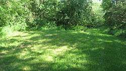
The Carl Potter Mound, a prehistoric Indian mound | |
 Location of Union Township in Champaign County | |
| Coordinates: 40°4′40″N 83°38′24″W / 40.07778°N 83.64000°WCoordinates: 40°4′40″N 83°38′24″W / 40.07778°N 83.64000°W | |
| Country | United States |
| State | Ohio |
| County | Champaign |
| Area | |
| • Total | 37.59 sq mi (97.35 km2) |
| • Land | 37.56 sq mi (97.28 km2) |
| • Water | 0.03 sq mi (0.07 km2) |
| Elevation[1] | 1,194 ft (364 m) |
| Population (2010) | |
| • Total | 2,210 |
| • Density | 59/sq mi (22.7/km2) |
| Time zone | Eastern (EST) (UTC-5) |
| • Summer (DST) | EDT (UTC-4) |
| FIPS code | 39-78274[2] |
| GNIS feature ID | 1085847[1] |
Union Township is one of the twelve townships of Champaign County, Ohio, United States. The 2010 census reported 2,210 people living in the township,[3] 2,106 of whom lived in the unincorporated portions of the township.
Geography
Located in the southeastern part of the county, it borders the following townships:
- Wayne Township - north
- Rush Township - northeast corner
- Goshen Township - east
- Pleasant Township, Clark County - south
- Moorefield Township, Clark County - southwest
- Urbana Township - west
- Salem Township - northwest
The village of Mutual is located in the center of the township.
Name and history
Union Township was established about 1805, but since the records were lost the exact date is likely unknown.[4]
It is one of twenty-seven Union Townships statewide.[5]
Union Township is the location of a Native American mound, the Carl Potter Mound. Believed to be a work of the Adena culture, the mound is an archaeological site and is listed on the National Register of Historic Places.[6]
Government
The township is governed by a three-member board of trustees, who are elected in November of odd-numbered years to a four-year term beginning on the following January 1. Two are elected in the year after the presidential election and one is elected in the year before it. There is also an elected township fiscal officer,[7] who serves a four-year term beginning on April 1 of the year after the election, which is held in November of the year before the presidential election. Vacancies in the fiscal officership or on the board of trustees are filled by the remaining trustees.
References
- 1 2 "US Board on Geographic Names". United States Geological Survey. 2007-10-25. Retrieved 2008-01-31.
- ↑ "American FactFinder". United States Census Bureau. Archived from the original on September 11, 2013. Retrieved 2008-01-31.
- ↑ "Geographic Identifiers: 2010 Demographic Profile Data (G001): Union township, Champaign County, Ohio". U.S. Census Bureau, American Factfinder. Retrieved January 13, 2015.
- ↑ The History of Champaign County, Ohio: Containing a History of the County; Its Cities, Towns, Etc. W.H. Beers & Company. 1881. p. 399.
- ↑ "Detailed map of Ohio" (PDF). United States Census Bureau. 2000. Retrieved 2007-02-16.
- ↑ Drennen, Bert C., III. National Register of Historic Places Inventory/Nomination: Carl Potter Mound. National Park Service, 1974-01-22, 2.
- ↑ §503.24, §505.01, and §507.01 of the Ohio Revised Code. Accessed 4/30/2009.
External links
Municipalities and communities of Champaign County, Ohio, United States | ||
|---|---|---|
| City |  | |
| Villages | ||
| Townships | ||
| CDP | ||
| Unincorporated communities | ||