Rosewood, Ohio
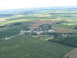
Rosewood and surrounding countryside
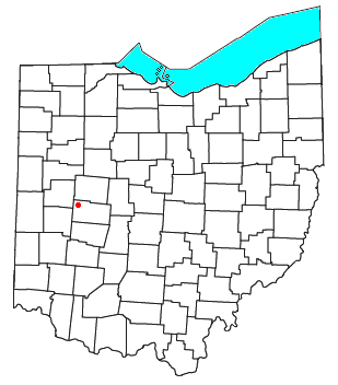
Rosewood is an unincorporated community and census-designated place (CDP) in northwestern Adams Township, Champaign County, Ohio, United States. As of the 2010 census it had a population of 257.[1] Although it is unincorporated, it has a post office, with the ZIP code of 43070.[2] It lies along State Route 29, an east-west highway.
Rosewood was laid out and platted in 1893 when the railroad was extended to that point.[3] A post office has been in operation at Rosewood since 1894.[4]
References
- ↑ "Geographic Identifiers: 2010 Demographic Profile Data (G001): Rosewood CDP, Ohio". U.S. Census Bureau, American Factfinder. Retrieved January 13, 2015.
- ↑ Zip Code Lookup
- ↑ Middleton, Evan P. (1917). History of Champaign County, Ohio: Its People, Industries and Institutions, Volume 1. B.F. Bowen. p. 331.
- ↑ "Champaign County". Jim Forte Postal History. Retrieved 21 December 2015.
Municipalities and communities of Champaign County, Ohio, United States | ||
|---|---|---|
| City |  | |
| Villages | ||
| Townships | ||
| CDP | ||
| Unincorporated communities | ||
Coordinates: 40°13′08″N 83°57′39″W / 40.21889°N 83.96083°W
This article is issued from Wikipedia - version of the 10/26/2016. The text is available under the Creative Commons Attribution/Share Alike but additional terms may apply for the media files.