Union Township, Knox County, Ohio
| Union Township, Knox County, Ohio | |
|---|---|
| Township | |
|
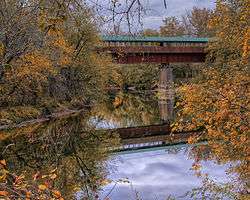
Bridge of Dreams over Vermilion River near Gann | |
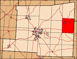 Location of Union Township in Knox County. | |
| Coordinates: 40°26′34″N 82°14′33″W / 40.44278°N 82.24250°WCoordinates: 40°26′34″N 82°14′33″W / 40.44278°N 82.24250°W | |
| Country | United States |
| State | Ohio |
| County | Knox |
| Area | |
| • Total | 30.3 sq mi (78.4 km2) |
| • Land | 30.2 sq mi (78.3 km2) |
| • Water | 0.0 sq mi (0.1 km2) |
| Elevation[1] | 1,070 ft (326 m) |
| Population (2000) | |
| • Total | 2,455 |
| • Density | 81.2/sq mi (31.4/km2) |
| Time zone | Eastern (EST) (UTC-5) |
| • Summer (DST) | EDT (UTC-4) |
| FIPS code | 39-78358[2] |
| GNIS feature ID | 1086413[1] |
Union Township is one of the twenty-two townships of Knox County, Ohio, United States. The 2000 census found 2,455 people in the township, 1,208 of whom lived in the unincorporated portions of the township.[3]
Geography
Located in the eastern part of the county, it borders the following townships:
- Jefferson Township - north
- Richland Township, Holmes County - northeast
- Tiverton Township, Coshocton County - east
- Newcastle Township, Coshocton County - southeast corner
- Butler Township - south
- Harrison Township - southwest corner
- Howard Township - west
- Brown Township - northwest
Two incorporated villages are located in Union Township: Danville in the northwest, and Gann (Brinkhaven) in the northeast.
Name and history
Union Township was organized in 1808.[4]
It is one of twenty-seven Union Townships statewide.[5]
Government
The township is governed by a three-member board of trustees, who are elected in November of odd-numbered years to a four-year term beginning on the following January 1. Two are elected in the year after the presidential election and one is elected in the year before it. There is also an elected township fiscal officer,[6] who serves a four-year term beginning on April 1 of the year after the election, which is held in November of the year before the presidential election. Vacancies in the fiscal officership or on the board of trustees are filled by the remaining trustees.
References
- 1 2 "US Board on Geographic Names". United States Geological Survey. 2007-10-25. Retrieved 2008-01-31.
- ↑ "American FactFinder". United States Census Bureau. Archived from the original on September 11, 2013. Retrieved 2008-01-31.
- ↑ Knox County, Ohio — Population by Places Estimates Ohio State University, 2007. Accessed 15 May 2007.
- ↑ Graham, Albert Adams (1881). History of Knox County, Ohio: Its Past and Present, Containing a Condensed, Comprehensive History of Ohio. A. A. Graham & Company. p. 550.
- ↑ "Detailed map of Ohio" (PDF). United States Census Bureau. 2000. Retrieved 2007-02-16.
- ↑ §503.24, §505.01, and §507.01 of the Ohio Revised Code. Accessed 4/30/2009.
External links
Municipalities and communities of Knox County, Ohio, United States | ||
|---|---|---|
| City |  | |
| Villages | ||
| Townships | ||
| CDPs | ||
| Unincorporated communities | ||
| Ghost town | ||
| Footnotes | ‡This populated place also has portions in an adjacent county or counties | |