Upper Siang district
| Upper Siang district | |
|---|---|
| District of Arunachal Pradesh | |
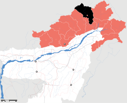 Location of Upper Siang district in Arunachal Pradesh | |
| Country | India |
| State | Arunachal Pradesh |
| Headquarters | Yingkiong |
| Area | |
| • Total | 6,188 km2 (2,389 sq mi) |
| Population (2011) | |
| • Total | 35,289[1] |
| Demographics | |
| • Literacy | 60.0%[1] |
| • Sex ratio | 891[1] |
| Website | Official website |
Upper Siang (Pron:/ˈsjæŋ or ˈsɪæŋ/) is an administrative district in the state of Arunachal Pradesh in India. It is the fourth least populous district in the country (out of 640).[2]
History
At one-point of history this place was part of Tibet and known as Pemako. Majority of the people are Adi of tribe while the Memba, Khamba Idu Mishmi tribe also exist there. There are 7 plants in the district. The district was formed in 1999 when it was split from East Siang district.[3]
Geography
The district headquarters are located at Yingkiong. Upper Siang district occupies an area of 6,118 square kilometres (2,362 sq mi),[4] comparatively equivalent to Russia's New Siberia Island.[5]
The district is the location of the massive Upper Siang Hydroelectric Project.
National protected area
- Mouling National Park (Part)
Transport
The 2,000-kilometre-long (1,200 mi) proposed Mago-Thingbu to Vijaynagar Arunachal Pradesh Frontier Highway along the McMahon Line,[6][7][8][9] (will intersect with the proposed East-West Industrial Corridor Highway) and will pass through this district, alignment map of which can be seen here and here.[10]
Divisions
There are two Arunachal Pradesh Legislative Assembly constituencies in this district: Tuting-Yingkiong and Mariyang-Geku. Both are part of Arunachal East Lok Sabha constituency.[11]
Demographics
According to the 2011 census Upper Siang district has a population of 35,320,[12] roughly equal to the nation of Liechtenstein.[13] This gives it a ranking of 637th in India (out of a total of 640).[12] The district has a population density of 5 inhabitants per square kilometre (13/sq mi) .[12] Its population growth rate over the decade 2001–2011 was 5.77%.[12] Upper Siang has a sex ratio of 891 females for every 1000 males,[12] and a literacy rate of 59.94%.[12]
Various tribal groups of the Adi people and the Memba tribe live in the district. The Adi follow generally follow Donyi-Polo, and the Memba are followers of Tibetan Buddhism.
Languages
Languages spoken include Adi, a Sino-Tibetan tongue with approximately 140 000 speakers, written in both the Tibetan and Latin scripts.[14]
Flora and fauna
In 1986 Upper Siang district became home to Mouling National Park, which has an area of 483 km2 (186.5 sq mi).[15] A new mammal to science, Mebo giant flying squirrel (Petaurista siangensis) has been reported from this district[16]
References
- 1 2 3 "District Census 2011". Census2011.co.in.
- ↑ "District Census 2011". Census2011.co.in. 2011. Retrieved 2011-09-30.
- ↑ Law, Gwillim (25 September 2011). "Districts of India". Statoids. Retrieved 2011-10-11.
- ↑ Srivastava, Dayawanti et al. (ed.) (2010). "States and Union Territories: Arunachal Pradesh: Government". India 2010: A Reference Annual (54th ed.). New Delhi, India: Additional Director General, Publications Division, Ministry of Information and Broadcasting (India), Government of India. p. 1113. ISBN 978-81-230-1617-7.
- ↑ "Island Directory Tables: Islands by Land Area". United Nations Environment Program. 18 February 1998. Retrieved 2011-10-11.
New Siberia (Novaya Sibir) 6,201km2
- ↑ "Top officials to meet to expedite road building along China border". Dipak Kumar Dash. timesofindia.indiatimes.com. Retrieved 27 October 2014.
- ↑ "Narendra Modi government to provide funds for restoration of damaged highways". http://www.dnaindia.com. Retrieved 27 October 2014. External link in
|publisher=(help) - ↑ "Indian Government Plans Highway Along Disputed China Border". Ankit Panda. thediplomat.com. Retrieved 27 October 2014.
- ↑ "Govt planning road along McMohan line in Arunachal Pradesh: Kiren Rijiju". Live Mint. Retrieved 2014-10-26.
- ↑ "China warns India against paving road in Arunachal". Ajay Banerjee. tribuneindia.com. Retrieved 2014-10-26.
- ↑ "Assembly Constituencies allocation w.r.t District and Parliamentary Constituencies". Chief Electoral Officer, Arunachal Pradesh website. Retrieved 21 March 2011.
- 1 2 3 4 5 6 "District Census 2011". Census2011.co.in. 2011. Retrieved 2011-09-30.
- ↑ US Directorate of Intelligence. "Country Comparison:Population". Retrieved 2011-10-01.
212 Liechtenstein 35,236 July 2011 est.
- ↑ M. Paul Lewis, ed. (2009). "Adi: A language of India". Ethnologue: Languages of the World (16th ed.). Dallas, Texas: SIL International. Retrieved 2011-09-28.
- ↑ Indian Ministry of Forests and Environment. "Protected areas: Arunachal Pradesh". Retrieved 25 September 2011.
- ↑ Choudhury, A.U. (2013). Description of a new species of giant flying squirrel of the genus Petaurista Link, 1795 from Siang Basin, Arunachal Pradesh in North East India. The NL & Journal of the Rhino Foundation for nat. in NE India 9: 30–38, plates.
External links
- Official website
- List of Places in Upper-Siang
 |
|
| ||
| West Siang district | |
Upper Dibang Valley district | ||
| ||||
| | ||||
| East Siang district | Lower Dibang Valley district |
Coordinates: 28°36′37″N 95°02′51″E / 28.61037°N 95.047531°E