Urlingford
| Urlingford Áth na nUrlainn | |
|---|---|
| Town | |
|
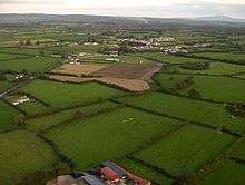
The Mason's Apron, Urlingford | |
 Urlingford Location in Ireland | |
| Coordinates: 52°43′13″N 7°34′57″W / 52.7203°N 7.5826°WCoordinates: 52°43′13″N 7°34′57″W / 52.7203°N 7.5826°W | |
| Country | Ireland |
| Province | Leinster |
| County | County Kilkenny |
| Elevation | 120 m (390 ft) |
| Population (2011)[1] | |
| • Urban | 973 |
| Time zone | WET (UTC+0) |
| • Summer (DST) | IST (WEST) (UTC-1) |
| Irish Grid Reference | S282633 |

Urlingford (Irish: Áth na nUrlainn, meaning "Ford of the slaughter"[2]) is a town in the south east of Ireland. It is located in the north east of County Kilkenny in Leinster.
The town lies on the R639. The M8 motorway runs just west of the town, from which both Urlingford and nearby Johnstown are accessed via junction four. Urlingford is a bus hub, with major operator JJ Kavanagh and Sons based there.[3] Situated 125 km (78 mi) from Dublin and 129 km (80 mi) from Cork, Urlingford has long been a resting-point for travellers half way between the Republic of Ireland's two largest cities. As a result, until September 2013 the Bus Éireann Dublin to Cork bus service called here. It is now replaced by route 128X which connects with express buses at Portlaoise and Cashel.[4]
The Irish name Áth na nUrlainn means "ford of the slaughter" and has been anglicised as Aghnenurlin, Aghnenoorlin, Awnanoorlin and similar.[2]
It is located in the civil parish of Urlingford which is part of the barony of Galmoy.[5]
History
| Historical population | ||
|---|---|---|
| Year | Pop. | ±% |
| 1831 | 1,366 | — |
| 1841 | 1,742 | +27.5% |
| 1851 | 1,168 | −33.0% |
| 1936 | 492 | −57.9% |
| 1946 | 586 | +19.1% |
| 2011 | 973 | +66.0% |
| [6][7][8][9][10][1] | ||
In 1526, Piers Butler, 8th Earl of Ormond, gave possession of the lands of Urlingford to John Tobin and Nicolas Mothing (chaplins).[11] The earlier settlement was focused around the castle, church and graveyard.[12]
The town had an organised planned growth with traditional plot patterns.[12] It was built over a cut-over bog, an extension to the Templetuohy Bog,[12] much of which has been reclaimed.[13] Urlingford is a linear town around the focused primary axis, the Main Street.[12] In 1837 it was the centre of a manufacture of coarse stuffs, flannels, and worsteds, and carries on an extensive retail trade with the surrounding districts.[14]
The town was recorded on Griffith's Valuation in 1864.[15] Urlingford has taken part in the Tidy Towns Competition.[16]
Geography
A tributary of the River Nore, the River Goul, enters the town from the southeast.[12] The river passes under Main Street and towards the bridge at Urlingford Castle (and mill).[12]
Culture
There is a library in Urlingford[17] which is based in the old courthouse.[18] Urlingford Castle and mill are located in Urlingford.[12]
Emeralds GAA is a junior Gaelic Athletic Association club, founded in 1972.
See also
References
- 1 2 (CSO, Census 2011 – Population Classified by Area)
- 1 2 (Fiontar 2008, Áth na nUrlainn/Urlingford)
- ↑ JJ Kavanagh Bus Company
- ↑ http://buseireann.ie/news.php?id=1361&month=Sep
- ↑ Down Survey Project. "Map of Urlingford Parish in the barony of Galmoy". downsurvey.tcd.ie. The Down Survey Project.
- ↑ (OHPR, p. 8, Comparative abstract, Ireland, 1831) and (OHPR, p. 40, Abstract, Ireland, 1831)
- ↑ (OHPR, p. 56, Report, Ireland, 1841)
- ↑ (OHPR, p. 93, County of Kilkenny, 1851)
- ↑ (CSO, 1936 Poplulation Data)
- ↑ (CSO, 1946 Poplulation Data)
- ↑ (Carrigan 1905, p. 23, Existing Civil Divisions or Baronies)
- 1 2 3 4 5 6 7 (KCC)
- ↑ (Tighe 1802, p. 4, Bog, Mountain)
- ↑ Lewis 1837, URLINGFORD Parish
- ↑ (Griffith 1864, Urlingford Search)
- ↑ "Tidy Towns Competition 2015 Adjudication Report" (PDF).
- ↑ KCC, Kilkenny County Council. "Kilkenny County Library Service". kilkenny.ie.
- ↑ Buildings of Ireland. "Urlingford Public Library (Urlingford Courthouse), Urlingford, County Kilkenny". buildingsofireland.ie.
Sources
- Fiontar (2008). "Placenames Database of Ireland". logainm.ie. Department of Community, Rural and Gaeltacht Affairs of the Government of Ireland.
- Griffith (1864). "Griffith's Valuation". www.askaboutireland.ie.
- Carrigan, William (1905). The History and Antiquities of the Diocese of Ossory. Sealy, Bryers & Walker. ISBN 9785879206463.
- Tighe, William (1802). Statistical observations relative to the county of Kilkenny: made in the years 1800 & 1801. Printed by Graisberry and Campbell.
- CSO, Central Statistics Office. "CSO Website". cso.ie. Government of Ireland.
- OHPR. "Histpop — The Online Historical Population Reports Project". histpop.org. University of Essex.
- KCC. "Urban Design Study for Urlingford" (PDF). kilkennycoco.ie. Kilkenny County Council.
- Lewis, Samuel (1837). A Topographical Dictionary of Ireland.
External links
- Buildings of Ireland. "Urlingford Buildings (Urlingford Courthouse), Urlingford, County Kilkenny". buildingsofireland.ie.
- "JJ Kavanagh & Sons". jjkavanagh.ie.
Places in County Kilkenny | ||
|---|---|---|
| Towns | 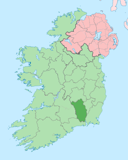 | |
| Villages |
| |
| Townlands | ||
| ||