Clogh, County Kilkenny
| Clogh An Chloch | |
|---|---|
| Town | |
 Clogh Location in Ireland | |
| Coordinates: 52°51′37″N 7°09′46″W / 52.86035°N 7.16281°WCoordinates: 52°51′37″N 7°09′46″W / 52.86035°N 7.16281°W | |
| Country | Ireland |
| Province | Leinster |
| County | County Kilkenny |
| Time zone | WET (UTC+0) |
| • Summer (DST) | IST (WEST) (UTC-1) |
| Irish Grid Reference | S5627678602 |
| Website |
www |
Clogh (Irish: An Chloch) is a village,[1] a townland,[2] and namesake of an electoral district[3] in County Kilkenny, Ireland.
Clogh on the R426 road near Castlecomer.
History
In 1837 it lay along the road from Castlecomer on the road to Athy.[1] It containing 116 houses and 582 inhabitants. Most people were employed in the neighbouring collieries.[1] It had a constabulary police station.[1] In 1837, the district of Clogh comprised parts of the parishes of Castlecomer and Rathaspeck.[1] The Roman Catholic chapel for the district was in Clogh.[1]
Clogh townland is in the parish of Castlecomer and the barony of Fassadining.[1] The name Clogh comes from Gaeilge Cloch, as it is believed that the natives threw stones at Saint Patrick when he arrived in the area to spread Catholicism.
Village
As of the 2006 census, by the Central Statistics Office, the town's population, including Chatsworth, was 351. This was a 9.7% change since 2002.[4]
See also
References
Further reading
- Census (2006), 2006 Census of Ireland, Central Statistics Office (Ireland)
- Agriculture (2002), 2002 Agriculture Census - Kilkenny, Central Statistics Office (Ireland)
- Lewis, Samuel (1837), "Clough, a village", A Topgrahical Dictionary of Ireland, Volume 1, London: Samuel Lewis & Co. 87, Aldergate Street.
- logainm (2010), "Irish placenames database", logainm.ie (in English and Irish), Department of Community, Rural and Gaeltacht Affairs, retrieved 30 September 2010
Places in County Kilkenny | ||
|---|---|---|
| Towns | 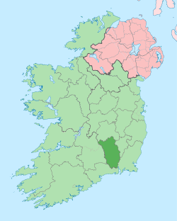 | |
| Villages |
| |
| Townlands | ||
| ||