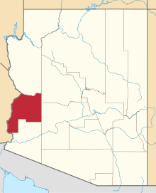
Utting, Arizona
| Utting, Arizona | |
|---|---|
| Census-designated place | |
 Utting, Arizona | |
| Coordinates: 33°50′20″N 113°53′13″W / 33.83889°N 113.88694°WCoordinates: 33°50′20″N 113°53′13″W / 33.83889°N 113.88694°W | |
| Country | United States |
| State | Arizona |
| County | La Paz |
| Area[1] | |
| • Total | 26.466 sq mi (68.55 km2) |
| • Land | 26.466 sq mi (68.55 km2) |
| • Water | 0 sq mi (0 km2) |
| Elevation | 1,132 ft (345 m) |
| Population (2010)[2] | |
| • Total | 126 |
| • Density | 4.8/sq mi (1.8/km2) |
| Time zone | Mountain (MST) (UTC-7) |
| Area code(s) | 928 |
| GNIS feature ID | 24669[3] |
Utting is a census-designated place in La Paz County, Arizona, United States. As of the 2010 census, its population was 126 .[2] The community was named after Charles Utting, who fought with the Rough Riders in the Spanish–American War.[3]
References
- ↑ "US Gazetteer files: 2010, 2000, and 1990". United States Census Bureau. 2011-02-12. Retrieved 2011-04-23.
- 1 2 "American FactFinder". United States Census Bureau. Retrieved 2011-05-14.
- 1 2 "Utting". Geographic Names Information System. United States Geological Survey.
This article is issued from Wikipedia - version of the 9/11/2015. The text is available under the Creative Commons Attribution/Share Alike but additional terms may apply for the media files.
