Ville-Émard
| Ville-Émard | |
|---|---|
| Neighbourhood | |
|
| |
|
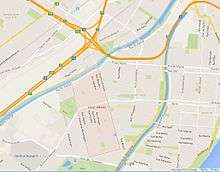
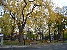
Ville-Émard Location of Ville-Émard in Montreal | |
| Coordinates: 45°27′21″N 73°35′33″W / 45.45572°N 73.59258°W | |
| Country | Canada |
| Province | Quebec |
| City | Montreal |
| Borough | Le Sud-Ouest |
| Population (2011)[1] | |
| • Total | 18,603 |
Ville-Émard is a neighbourhood located in the Sud-Ouest borough of Montreal, Quebec, Canada, and is the home of Angrignon Park.
Overview
Geography
This neighbourhood is bordered by the Aqueduct Canal to the east as far north as Desmarchais Boulevard where it meets Côte-Saint-Paul, after which the eastern boundary runs north along Monk Boulevard to the Lachine Canal, the community's northern edge. The western boundary runs south along Irwin Street and Irwin Avenue to Angrinon Park, the outer boundaries of which form the community's western and southern edges.[2] This neighbourhood is accessible via the Angrignon exit on Quebec Autoroute 20 and the De La Vérendrye exit on Quebec Autoroute 15.
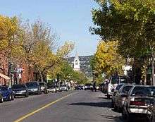
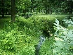
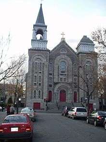
Neighbourhood Views

History
Ville-Émard was originally part of the concession of Côte Saint-Paul, granted by the Sulpician Order, seigneurs of the Island of Montreal, in 1662. The concession included modern-day Ville-Émard, Côte-Saint-Paul, and the Turcot Yards, and was used for agriculture. The Lachine Canal bisected the area in 1825 and disrupted agricultural activities.[3]
The Lachine Canal brought numerous factories to the region, drawn by the availability of transport and water power. The two first streets of Ville-Émard were Hamilton and Beaulieu, opened up by Éphrem Hudon in 1871. By 1875, several factories were present. The core of the modern-day neighbourhood, a farm belonging to W. B. Davidson, was sold by his widow Ann Ryan to entrepreneur Joseph-Ulric Émard. He subdivided the land, rapidly selling the properties, and created the Compagnie des Terrains de la banlieue de Montréal with his business partners, Messrs. Ouimet, Monk, Swail and Gohier.[4]
Shortly after the creation of the Village of Côte-Saint-Paul in 1874, this area separated as the Parish Municipality of Côte-Saint-Paul in 1878. In 1902 it became the Village du Boulevard-Saint-Paul, and in 1908, Joseph-Ulric Émard, who had become the mayor, renamed the town for himself. Shops and municipal services opened along Boulevard Monk. The parish of Notre-Dame-du-Perpétuel-Secours was founded in 1906 under Curé J. Moïse Jolicoeur.[4]
Clockwise from the north, the town of Ville-Émard was bounded by the Lachine Canal, St. Louis Street (now Rue Briand), First Avenue (now Rue le Caron), a property line just north of Rielle Street (now Rue Laurendeau), the property line behind the lots on the west side of Frontenac Street (now Rue Leprohon), the north bank of the Aqueduct Canal, and the boundary with the parish of Lachine (approximately the same as the boundary between the modern borough and LaSalle).[5]
In 1910, Ville-Emard was annexed to the city of Montreal at the same time as its neighbour Côte-Saint-Paul.
The vast English-style Angrignon Park was opened on the former Crawford family farm in 1927.[6]
The metro arrived in Ville-Émard in 1978, with the construction of Angrignon, Monk, and Jolicoeur stations.
Ville-Émard became part of the borough of Le Sud-Ouest in 2002.
Demographics
Home language (2006)
| Language | Population | Pct (%) |
|---|---|---|
| French | 9,130 | 66.59% |
| English | 1,785 | 13.02% |
| Both English and French | 165 | 1.20% |
| Other languages | 2,630 | 19.18% |
Infrastructure
Ville-Émard is served by three stations on the Montreal Metro's Green Line, Monk, Angrignon and Jolicoeur. It is crossed and bordered by the Lachine and Aqueduct Canal. Various bicycle paths run alongside the canals.
Angrignon Park, one of the most important urban parks in the city of Montreal is located at the southern tip of the neighbourhood. The Maison de la culture Marie-Uguay as well as the Marie-Uguay library are situated in Ville-Émard, as is École secondaire Honoré-Mercier.
Notable people
- Rychard Campeau, Professional hockey player (Philadelphia Blazer's WHA)
- Bianca Gervais, actrice
- Albert Millaire, Actor and Theatre person
- Alain Lefèvre, CLassical pianist, born in Émard and proud to say it.
- Marina Orsini, actor (cinema and television)
- Edgar Fruitier, actor, radio host (SRC)
- Robin Philpot polemicist, author
- Karole Lauzier, Editor
- Mario Lemieux, NHL ice hockey player
- Patrick Traverse, Professional hockey player
- Marie Uguay, poet Neighbourhood's library and cultural center named after her
- Vittorio Rossi, (Playwright, Actor, Director)
- Maurice "Mad Dog" Vachon, (Pro Wrestler)
- Alberto Cellucci, Legendary Socialite
The Quebec publisher Alain Stanké as well as the politician and journalist Claude Ryan also spent their childhoods in Ville-Émard. The Ville-Émard Blues Band music group pays tribute to the neighbourhood where band members would practice at the recording studio of bassist Roland "Bill" Gagnon.
References
- ↑ 2011 Canadian census tracts 4620089 - 4620093
- ↑ "Map of Montreal" Retrieved October 13, 2011.
- ↑ "Fiche du secteur: Côte-Saint-Paul." Grand répertoire du patrimoine bâti de Montréal. Accessed 4 July 2011.
- 1 2 "L'Histoire du quartier en quelques mots." ville-emard.com. Accessed July 4, 2011.
- ↑ Pinsoneault, Adolphe Rodrigue. Atlas of the island and city of Montreal and Ile Bizard : a compilation of the most recent cadastral plans from the book of reference. Atlas Publishing Co. Ltd: 1907. Pp. 35-39. Available online from Bibliothèque et Archives nationales du Québec; consulted July 5, 2011.
- ↑ "Angrignon Metro: History." metrodemontreal.com. Accessed July 4, 2011.
External links
- http://ville-emard.com/
- http://shspe.info/
- https://www.facebook.com/shstpaulemard
- http://pizzanino.com/en/home since 1959
- http://www.villeemardbagels.com/
Coordinates: 45°27′20.6″N 73°35′33.3″W / 45.455722°N 73.592583°W