Saint-Laurent, Quebec
| Saint-Laurent | ||
|---|---|---|
| Borough of Montreal | ||
|
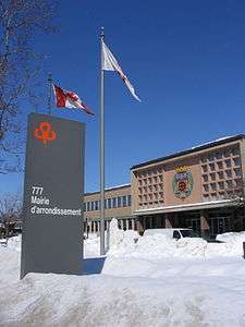
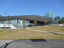
Saint-Laurent borough hall. | ||
| ||
 Location on the Island of Montreal. (Dark grey areas indicate demerged municipalities). | ||
| Country |
| |
| Province |
| |
| Region | Montréal | |
| Established | January 01, 2002 | |
| Electoral Districts Federal |
Saint-Laurent | |
| Provincial |
Saint-Laurent and Acadie | |
| Government[1][2][3] | ||
| • Type | Borough | |
| • Mayor | Alan DeSousa (EDC) | |
| • Federal MP(s) | Stéphane Dion (LIB) | |
| • Quebec MNA(s) |
Jean-Marc Fournier (PLQ) Christine St-Pierre (PLQ) | |
| Area[4] | ||
| • Land | 42.88 km2 (16.56 sq mi) | |
| Population (2011)[4][5] | ||
| • Total | 93,842 | |
| • Density | 2,188.5/km2 (5,668/sq mi) | |
| • Pop 2006-2011 |
| |
| • Dwellings(2006) | 35,287 | |
| Time zone | EST (UTC-5) | |
| • Summer (DST) | EDT (UTC-4) | |
| Postal code(s) | H4L, H4M, H4R, H4S, H4T | |
| Area code(s) | (514) and (438) | |
| Highways |
| |
| Website |
ville | |

Saint-Laurent is a borough of the city of Montreal, the largest in area of Montreal's boroughs. Prior to its 2002 merger, it was a city.
History
Saint-Laurent was founded as the Parish of Saint-Laurent in 1720.
Merger and proposed demerger
The City of Saint-Laurent or Ville Saint-Laurent was merged into the City of Montreal on January 1, 2002, by the Parti Québécois government. On June 20, 2004, the demerger forces lost a referendum on the issue of recreating Saint-Laurent as a city. While 75% of the turnout voted to demerge, this only represented 28.5% of the total eligible voting population, falling short of the requisite 35% as set by the province.
Geography
Neighbourhoods within this borough include Bois-Franc.
Demographics
| Historical populations | ||
|---|---|---|
| Year | Pop. | ±% |
| 1966 | 59,188 | — |
| 1971 | 62,955 | +6.4% |
| 1976 | 64,404 | +2.3% |
| 1981 | 65,900 | +2.3% |
| 1986 | 67,002 | +1.7% |
| 1991 | 72,402 | +8.1% |
| 1996 | 74,240 | +2.5% |
| 2001 | 77,391 | +4.2% |
| 2006 | 84,833 | +9.6% |
| 2011 | 93,842 | +10.6% |
| [6] | ||
Saint-Laurent is one of Quebec's (and Canada's) most ethnically mixed areas, with some 166 ethnicities reported to live there in relative harmony.[7]
Mother tongue figures from the 2011 census of Canada are: English (15.6 per cent), French (29.7 per cent), non-official languages (54.7 per cent; largest linguistic groups are Arabic, Chinese, Greek and Spanish)[8]
In 2011 the immigrant population was 45.4 percent, according to the National Household Survey by Statistics Canada.[8]
| Language | Population | Percentage (%) |
|---|---|---|
| French | 30,190 | 36% |
| English | 21,220 | 26% |
| Other languages | 31,295 | 38% |
| Ethnicity | Population | Percent |
|---|---|---|
| Canadian | 16,685 | 21.78% |
| French | 9,570 | 12.49% |
| Lebanese | 7,875 | 10.28% |
| Israeli | 6,765 | 9.98% |
| Chinese | 5,460 | 7.13% |
| Greek | 4,265 | 5.57% |
| Italian | 3,285 | 4.29% |
| English | 2,800 | 3.66% |
| Irish | 2,375 | 3.1% |
| East Indian | 2,265 | 2.96% |
Linguistic trend
| Language | 1996 | 2001 | 2006 |
|---|---|---|---|
| French | 23,715 | 24,520 | 24,280 |
| English | 13,550 | 12,805 | 13,290 |
| English and French | 1,540 | 1,030 | 710 |
| Other languages | 35,445 | 38,255 | 45,590 |
| Population | 74,240 | 77,391 | 84,833 |
Economy
Saint-Laurent is the second-largest employment hub within the metropolitan region, after downtown Montréal.[10]
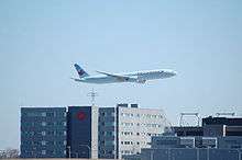
Air Canada Centre,[11] also known as La Rondelle ("The Puck" in French), is Air Canada's headquarters,[12] located on the grounds of Montréal-Pierre Elliott Trudeau International Airport and in Saint-Laurent.[13][14] In 1990 the airline announced that it was moving its headquarters from Downtown Montreal to the airport to cut costs.[15]
In addition Air Transat's headquarters and a regional office of Air Canada Jazz are in Saint-Laurent and on the grounds of Trudeau Airport.[16][17] Before its dissolution Jetsgo was headquartered in Saint-Laurent.[18]
Bombardier Aerospace has the Amphibious Aircraft Division in Saint-Laurent.[19]
Norgate Shopping Centre (a strip mall) is the earliest shopping centre in Canada. It was built in Saint-Laurent in 1949, is still operational, and has been refurbished in the 2010s.
Government
Borough council
Saint-Laurent is divided into two districts, Norman-McLaren and Côte-de-Liesse. The Norman-McLaren district is named for Norman McLaren, a cinema pioneer at the National Film Board of Canada, whose headquarters are located in the borough district.
As of the November 3, 2013 Montreal municipal election, the current borough council consists of the following councillors:
| District | Position | Name | Party | |
|---|---|---|---|---|
| — | Borough mayor City councillor |
Alan DeSousa | Équipe Coderre | |
| Côte-de-Liesse | City councillor | Francesco Miele | Équipe Coderre | |
| Borough councillor | Maurice Cohen | Équipe Coderre | ||
| Norman-McLaren | City councillor | Aref Salem | Équipe Coderre | |
| Borough councillor | Michèle Biron | Équipe Coderre |
Federal riding of Saint-Laurent
The riding has elected a Liberal Party of Canada member of Parliament since its creation in 1986. It is the riding of longtime MP and former federal Liberal leader Stéphane Dion. Dion has represented the riding since 1996. He survived the Orange Wave that eliminated many of his Liberal cohort in the federal election of 2011, besting his closest adversary by greater than 5700 votes.[8]
Infrastructure
Saint-Laurent has three fire stations and two police stations, one municipal court building, two libraries, the former City Hall (now the borough hall). There are two indoor hockey arenas, the municipal Raymond Bourque Arena, named after Raymond Bourque a former NHL player and Hockey Hall of Fame member. There is also the commercial Bonaventure's Arena which has rinks available for rent.
Transportation
Saint-Laurent has many transportation links, with one municipal bus terminal (Terminus Côte-Vertu), two Montreal Metro stations (du Collège, Côte-Vertu), three commuter train stations (Bois-Franc, du Ruisseau and Montpellier), four autoroutes (Autoroute 15 (Decarie Expressway and Laurentian Autoroute), Autoroute 40 - Metropolitan Boulevard/Transcanada Highway, Autoroute 520, and Autoroute 13), and a secondary highway (Route 117), in addition to major urban boulevards (Marcel-Laurin Boulevard, Henri Bourassa Boulevard, Cavendish Boulevard, De la Côte-Vertu Road, Decarie Boulevard, Thimens Boulevard). The former Cartierville Airport is no more, having been turned into a residential subdivision called Bois-Franc.
Part of Trudeau International Airport also lies within the territory of Saint-Laurent.[13][20]
Education
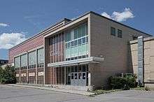
Saint-Laurent contains two CÉGEPs within its limits, one English (Vanier College) and one French (Cégep de Saint-Laurent). An art museum, the Saint-Laurent Museum of Art, is located on the campus of Cégep de Saint-Laurent, along with a bowling alley and an indoor college hockey rink.
The Commission scolaire Marguerite-Bourgeoys (CSMB) operates Francophone public schools. The district operates the École secondaire Saint-Laurent buildings Émile-Legault and Saint-Germain in Saint-Laurent.[21] It also operates multiple primary schools and the Centre de formation professionnelle Léonard-De Vinci (Édifice Côte-Vertu and Édifice Thimens).[22]
The English Montreal School Board (EMSB) operates Anglophone public schools in the nearby area.[23] LaurenHill Academy is a secondary school in the borough.
Private schools:
- École Alex Manoogian(ՀԲԸՄ ԱԼԵՔ ՄԱՆՈՒԿԵԱՆ ՎԱՐԺԱՐԱՆ)-Armen Québec
- École Maïmonide, Campus Jacob Safra
- École Montessori Ville-Marie, Campus Saint-Laurent
- École bilingue Notre-Dame de Sion
- École Dar-Al-Iman
- École Les jeunes Musulmans canadiens
Previously it housed a campus of the United Talmud Torahs of Montreal Jewish school.[26]
Public libraries
The Montreal Public Libraries Network operates the Vieux-Saint-Laurent Branch and the Du Boisé Branch in Saint-Laurent.[27]
International relations
Twin towns — Sister cities
Saint-Laurent is twinned with:
-
 Mérignac, Gironde, Nouvelle-Aquitaine, France[28]
 -
 Lethbridge, Alberta, Canada
See also
| Wikimedia Commons has media related to Saint-Laurent, Quebec. |
References
- ↑ Ministère des Affaires Municipales et Régions: Saint-Laurent (Montreal)
- ↑ Parliament of Canada Federal Riding History: SAINT-LAURENT--CARTIERVILLE (Quebec)
- ↑ Chief Electoral Officer of Québec - 40th General Election Riding Results: SAINT-LAURENT
^ Chief Electoral Officer of Québec - 40th General Election Riding Results: ACADIE - 1 2 3 2006 Statistics Canada Community Profile: Saint-Laurent, Quebec
- ↑ "Population totale en 2006 et en 2011 - Variation — Densité" (PDF). Canada 2011 Census (in French). Ville de Montréal. 2012. Retrieved 5 June 2012.
- ↑ "Profil sociodéographique: Arrondissement de Saint-Laurent" (PDF) (in French). Ville de Montréal. 2013. Retrieved 28 October 2013.
- ↑ "Harel to divide and conquer?". Thesuburbannews.ca. Retrieved 2012-01-06.
- 1 2 3 http://www.cbc.ca/news/canada/montreal/spotlight-on-montreal-ridings-saint-laurent-1.3243810
- ↑ http://ville.montreal.qc.ca/portal/page?_pageid=6897,68087673&_dad=portal&_schema=PORTAL
- ↑ CA (2009-06-15). "Local transportation plan adopted - Vos nouvelles - Nouvelles Saint-Laurent News". Nouvellessaint-laurent.com. Retrieved 2012-01-06.
- ↑ World Airline Directory. Flight International. March 17–23, 1999. "46.
- ↑ "Investors Contacts." Air Canada. Retrieved on May 18, 2009.
- 1 2 "Detailed Map of Dorval." City of Dorval. Retrieved on November 4, 2010.
- ↑ Israelson, David. "Companies eye exits in case of separation." Toronto Star. September 11, 1994. Retrieved on September 23, 2009.
- ↑ "Air Canada layoffs blamed on free trade." Toronto Star. October 10, 1990. A1. Retrieved on September 23, 2009.
- ↑ "Contact Us." Air Transat. Retrieved on May 20, 2009.
- ↑ "Contact Us." Air Canada Jazz. Retrieved on May 19, 2009.
- ↑ "Talk to Us." Jetsgo. Retrieved on June 5, 2009.
- ↑ "Aerospace Directory." Bombardier Inc. Retrieved on December 4, 2010. "3400 Douglas-B. Floréani Road Saint-Laurent, Québec Canada H4S 1V2." Address in French: "3400, rue Douglas-B. Floréani Saint-Laurent (Québec) H4S 1V2 Canada"
- ↑ "ab11e5b4-ccb1-430e-9a7c-598d63c7480b.gif." City of Montreal. Retrieved on December 4, 2010.
- ↑ http://www.csmb.qc.ca/fr-CA/enseignement/secondaire/ecoles/liste/saint-laurent.aspx
- ↑ "ÉCOLES ET CENTRES." Commission Scolaire Marguerite-Bourgeoys. Retrieved on December 7, 2014.
- ↑ "House Education." City of Montreal. Retrieved on December 10, 2014.
- ↑ http://www.emsb.qc.ca/gardenview/
- ↑ http://www.emsb.qc.ca/en/adults_en/pages/adultacademic.asp?id=101
- ↑ Seidman, Karen. "UTT-Herzliah to leave St. Laurent" (Archive). Montreal Gazette. October 12, 2010. Retrieved on April 23, 2016.
- ↑ "Les bibliothèques par arrondissement." Montreal Public Libraries Network. Retrieved on December 7, 2014.
- ↑ "National Commission for Decentralised cooperation". Délégation pour l’Action Extérieure des Collectivités Territoriales (Ministère des Affaires étrangères) (in French). Retrieved 2013-12-26.
External links
- Borough of Saint-Laurent
- Borough of Saint-Laurent (French)
- City of Saint-Laurent (Archive) (English)/(French)
- Socio-economic profile 2002 (PDF)
- Socio-economic profile 2004 (PDF) (French)
 |
|
|
|
|
| Dollard-des-Ormeaux | |
Mount Royal | ||
| ||||
| | ||||
| Dorval | |
Côte Saint-Luc |
Coordinates: 45°31′01″N 73°40′01″W / 45.517°N 73.667°W