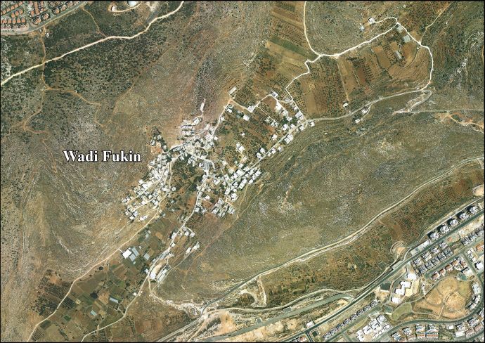
Wadi Fukin
| Wadi Fukin | |
|---|---|
| Other transcription(s) | |
| • Arabic | وادي فوكين |
| • Also spelled |
Wadi Fukin (official) Wadi Foukin (unofficial) |
 Wadi Fukin Location of Wadi Fukin within the Palestinian territories | |
| Coordinates: 31°42′24″N 35°06′14″E / 31.70667°N 35.10389°ECoordinates: 31°42′24″N 35°06′14″E / 31.70667°N 35.10389°E | |
| Palestine grid | 159/123 |
| Governorate | Bethlehem |
| Government | |
| • Type | Village council |
| • Head of Municipality | Ahmad Sukkar |
| Area | |
| • Jurisdiction | 4,347 dunams (4.3 km2 or 1.7 sq mi) |
| Population (2007) | |
| • Jurisdiction | 1,168 |
| Name meaning | "Valley of thorns"[1] or "Valley of Fukin"[2] |
Wadi Fukin (Arabic: وادي فوقين) is a Palestinian village in the West Bank, eight kilometers southwest of Bethlehem in the Bethlehem Governorate. The village, is located on 700 acres of land,[3] between the Green Line and the Israeli West Bank barrier,[4] According to the Palestinian Central Bureau of Statistics, Wadi Fukin had a population of over 1,168 in 2007.[5] with the Israeli settlement of Beitar Illit on one side, and the Israeli town of Tzur Hadasa on the other.[3] The village relies on agriculture as its primary source of income.[6] Israel served eviction orders on the village in September 2014.[7]
Ahmad Sukkar is the head of the village council.[8]
History
Ancient remains have been found in the area, including remains of a chapel, cisterns, burial caves in rock, columbarium, and Byzantine ceramics.[9]
At Kh. Ain Al-Kanisah, just east of Wadi Fukin, there are the remains of a church. The church had two construction phases; the first in the 5th-7th century C.E., the second construction phase was probably between the 8th and the 11th century.[10]
Ottoman period
Wadi Fukin, like the rest of Palestine, was incorporated into the Ottoman Empire in 1517, and in the Ottoman census of 1596, the village, called Fuqin, was in the Nahiya of Quds of the Liwa of Al Quds (i.e. Jerusalem). It had an entirely Muslim population of 20 households. Taxes were paid on wheat, barley, olives, grape syrup/molasses, goats and/or beehives.[11]
The French explorer Victor Guérin visited the village in the 1863, which he described as "half ruined" with a small number of people. He noted that the village was the successor to an ancient town, as he found several ancient tombs carved into rock.[12] An official Ottoman village list from about 1870 showed that "Wad Fukin" had a total of 22 houses and a population of 62, though the population count included only men.[13]
In 1883, the Palestine Exploration Fund's Survey of Western Palestine described Wad Fukin as "A small stone village on the side of a hill, with a good spring in the valley below on the south-west. There are gardens of oranges and lemons near the spring. To the west of the village there are rock-cut tombs. To the east is a second spring, Ain el Keniseh."[14]
British Mandate period
In the 1922 census of Palestine, conducted by the British Mandate authorities, Wadi Fukin had a population of 149, all Muslims.[15] In the 1931 census the population of Wadi Fukin was 205, still all Muslim, in 45 inhabited houses.[16]
In 1945 the population of Wady Fukin was 280, all Muslim,[17] who owned 9,928 dunams of land according to an official land and population survey.[18] Of this, 226 dunams were plantations and irrigable land, 863 for cereals,[19] while 6 dunams were built-up (urban) land.[20]
1948 and after
Prior to the 1948 Arab–Israeli War, Wadi Fukin was raided by the Haganah a number of times and several inhabitants fled to the Dheisheh camp established just south of Bethlehem. They returned during the Jordanian rule and fled once more after Israel occupied the West Bank after the Six-Day War in 1967. In 1972, the inhabitants were permitted to return to Wadi Fukin on the basis that they construct their homes within a month.[1]
The expulsion at Wadi Fukin led to a change in the Green line where an exchange of fertile land in the Bethlehem area to Israeli control and the village of Wadi Fukin being given to Jordanian control. On 15 July 1949 when the Israeli Army expelled the population of Wadi Fukin after the village had been transferred to the Israeli-occupied area under the terms of the Armistice Agreement concluded between Israel and Jordan. The Mixed Armistice Commission decided on 31 August 1949, by a majority vote, that Israel had violated the Armistice Agreement by expelling villagers of Wadi Fukin across the demarcation line and decided that the villagers should be allowed to return to their homes. However, when the villagers returned to Wadi Fukin under the supervision of the United Nations observers on September 6, 1949, they found most of their houses destroyed and were again compelled by the Israeli Army to return to Jordanian controlled territory. The United Nations Chairman of the Mixed Commission, Colonel Garrison B. Coverdale (US), pressed for a solution of this issue to be found in the Mixed Armistice Commission, in an amicable and UN spirit. After some hesitation, an adjustment in the Green Line was accepted and finally an agreement was reached whereby the Armistice line was changed to give back Wadi Fukin to the Jordanian authority who, in turn, agreed to transfer some uninhabited, but fertile territory south of Bethlehem to the Israeli authority in November 1949.[21] After the Six Day War, most of the villages land, roughly 667 acres, was redefined as lying in Area C under complete Israeli control, and military administration. Obtaining building permits from that authority are, according to residents, all but impossible.[3] In late August 2014 Israel declared 1,000 acres near Wadi Fukin was state land. Many of Wadi Fukin's villagers with plots on that land have, according to their attorney, a kushan testifying to their legal ownership, around two-thirds, of areas within this expropriated land.[3]
Geography
Wadi Fukin has a total land area of 434.7 hectares (4,347 dunams), 20.1 hectares of which are built-up. Much of the remaining land is planted with orchards and vineyards. Israel allotted 5.1 hectares to Israeli settlements near the town and an additional 88.5 hectares were seized in 2005. The Israeli West Bank barrier separates 103.9 hectares from the majority of the town's area.[4] As a result of the Interim Agreement on the West Bank and the Gaza Strip in 1995, 93.6% of Wadi Fukin's land is located in Area C (complete Israeli control) while 6.4% is located in Area B which is under the administration of the Palestinian National Authority and Israeli security.[6] Wadi Fukin is connected to Bethlehem by the village's main road.
The village is watered by 11 springs used to irrigate hundreds of small farm plots using a system of canals and dams.[22] Armed Israeli settlers have made these areas unsafe for their local Palestinian owners.[23]
Infrastructure
There are two elementary schools, a mosque, a pharmacy and health clinic in Wadi Fukin. The area around Wadi Fukin is known for its stone masonry, and a stone-cutting factory is located in the village.[4]
Organic farming
Wadi Fukin has long been known for the high quality of its agricultural produce.[22] Friends of the Earth Middle East, a joint Israeli-Palestinian-Jordanian organization, taught the villagers ecological and organic farming techniques,[24] but the presence of military checkpoints has prevented them from marketing their produce in Israel where prices are higher. Residents of Tzur Hadassah, an Israeli bedroom community bounding the village to the west, were the first to buy from the villagers, paying a fixed weekly price for fresh seasonal produce.[24] Another project in October 2007 involved direct marketing of the produce to households in Jerusalem.[22]
References
- 1 2 Stories from Palestine Wadi Fukin Khano, Delia. This Week in Palestine. 2007-07-09
- ↑ Palmer, 1881, p.333
- 1 2 3 4 David Tepper, 'The fight to save a village continues in Wadi Fukin,'Mondoweiss 19 November 2014.
- 1 2 3 Settlement expansion and loss of Wadi Fukin’s land Applied Research Institute - Jerusalem. 2005-05-23
- ↑ 2007 PCBS Census Palestinian Central Bureau of Statistics. p.117.
- 1 2 “Declared as State Land” New Israeli Military Orders Targeting Palestinian Lands in Al Jaba’a & Wadi Fukin villages Southwest Bethlehem city Applied Research Institute - Jerusalem. 2008-02-03
- ↑ Vinciane Jacquet, 'In Pictures: Seized land in Palestine:Residents of the Wadi Fukin village received eviction notices as Israel plans on further seizing 400 hectares of land. Al-Jazeera 28 Sptmbr 2014.
- ↑ Israel seizes most West Bank land in 30 years, Dalia Hatuqa, 1 Sep 2014, Al-Jazeera
- ↑ Dauphin, 1998, p. 915
- ↑ Conder and Kitchener, 1883, SWP III, pp. 38-39; Cited in Pringle, 1991, p. 27-28
- ↑ Hütteroth and Abdulfattah, 1977, p. 116
- ↑ Guérin, 1869, p. 321
- ↑ Socin, 1879, p. 162
- ↑ Conder and Kitchener, 1883, SWP III, p. 27
- ↑ Barron, 1923, Table VII, Sub-district of Bethlehem, p. 18
- ↑ Mills, 1932, p. 35
- ↑ Department of Statistics, 1945, p. 25
- ↑ Government of Palestine, Department of Statistics. Village Statistics, April, 1945. Quoted in Hadawi, 1970, p. 58
- ↑ Government of Palestine, Department of Statistics. Village Statistics, April, 1945. Quoted in Hadawi, 1970, p. 104
- ↑ Government of Palestine, Department of Statistics. Village Statistics, April, 1945. Quoted in Hadawi, 1970, p. 154
- ↑ Press Release PAL/537 4 November 1949
- 1 2 3 The ballad of baladi Archived February 24, 2009, at the Wayback Machine.
- ↑ Armed and entitled, Israeli hikers sow fear in Palestinian farming village, Amira Hass, Oct. 29, 2016, Haaretz
- 1 2 "Palestinian village and Israeli town build rare partnership across line". Jewish Journal of Greater Los Angeles. April 20, 2010. Retrieved August 22, 2012.
Bibliography
| Wikimedia Commons has media related to Wadi Fukin. |
- Barron, J. B., ed. (1923). Palestine: Report and General Abstracts of the Census of 1922. Government of Palestine.
- Conder, Claude Reignier; Kitchener, Herbert H. (1883). The Survey of Western Palestine: Memoirs of the Topography, Orography, Hydrography, and Archaeology. 3. London: Committee of the Palestine Exploration Fund.
- Dauphin, Claudine (1998). La Palestine byzantine, Peuplement et Populations. BAR International Series 726 (in French). III : Catalogue. Oxford: Archeopress. ISBN 0-860549-05-4.
- Department of Statistics (1945). Village Statistics, April, 1945. Government of Palestine.
- Guérin, Victor (1869). Description Géographique Historique et Archéologique de la Palestine (in French). 1: Judee, pt. 3. Paris: L'Imprimerie Nationale.
- Hadawi, Sami (1970). Village Statistics of 1945: A Classification of Land and Area ownership in Palestine. Palestine Liberation Organization Research Center.
- Hütteroth, Wolf-Dieter; Abdulfattah, Kamal (1977). Historical Geography of Palestine, Transjordan and Southern Syria in the Late 16th Century. Erlanger Geographische Arbeiten, Sonderband 5. Erlangen, Germany: Vorstand der Fränkischen Geographischen Gesellschaft. ISBN 3-920405-41-2.
- Mills, E., ed. (1932). Census of Palestine 1931. Population of Villages, Towns and Administrative Areas (PDF). Jerusalem: Government of Palestine.
- Palmer, E. H. (1881). The Survey of Western Palestine: Arabic and English Name Lists Collected During the Survey by Lieutenants Conder and Kitchener, R. E. Transliterated and Explained by E.H. Palmer. Committee of the Palestine Exploration Fund.
- Pringle, Denys (1993). The Churches of the Crusader Kingdom of Jerusalem: A-K (excluding Acre and Jerusalem). I. Cambridge University Press. ISBN 0 521 39036 2.
- Socin, A. (1879). "Alphabetisches Verzeichniss von Ortschaften des Paschalik Jerusalem". Zeitschrift des Deutschen Palästina-Vereins. 2: 135–163.
External links
- Welcome To Wadi Fukin
- Survey of Western Palestine, Map 17: IAA, Wikimedia commons
- Wadi Fukin Village (Fact Sheet), ARIJ
- Wadi Fukin Village Profile, ARIJ
- Wadi Fukin aerial photo, ARIJ
- The priorities and needs for development in Wadi Fukin village based on the community and local authorities’ assessment
- Betar Illit settlement Expansion and The Fate of Wadi Fukin Village 08, February, 2001, Applied Research Institute - Jerusalem.
- Israeli Land slays of Wadi Fukin 14, January, 2003, Applied Research Institute - Jerusalem.
- Wadi Fukin Village West of Bethlehem, "Trampling Onto a Dark Future" 03, November, 2006, Applied Research Institute - Jerusalem.
- Stop-work Orders in Wadi Fukin 26, May, 2012, Applied Research Institute - Jerusalem.
- The settlers next door: Notes from Wadi Fukin AIC, OCT 26, 2009
- A death sentence to this valley Zafrir Rinat Jun.15, 2005 Haaretz,
- Green groups: Wadi Fukin under threat from fence route, Zafrir Rinat Oct.16, 2006 Haaretz,
- Israelis, Palestinians work together in bid to solve local water shortage, Akiva Eldar Sep.27, 2009, Haaretz,
| Cities |  | |
|---|---|---|
| Municipalities | ||
| Villages |
| |
| Refugee camps | ||