Wagon Wheel, New Mexico
| Wagon Wheel, New Mexico | |
|---|---|
| Unincorporated community | |
 Wagon Wheel, New Mexico | |
| Coordinates: 35°00′18″N 105°49′21″W / 35.00500°N 105.82250°WCoordinates: 35°00′18″N 105°49′21″W / 35.00500°N 105.82250°W | |
| Country | United States |
| State | New Mexico |
| County | Torrance |
| Elevation | 6,575 ft (2,004 m) |
| Time zone | Mountain (MST) (UTC-7) |
| • Summer (DST) | MDT (UTC-6) |
| Area code(s) | 505 |
| GNIS feature ID | 924956[1] |
Wagon Wheel is an unincorporated community in Torrance County, New Mexico, United States. The community is located at exit 208 of Interstate 40, 12 miles (19 km) east of Moriarty, and provides services for travelers on the highway.[2][3]
References
- ↑ "Wagon Wheel Interchange". Geographic Names Information System. United States Geological Survey.
- ↑ New Mexico Transportation Map (PDF) (Map). New Mexico Department of Transportation. 2011. Retrieved September 22, 2013.
- ↑ Robert Hixson Julyan (1996). The Places Names of New Mexico. UNM Press. ISBN 9780826316899.
External links
Municipalities and communities of Torrance County, New Mexico, United States | ||
|---|---|---|
| City | 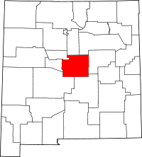 | |
| Towns | ||
| Village | ||
| CDPs | ||
| Other unincorporated communities | ||
| Footnotes | ‡This populated place also has portions in an adjacent county or counties | |
This article is issued from Wikipedia - version of the 1/20/2014. The text is available under the Creative Commons Attribution/Share Alike but additional terms may apply for the media files.