Clines Corners, New Mexico
| Clines Corners, New Mexico | |
|---|---|
| Unincorporated community | |
 Clines Corners, New Mexico | |
| Coordinates: 35°00′34″N 105°40′09″W / 35.00944°N 105.66917°WCoordinates: 35°00′34″N 105°40′09″W / 35.00944°N 105.66917°W | |
| Country | United States |
| State | New Mexico |
| County | Torrance |
| Elevation | 7,057 ft (2,151 m) |
| Time zone | Mountain (MST) (UTC-7) |
| • Summer (DST) | MDT (UTC-6) |
| ZIP code | 87070[1] |
| Area code(s) | 575 |
| GNIS feature ID | 898646[2] |
Clines Corners is an unincorporated community in Torrance County, New Mexico, United States.[2] Clines Corners is located at the junction of Interstate 40 and U.S. Route 285, 21.6 miles (34.8 km) east of Moriarty. The community was established in 1937 by Roy E. Cline, who built a rest stop at what was then the intersection of U.S. Route 66 and US 285; the rest stop, known as Clines Corners Retail Center, is now over 30,000 square feet (2,800 m2) in size.[3]
References
- ↑ United States Postal Service (2012). "USPS - Look Up a ZIP Code". Retrieved 2012-02-15.
- 1 2 "Clines Corners". Geographic Names Information System. United States Geological Survey.
- ↑ "Clines Corners Retail Center: A Bit of History". Clines Corners. Retrieved August 11, 2013.
External links
Municipalities and communities of Torrance County, New Mexico, United States | ||
|---|---|---|
| City | 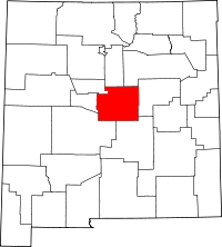 | |
| Towns | ||
| Village | ||
| CDPs | ||
| Other unincorporated communities | ||
| Footnotes | ‡This populated place also has portions in an adjacent county or counties | |
This article is issued from Wikipedia - version of the 5/24/2016. The text is available under the Creative Commons Attribution/Share Alike but additional terms may apply for the media files.