Wagontire, Oregon
| Wagontire, Oregon | |
|---|---|
| Unincorporated community | |
 Wagontire, Oregon  Wagontire, Oregon Location within the state of Oregon | |
| Coordinates: 43°14′59″N 119°52′33″W / 43.24972°N 119.87583°WCoordinates: 43°14′59″N 119°52′33″W / 43.24972°N 119.87583°W | |
| Country | United States |
| State | Oregon |
| County | Harney |
| Elevation | 4,737 ft (1,444 m) |
| Time zone | PST (UTC-8) |
| • Summer (DST) | PDT (UTC-7) |
| Area code(s) | 541 |
| Coordinates and elevation from United States Geological Survey[1] | |
Wagontire is an unincorporated community in Harney County, Oregon, United States,[1] along U.S. Route 395.[2]
From 1986 to at least 1997, Wagontire was home to two people: William and Olgie Warner.[3] The Warners' property included a gas station, cafe, motel, general store, and recreational vehicle (RV) park.[4] Also theirs was Wagontire Airport, across the road from the buildings.[4] Planes flying into the airport taxied across the highway, and filled up at the gas station.[3]
References
- 1 2 "Wagontire". Geographic Names Information System. United States Geological Survey. November 28, 1980. Retrieved January 3, 2016.
- ↑ "United States Topographic Map". United States Geological Survey. Retrieved January 3, 2016 – via Acme Mapper.
- 1 2 Monroe, Bill (December 14, 1997). "Under the Desert Sky: Solitude for Sale". The Oregonian. pp. A01.
- 1 2 Weber, first (July 11, 1993). "Everyone Stops At Wagontire (Pop. 2)". The New York Times. Retrieved January 3, 2016.
External links
- A brief history of Wagontire from Harney County Economic Development.
- Historic images of Wagontire from Salem Public Library
Municipalities and communities of Harney County, Oregon, United States | ||
|---|---|---|
| Cities | 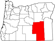 | |
| CDP | ||
| Other unincorporated communities | ||
| Indian reservation | ||
| Ghost town | ||
This article is issued from Wikipedia - version of the 7/30/2016. The text is available under the Creative Commons Attribution/Share Alike but additional terms may apply for the media files.