Warrenton, North Carolina
| Warrenton, North Carolina | |
|---|---|
| Town | |
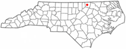 Location of Warrenton, North Carolina | |
| Coordinates: 36°24′1″N 78°9′25″W / 36.40028°N 78.15694°WCoordinates: 36°24′1″N 78°9′25″W / 36.40028°N 78.15694°W | |
| Country | United States |
| State | North Carolina |
| County | Warren |
| Area | |
| • Total | 0.9 sq mi (2.3 km2) |
| • Land | 0.9 sq mi (2.3 km2) |
| • Water | 0.0 sq mi (0.0 km2) |
| Elevation | 390 ft (119 m) |
| Population (2010) | |
| • Total | 862 |
| • Density | 957.7/sq mi (374.7/km2) |
| Time zone | Eastern (EST) (UTC-5) |
| • Summer (DST) | EDT (UTC-4) |
| ZIP code | 27589 |
| Area code(s) | 252 |
| FIPS code | 37-71100[1] |
| GNIS feature ID | 0996808[2] |
Warrenton is a town in and the county seat of Warren County, North Carolina, United States. The population was 862 at the 2010 census. Warrenton, now served by U.S. 401 and U.S. 158, was founded in 1779. It became one of the wealthiest towns in the state from 1840 to 1860, as it was the trading center of an area of rich tobacco and cotton plantations. It has a large stock of historic architecture. More than 90 percent of its buildings are listed in the National Register of Historic Places and its National Historic District encompasses nearly half its area.
History and attractions
Warrenton was founded at the time when Bute County was divided to form Warren and Franklin counties. Named for Dr. Joseph Warren, a Patriot and soldier who fell at Bunker Hill in Boston during the American Revolutionary War, it was incorporated in 1779. William Christmas platted and surveyed the streets and lots, and public squares that year. He established one hundred lots, each containing one-half acre; convenient streets and squares, and a common area for the use of the town.
The area was developed as tobacco and cotton plantations dependent on the labor of enslaved African Americans. Warrenton served as a center for trade and entertainment for the region's planters and their slaves. The planters and merchants built large homes in the town, and would keep slaves as domestic servants. The majority of slaves worked as laborers on the plantations; some would package and transport the tobacco and cotton to town for shipping out to markets.
Many early and mid-19th century houses have been preserved. The planters chartered private academies to educate their children, one of the earliest being The Warrenton Male Academy, formed in 1788. A girls' school was founded by Jacob Mordecai, a Sephardic Jew, whose son Moses became a prominent lawyer in Raleigh. Commercial and government structures in the town date to the late 19th century and early 1900s.
In the 1850s, the town became a busy center of commerce when the railroad was built to improve shipping of the commodities of the rich tobacco and cotton fields to markets; it became the wealthiest town in North Carolina of the time. The well-known builder Jacob Holt lived here; he built Greek Revival style houses throughout the region and his workshop supplied millwork to builders even farther afield.
As one of the wealthiest towns in North Carolina from 1840 to 1860, Warrenton had property owners who built fine residences and commercial buildings, forming the core of its current historic architecture. They employed the prominent architects Jacob W. Holt and Albert Gamaliel Jones, who designed and built houses in the Federal, Greek Revival, and Italianate styles.
The Warrenton Historic District was listed on the National Register of Historic Places in 1976, and includes over 200 contributing buildings.[3] The Coleman-White House, Elgin, Liberia School, Reedy Rill, Shady Oaks, Sledge-Hayley House, Mansfield Thornton House, and John Watson House are also listed on the National Register of Historic Places.[3]
Demographics
| Historical population | |||
|---|---|---|---|
| Census | Pop. | %± | |
| 1850 | 1,242 | — | |
| 1860 | 1,520 | 22.4% | |
| 1870 | 941 | −38.1% | |
| 1880 | 816 | −13.3% | |
| 1890 | 740 | −9.3% | |
| 1900 | 836 | 13.0% | |
| 1910 | 807 | −3.5% | |
| 1920 | 927 | 14.9% | |
| 1930 | 1,072 | 15.6% | |
| 1940 | 1,147 | 7.0% | |
| 1950 | 1,166 | 1.7% | |
| 1960 | 1,124 | −3.6% | |
| 1970 | 1,035 | −7.9% | |
| 1980 | 908 | −12.3% | |
| 1990 | 949 | 4.5% | |
| 2000 | 811 | −14.5% | |
| 2010 | 862 | 6.3% | |
| Est. 2015 | 866 | [4] | 0.5% |
Notable people
- Josiah Bailey, former U.S. Senator
- Braxton Bragg, Confederate States Army Officer
- Saxby Chambliss, U.S. Senator
- Rick Hendrick, NASCAR team owner
- Nathaniel Macon, former U.S. Senator and Speaker of the House
- Chandler Owen, writer and editor
- Chuck Rowland, baseball player
- Mary Tannahill, painter, born at the nearby plantation "Kinderhook"
References
- ↑ "American FactFinder". United States Census Bureau. Retrieved 2008-01-31.
- ↑ "US Board on Geographic Names". United States Geological Survey. 2007-10-25. Retrieved 2008-01-31.
- 1 2 National Park Service (2010-07-09). "National Register Information System". National Register of Historic Places. National Park Service.
- ↑ "Annual Estimates of the Resident Population for Incorporated Places: April 1, 2010 to July 1, 2015". Retrieved July 2, 2016.
- ↑ "Census of Population and Housing". Census.gov. Retrieved June 4, 2015.
External links
Municipalities and communities of Warren County, North Carolina, United States | ||
|---|---|---|
| Towns | 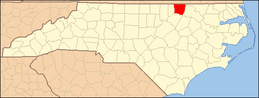 | |
| Unincorporated communities | ||