Washington, Arkansas
| Washington, Arkansas | |
|---|---|
| City | |
 | |
 Location in Hempstead County and the state of Arkansas | |
| Coordinates: 33°46′29″N 93°40′53″W / 33.77472°N 93.68139°WCoordinates: 33°46′29″N 93°40′53″W / 33.77472°N 93.68139°W | |
| Country | United States |
| State | Arkansas |
| County | Hempstead |
| Area | |
| • Total | 1 sq mi (2.6 km2) |
| • Land | 1 sq mi (2.6 km2) |
| • Water | 0 sq mi (0 km2) |
| Elevation | 446 ft (136 m) |
| Population (2000) | |
| • Total | 148 |
| • Density | 148/sq mi (56.9/km2) |
| Time zone | Central (CST) (UTC-6) |
| • Summer (DST) | CDT (UTC-5) |
| ZIP code | 71862 |
| Area code(s) | 870 |
| FIPS code | 05-73370 |
| GNIS feature ID | 0078702 |
Washington is a city in Hempstead County, Arkansas, United States. The population was 148 at the 2000 census. It is part of the Hope Micropolitan Statistical Area.
History
From its establishment in 1826, Washington was an important stop on the rugged Southwest Trail for pioneers traveling to Texas. That same year it was established as the "seat of justice" for that area, and in 1825 the "Hempstead County Court of Common Pleas" was established, located in a building constructed next door to a tavern owned by early resident Elijah Stuart. Between 1832 and 1839 thousands of Choctaw American Indians passed through Washington on their way to Indian Territory. Frontiersmen and national heroes James Bowie, Sam Houston and Davy Crockett all traveled through Washington en route to the Alamo. Houston is believed to have planned parts of the revolt strategy in a tavern in Washington during 1834. James Black, a local blacksmith, is credited with creating the legendary Bowie knife carried by Jim Bowie at his blacksmith shop in Washington.[1]
During the War with Mexico, beginning in 1846, Washington became a rally point for volunteer troops on their way to serve with the US Army.[2] Later, the town became a major service center for area planters, merchants and professionals. Following the capture of Little Rock by the Union Army in 1863, the Confederate government moved the state government offices to Hot Springs for short time, then ultimately based the state government out of Washington, making it the state capital until 1865. Albert G. Simms (1882–1964), a United States Representative from New Mexico, was born here. Following the construction of the Cairo and Fulton railroad eight miles to the south of Washington, which connected much of the state with Little Rock, the town began a slow decline. Now located on the area's primary travel route, Hope took on Washington's formerly important role.
Geography
Washington is located at 33°46′29″N 93°40′53″W / 33.77472°N 93.68139°W (33.774670, -93.681451).[3]
According to the United States Census Bureau, the city has a total area of 1.0 square mile (2.6 km2), all of it land.
Demographics
| Historical population | |||
|---|---|---|---|
| Census | Pop. | %± | |
| 1880 | 730 | — | |
| 1890 | 519 | −28.9% | |
| 1900 | 374 | −27.9% | |
| 1910 | 399 | 6.7% | |
| 1920 | 556 | 39.3% | |
| 1930 | 457 | −17.8% | |
| 1940 | 432 | −5.5% | |
| 1950 | 344 | −20.4% | |
| 1960 | 321 | −6.7% | |
| 1970 | 290 | −9.7% | |
| 1980 | 265 | −8.6% | |
| 1990 | 148 | −44.2% | |
| 2000 | 148 | 0.0% | |
| 2010 | 180 | 21.6% | |
| Est. 2015 | 176 | [4] | −2.2% |
As of the census[6] of 2000, there were 148 people, 78 households, and 40 families residing in the city. The population density was 147.6 people per square mile (57.1/km²). There were 93 housing units at an average density of 92.7/sq mi (35.9/km²). The racial makeup of the city was 38.51% White and 61.49% Black or African American.
There were 78 households out of which 14.1% had children under the age of 18 living with them, 37.2% were married couples living together, 12.8% had a female householder with no husband present, and 48.7% were non-families. 44.9% of all households were made up of individuals and 21.8% had someone living alone who was 65 years of age or older. The average household size was 1.90 and the average family size was 2.58.
In the city the population was spread out with 14.9% under the age of 18, 6.1% from 18 to 24, 25.0% from 25 to 44, 28.4% from 45 to 64, and 25.7% who were 65 years of age or older. The median age was 49 years. For every 100 females there were 72.1 males. For every 100 females age 18 and over, there were 85.3 males.
The median income for a household in the city was $19,375, and the median income for a family was $21,042. Males had a median income of $41,875 versus $20,313 for females. The per capita income for the city was $16,066. There were 10.8% of families and 18.6% of the population living below the poverty line, including 25.0% of under eighteens and 21.7% of those over 64.
Arts and culture
The city is home to Old Washington Historic State Park.[7]
Notable people
- Augustus H. Garland, the Attorney General of the United States under U.S. President Grover Cleveland[8]
- Daniel Webster Jones, the 19th Governor of the U.S. state of Arkansas[9]
- Jimmie Durham, visual artist, poet and activist
- James Black, blacksmith who crafted the Bowie knife based upon a design by Jim Bowie
Climate
The climate in this area is characterized by hot, humid summers and generally mild to cool winters. According to the Köppen Climate Classification system, Washington has a humid subtropical climate, abbreviated "Cfa" on climate maps.[10]
References
- ↑ "Role in developing history". The Arkansas School for Mathematics.
- ↑ "Washington". The Official Site of Arkansas Department of Parks & Tourism. Retrieved August 17, 2012.
- ↑ "US Gazetteer files: 2010, 2000, and 1990". United States Census Bureau. 2011-02-12. Retrieved 2011-04-23.
- ↑ "Annual Estimates of the Resident Population for Incorporated Places: April 1, 2010 to July 1, 2015". Retrieved July 2, 2016.
- ↑ "Census of Population and Housing". Census.gov. Retrieved June 4, 2015.
- ↑ "American FactFinder". United States Census Bureau. Retrieved 2008-01-31.
- ↑ "The Arkansas Department of Parks and Tourism". Historic Washington State Park. Retrieved August 17, 2012.
- ↑ "Washington". The Encyclopedia of Arkansas History & Culture. Retrieved August 17, 2012.
- ↑ "Daniel Webster Jones(1897-1901)". Old State House Museum. Retrieved August 17, 2012.
- ↑ Climate Summary for Washington, Arkansas
Municipalities and communities of Hempstead County, Arkansas, United States | ||
|---|---|---|
| Cities | 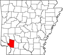 | |
| Towns | ||
| Unincorporated communities | ||
| Footnotes | ‡This populated place also has portions in an adjacent county or counties | |