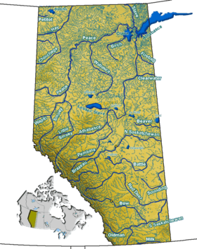
Waterton Lake
| Waterton Lake | |
|---|---|
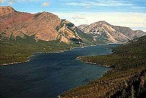 Seen from Goat Haunt | |
| Location | Waterton Lakes National Park, Alberta, Canada / Glacier National Park, Glacier County, Montana, United States |
| Coordinates | 49°03′01″N 113°52′53″W / 49.05028°N 113.88139°WCoordinates: 49°03′01″N 113°52′53″W / 49.05028°N 113.88139°W |
| Primary outflows | Waterton River |
| Basin countries | United States, Canada |
| Surface area | 10.1 km2 (3.9 sq mi) +1.5 km2 (0.58 sq mi) |
| Average depth | 80 m (260 ft) |
| Surface elevation | 1,280 m (4,200 ft) |
Waterton Lake is a mountain lake in southern Alberta, Canada and northern Montana, United States. The lake is composed of two bodies of water, connected by a shallow channel known locally as the Bosporus. The two parts are referred to as Lower Waterton Lake, and Upper Waterton Lake, the latter of which is crossed at the tip by the Canada–United States border. The United States Geological Survey gives the geocoordinates of 49°03′00″N 113°54′03″W / 49.05000°N 113.90083°W for Upper Waterton Lake.
The northern, lower end of the main lake lies in Waterton Lakes National Park while the upper, southern part of the lake is located in Glacier National Park. In 1979, UNESCO established the Waterton Biosphere Reserve to protect the diverse habitats including prairie grasslands, aspen parkland, subalpine forests, alpine tundra and freshwater fens that surround the lake.[1]
Waterton-Glacier International Peace Park was created by the US and Canada in 1932, and in 1976 it was designated an International Biosphere Reserve.[2] Later, in 1995, it was inscribed as a World Heritage Site by UNESCO.[3]
The upper and middle Waterton Lake system has a surface of 10.1 km2 (3.9 sq mi), while the lower lake, which is in Canada only, has 1.5 km2 (0.58 sq mi) and lies at an altitude of 1,274 m (4,180 ft). Two soundings of the lake were 210 feet (64 m) and 317 feet (97 m), done in 1910. More recent soundings have revealed a depth of 487 ft (149 m).[4]
Highway 5 has its westernmost point on the shores of the lake.
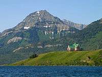 Upper Waterton Lake with Prince of Wales Hotel
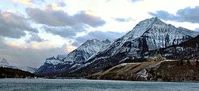 Waterton Lake in winter
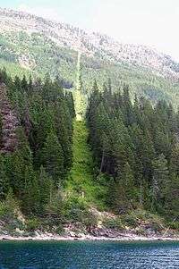 49th parallel north at Waterton Lake
 Looking south across Waterton Lake.
Waterton River
The Waterton River is part of the South Saskatchewan River Basin, and the Oldman River Sub-Basin.
Waterton River flows north from the Lower Waterton Lake for approx. 32 km to reach the Waterton Reservoir (Est. 1964) by the village of Hill Spring.
The Waterton Reservoir diverts water of about 20 m3/s to the Belly River just upstream from the Belly's own diversion weir which diverts water to the St. Mary River. The Waterton continues north from the reservoir for approx. 39 km until it reaches the confluence with the Belly River, which is a tributary of the Oldman River.
Waterton River has relatively reduced sediment concentrations due to the lakes and the reservoir acting as a sediment-settling trap.
The total length of the river is 80 km (50 mi).
Waterton River’s mean peak discharge averages about 80 m3/s.
Tributaries to the Waterton River include:
- Foothill Creek
- Drywood Creek
- Yarrow Creek
- Dungarvan Creek
- Galwey Brook
- Cottonwood Creek
- Crooked Creek
Waterton Reservoir has a Full Supply Level (FSL) of 1,185.67 metres, and an Irrigation Capacity of 114,334 dam3.
References
- ↑ UNESCO - Waterton Biosphere Reserve
- ↑ U.S. Geological Survey Geographic Names Information System: Waterton-Glacier International Peace Park
- ↑ UNESCO World Heritage Site - Waterton Glacier International Peace Park
- ↑