Alberta Highway 5
| ||||
|---|---|---|---|---|
 | ||||
| Route information | ||||
| Length: | 129 km (80 mi) | |||
| Major junctions | ||||
| Southwest end: | Waterton Lake | |||
|
| ||||
| Northeast end: |
| |||
| Location | ||||
| Specialized and rural municipalities: | I.D. No. 4, Cardston County, Warner No. 5 County, Lethbridge County | |||
| Major cities: | Lethbridge | |||
| Towns: | Magrath, Cardston | |||
| Highway system | ||||
|
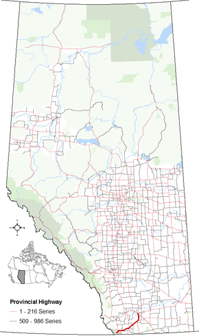
Provincial highways in Alberta
| ||||

Alberta Provincial Highway No. 5 is a highway in southern Alberta, Canada. Over its approximate 129 km (80 mi) length, the highway starts as an east-west highway in Waterton Lakes National Park and transitions to a north-south highway before ending at Crowsnest Trail (Highway 3) in Lethbridge.[1][2]
Route description
Highway 5 begins in the Hamlet of Waterton Park within Waterton Lakes National Park. After leaving the park, the highway generally travels east, passing by the hamlets of Mountain View and Leavitt, to the Town of Cardston.[3] After Cardston, the highway generally travels northeast, passing by the Hamlet of Spring Coulee, the Town of Magrath, and the Hamlet of Welling Station. Shortly after Welling Station, the highway travels north, passing the Hamlet of Welling, before ending at Highway 3 in Letbridge.[2][1]
Major intersections
The following is a list of major intersections along Alberta Highway 5 from southwest to northeast.[1][2]
| Rural/specialized municipality | Location | km | mi | Destinations | Notes | ||
|---|---|---|---|---|---|---|---|
| I.D. No. 4 (Waterton Lakes National Park) | Waterton Park | 0 | 0.0 | Mountain View Road / Evergreen Avenue | Hwy 5 begins | ||
| | 8 | 5.0 | Hwy 5 branches south Hwy 6 concurrency begins | ||||
| | 9 | 5.6 | Hwy 5 turns east Hwy 6 concurrency ends | ||||
| Cardston County | | 26 | 16 | ||||
| Mountain View | 28 | 17 | School Avenue | ||||
| | 33 | 21 | |||||
| Cardston | 53 | 33 | Cardston Truck Bypass (Unsigned Hwy 501) | Hwy 5 branches north Hwy 2 concurrency begins | |||
| Blood I.R. No. 148 | 54 | 34 | Hwy 5 branches northeast Hwy 2 concurrency ends | ||||
| ↑ / ↓ | | 57 | 35 | Crosses St. Mary River | |||
| Cardston County | | 58 | 36 | ||||
| | 74 | 46 | |||||
| Spring Coulee | 77 | 48 | |||||
| Magrath | 95 | 59 | |||||
| Welling | 102 | 63 | Hwy 5 turns north | ||||
| Lethbridge County | | 119 | 74 | ||||
| | 122 | 76 | Passes | ||||
| City of Lethbridge | 126 | 78 | Scenic Drive / 24th Avenue S | Former alignment of Hwy 4 | |||
| 126 | 78 | Grade separated Hwy 5 ends | |||||
| Mayor Magrath Drive continues north | |||||||
1.000 mi = 1.609 km; 1.000 km = 0.621 mi
| |||||||
See also
References
- 1 2 3 "2015 Provincial Highway 1-216 Progress Chart" (PDF). Alberta Transportation. March 2015. Archived (PDF) from the original on April 10, 2016. Retrieved November 9, 2016.
- 1 2 3 Alberta Official Road Map (Map) (2010 ed.). Alberta Tourism, Parks and Recreation. § N-6, O-5, O-6.
- ↑ Google (October 28, 2016). "Highway 5 in Alberta" (Map). Google Maps. Google. Retrieved October 28, 2016.