Watertown Municipal Airport (Wisconsin)
| Watertown Municipal Airport | |||||||||||||||
|---|---|---|---|---|---|---|---|---|---|---|---|---|---|---|---|
 | |||||||||||||||
| IATA: none – ICAO: KRYV – FAA LID: RYV | |||||||||||||||
| Summary | |||||||||||||||
| Airport type | Public | ||||||||||||||
| Owner | City of Watertown | ||||||||||||||
| Serves | Watertown, Wisconsin | ||||||||||||||
| Elevation AMSL | 833 ft / 254 m | ||||||||||||||
| Coordinates | 43°10′11″N 088°43′24″W / 43.16972°N 88.72333°W | ||||||||||||||
| Map | |||||||||||||||
 RYV  RYV Location of airport in Wisconsin/United States | |||||||||||||||
| Runways | |||||||||||||||
| |||||||||||||||
| Statistics | |||||||||||||||
| |||||||||||||||
Watertown Municipal Airport (ICAO: KRYV, FAA LID: RYV) is a public use airport located in and owned by the city of Watertown, in Jefferson County, Wisconsin, United States.[1] It is included in the Federal Aviation Administration (FAA) National Plan of Integrated Airport Systems for 2017–2021, in which it is categorized as a regional general aviation facility.[2]
Although most U.S. airports use the same three-letter location identifier for the FAA and IATA, this airport is assigned RYV by the FAA but has no designation from the IATA.[3]
Watertown Municipal Airport was the site of the first Transponder Landing System in the United States.
Facilities and aircraft
Watertown Municipal Airport covers an area of 360 acres (150 ha) at an elevation of 833 feet (254 m) above mean sea level. It has two runways:[1]
- Runway 5/23: 4,429 x 75 ft. (1,350 x 23 m.), Surface: Asphalt. Approved GPS and NDB approaches.
- Runway 11/29: 2,801 x 75 ft. (854 x 23 m.), Surface: Asphalt. Approved GPS approaches.
The ROCK RIVER (RYV) non-directional beacon, 371 kHz, is located on the field.
For the 12-month period ending August 26, 2015, the airport had 58,000 aircraft operations, an average of 159 per day: 89% general aviation, 9% air taxi and 2% military. In November 2016, there were 70 aircraft based at this airport: 55 single-engine, 13 multi-engine, 1 jet and 1 helicopter.[1]
Aero park
There is an aero-park, sponsored by the local Marine League, located adjacent to the airport where air operations can be observed. 43°10′27″N 88°43′3″W / 43.17417°N 88.71750°W
Gallery
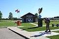 Various monuments at the Marine League Aero Park adjacent to the airport.
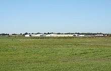
.jpg) TLS Building (Right) and elevation receive antenna (left) as seen December 2005. (TLS equipment was removed prior to September 2007)
TLS Building (Right) and elevation receive antenna (left) as seen December 2005. (TLS equipment was removed prior to September 2007)
References
- 1 2 3 4 FAA Airport Master Record for RYV (Form 5010 PDF), effective Nov 10, 2016.
- ↑ "List of NPIAS Airports" (PDF). FAA.gov. Federal Aviation Administration. 21 October 2016. Retrieved 23 November 2016.
- ↑ Great Circle Mapper: KRYV - Watertown, Wisconsin
External links
- "Watertown Municipal Airport" (PDF). at Wisconsin DOT Airport Directory
- Wisconsin Aviation, the Fixed-Base Operator (FBO)
- FAA Terminal Procedures for RYV, effective December 8, 2016
- Resources for this airport:
- FAA airport information for RYV
- AirNav airport information for KRYV
- FlightAware airport information and live flight tracker
- NOAA/NWS latest weather observations
- SkyVector aeronautical chart, Terminal Procedures
Aviation in Wisconsin | ||
|---|---|---|
| Primary airports | ||
| Airlines | ||
| Aviation related | ||
| People | ||