Wayne Township, Doniphan County, Kansas
| Wayne Township | |
|---|---|
| Township | |
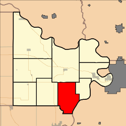 Location in Doniphan County | |
| Coordinates: 39°40′19″N 095°05′01″W / 39.67194°N 95.08361°WCoordinates: 39°40′19″N 095°05′01″W / 39.67194°N 95.08361°W | |
| Country | United States |
| State | Kansas |
| County | Doniphan |
| Area | |
| • Total | 35.88 sq mi (92.92 km2) |
| • Land | 35.61 sq mi (92.24 km2) |
| • Water | 0.26 sq mi (0.68 km2) 0.73% |
| Elevation | 978 ft (298 m) |
| Population (2000) | |
| • Total | 226 |
| • Density | 6.3/sq mi (2.5/km2) |
| GNIS feature ID | 0473294 |
Wayne Township is a township in Doniphan County, Kansas, USA. As of the 2000 census, its population was 226.
Geography
Wayne Township covers an area of 35.88 square miles (92.9 km2) and contains no incorporated settlements. According to the USGS, it contains one cemetery, Doniphan.
The stream of Rock Creek runs through this township. It is also drained by Independence and Brush Creeks.[1]
History
Wayne Township was organized on September 1, 1855. It was named for General Anthony Wayne.[2]
References
- ↑ Link text
- ↑ Gray, Patrick Leopoldo (1905). Gray's Doniphan County History: A Record of the Happenings of Half a Hundred Years. Roycroft Press.
External links
Municipalities and communities of Doniphan County, Kansas, United States | ||
|---|---|---|
| Cities |  | |
| CDP | ||
| Unincorporated communities | ||
| Ghost town | ||
| Indian reservation | ||
| Townships | ||
| Footnotes | ‡This populated place also has portions in an adjacent county or counties | |
This article is issued from Wikipedia - version of the 6/8/2014. The text is available under the Creative Commons Attribution/Share Alike but additional terms may apply for the media files.