West Point, Minnesota
| West Point, Minnesota | |
|---|---|
| Unincorporated community | |
 West Point, Minnesota  West Point, Minnesota Location of the community of West Point | |
| Coordinates: 45°33′28″N 93°23′21″W / 45.55778°N 93.38917°WCoordinates: 45°33′28″N 93°23′21″W / 45.55778°N 93.38917°W | |
| Country | United States |
| State | Minnesota |
| County | Isanti |
| Elevation | 945 ft (288 m) |
| Time zone | Central (CST) (UTC-6) |
| • Summer (DST) | CDT (UTC-5) |
| ZIP code | 55008 and 55371 |
| Area code(s) | 763 |
| GNIS feature ID | 655005[1] |
West Point is an unincorporated community in Isanti County, Minnesota, United States.
The community is located at the junction of State Highway 47 (MN 47) and Roanoke Street NW. The Rum River flows through the community.
West Point is located at the survey point boundary line for:
References
- Official State of Minnesota Highway Map – 2013/2014 edition
- Mn/DOT map of Isanti County – 2013 edition
Municipalities and communities of Isanti County, Minnesota, United States | ||
|---|---|---|
| Cities | 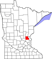 | |
| Townships | ||
| CDP | ||
| Unincorporated communities | ||
| Ghost town | ||
| Footnotes | ‡This populated place also has portions in an adjacent county or counties | |
This article is issued from Wikipedia - version of the 7/28/2016. The text is available under the Creative Commons Attribution/Share Alike but additional terms may apply for the media files.