West Siloam Springs, Oklahoma
| West Siloam Springs, Oklahoma | |
|---|---|
| Town | |
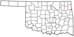 Location of West Siloam Springs, Oklahoma | |
| Coordinates: 36°10′41″N 94°35′45″W / 36.17806°N 94.59583°WCoordinates: 36°10′41″N 94°35′45″W / 36.17806°N 94.59583°W | |
| Country | United States |
| State | Oklahoma |
| County | Delaware |
| Area | |
| • Total | 3.5 sq mi (8.9 km2) |
| • Land | 3.5 sq mi (8.9 km2) |
| • Water | 0.0 sq mi (0.0 km2) |
| Elevation | 1,142 ft (348 m) |
| Population (2010) | |
| • Total | 877 |
| • Density | 253.9/sq mi (98.0/km2) |
| Time zone | Central (CST) (UTC-6) |
| • Summer (DST) | CDT (UTC-5) |
| FIPS code | 40-80350[1] |
| GNIS feature ID | 1099609[2] |
West Siloam Springs is a town in Delaware County, Oklahoma, United States. The population was 846 at the 2010 census, a 3.5 percent decrease from 877 at the 2000 census.[3] A bedroom community for Siloam Springs, Arkansas, it is notable for its Cherokee casino,[4] and is the closest town to Natural Falls State Park.[5] It is also a notorious speed trap, with fines from the trap being a major source of the town's revenue.[6]
History
In the mid twentieth century, the population of Siloam Springs, Arkansas spilled across the Oklahoma - Arkansas state line, creating the need for Oklahoma-based town government. The population of the community had grown to 142 by July 10, 1969, when 35 out of 49 eligible voters approved incorporation.[5]
Geography
West Siloam Springs is located at 36°10′41″N 94°35′45″W / 36.17806°N 94.59583°W (36.178147, -94.595751).[7] It is immediately west of Siloam Springs, Arkansas.
According to the United States Census Bureau, the town has a total area of 3.5 square miles (9.1 km2), all of it land.
Demographics
| Historical population | |||
|---|---|---|---|
| Census | Pop. | %± | |
| 1970 | 210 | — | |
| 1980 | 431 | 105.2% | |
| 1990 | 539 | 25.1% | |
| 2000 | 877 | 62.7% | |
| 2010 | 846 | −3.5% | |
| Est. 2015 | 840 | [8] | −0.7% |
As of the census[1] of 2000, there were 877 people, 306 households, and 205 families residing in the town. The population density was 253.9 people per square mile (98.1/km²). There were 349 housing units at an average density of 101.1 per square mile (39.1/km²). The racial makeup of the town was 76.40% White, 0.11% African American, 11.74% Native American, 0.57% Asian, 1.14% from other races, and 10.03% from two or more races. Hispanic or Latino of any race were 4.56% of the population.
There were 306 households out of which 30.1% had children under the age of 18 living with them, 47.4% were married couples living together, 13.4% had a female householder with no husband present, and 33.0% were non-families. 26.8% of all households were made up of individuals and 8.8% had someone living alone who was 65 years of age or older. The average household size was 2.45 and the average family size was 2.95.
In the town the population was spread out with 22.7% under the age of 18, 6.8% from 18 to 24, 27.1% from 25 to 44, 20.9% from 45 to 64, and 22.5% who were 65 years of age or older. The median age was 41 years. For every 100 females there were 85.4 males. For every 100 females age 18 and over, there were 78.0 males.
The median income for a household in the town was $28,750, and the median income for a family was $31,953. Males had a median income of $22,243 versus $20,000 for females. The per capita income for the town was $12,858. About 13.4% of families and 18.3% of the population were below the poverty line, including 20.0% of those under age 18 and 26.2% of those age 65 or over.
References
- 1 2 "American FactFinder". United States Census Bureau. Retrieved 2008-01-31.
- ↑ "US Board on Geographic Names". United States Geological Survey. 2007-10-25. Retrieved 2008-01-31.
- ↑ CensusViewer: Population of the City of West Siloam Springs, Oklahoma
- ↑ "New Okla. casino to also benefit Arkansas town", Associated Press in Arkansas Democrat-Gazette, November 15, 2008.
- 1 2 Sharon Koons, "West Siloam Springs" Encyclopedia of Oklahoma History and Culture. Accessed July 19, 2012.
- ↑ Marie Price, "House Roundup: Speed-trap measure races past chamber", Tulsa World, February 28, 2003.
- ↑ "US Gazetteer files: 2010, 2000, and 1990". United States Census Bureau. 2011-02-12. Retrieved 2011-04-23.
- ↑ "Annual Estimates of the Resident Population for Incorporated Places: April 1, 2010 to July 1, 2015". Retrieved July 2, 2016.
- ↑ "Census of Population and Housing". Census.gov. Retrieved June 4, 2015.
Municipalities and communities of Delaware County, Oklahoma, United States | ||
|---|---|---|
| Cities | 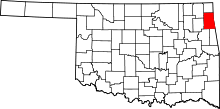 | |
| Towns | ||
| CDPs | ||
| Other unincorporated communities | ||
| Footnotes | ‡This populated place also has portions in an adjacent county or counties | |