Westfield, North Carolina
Westfield in an unincorporated community in the Westfield Township of Surry County, North Carolina.
History
Westfield was originally named "Tom's Creek" but the name was later changed to Westfield in recognition of the Quaker ("Society of Friends") mission, first established here in 1760, by members of New Garden Friend's Meeting from Guilford County, North Carolina. (Powell 1968, p. 525). Early Friends from New Garden traveled through Quaker Gap in the Sauratown Mountains to establish the Meeting at Tom's Creek, and the area was referred to at the time as "the western field,' later becoming "Westfield." Westfield is the childhood hometown of Kenneth Lowe, president of Scripps Networks Interactive, and the creator of Home & Garden Television.
Demographics
Westfield's Zip Code Tabulation Area (Zip Code 27053) has a population of about 2,811 as of the 2000 census. The population is 50.1% male and 49.9% female. About 90.9% of the population is white, 7.0% African-American, 2.8% Hispanic, and 1.4% of other races. 0.5% of people are two or more races.
The median household income is $32,768 with 10.2% of the population living below the poverty line.
Geography
The community has an elevation of 1,160 feet above sea level. Landmarks near the center of the community include the community post office, cafeteria and gymnasium buildings of the old Westfield Elementary School, the headquarters building of the Westfield Volunteer Fire Department, Westfield Friends meeting house, and Westfield Baptist Church. North Carolina Highway 89, also known as Westfield Road, serves as the main thoroughfare in the community, connecting it to Mount Airy and Interstate Highway 74 to the west, and Danbury, the Stokes County seat to the east. Old Westfield Road, terminating at HW 89, connects the community to Pilot Mountain and, via North Carolina Highway 52, to Winston-Salem to the south-east.
Notable people
- Howie Nunn, Major League Baseball player with the St. Louis Cardinals and Cincinnati Reds
References
Powell, William S. (1968), The North Carolina Gazetteer: A Dictionary of Tar Heel Places, Chapel Hill: University of North Carolina Press, ISBN 0-8078-1247-1
External links
- Westfield Elementary School
- Westfield Volunteer Fire Department
- Profile of General Population and Housing Characteristics: 2010 for Zip Code Tabulation Area 27053
Coordinates: 36°28′30″N 80°26′49″W / 36.475°N 80.447°W
Municipalities and communities of Surry County, North Carolina, United States | ||
|---|---|---|
| City | 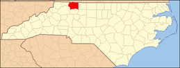 | |
| Towns | ||
| CDPs | ||
| Unincorporated communities |
| |
| Footnotes | ‡This populated place also has portions in an adjacent county or counties | |