Pilot Mountain, North Carolina
| Pilot Mountain, North Carolina | ||
|---|---|---|
| Town | ||
| ||
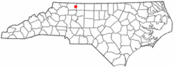 Location of Pilot Mountain, North Carolina | ||
| Coordinates: 36°23′4″N 80°28′9″W / 36.38444°N 80.46917°WCoordinates: 36°23′4″N 80°28′9″W / 36.38444°N 80.46917°W | ||
| Country | United States | |
| State | North Carolina | |
| County | Surry | |
| Area | ||
| • Total | 1.7 sq mi (4.5 km2) | |
| • Land | 1.7 sq mi (4.5 km2) | |
| • Water | 0.0 sq mi (0.0 km2) | |
| Elevation | 1,158 ft (353 m) | |
| Population (2010) | ||
| • Total | 1,477 | |
| • Density | 742.3/sq mi (286.6/km2) | |
| Time zone | Eastern (EST) (UTC-5) | |
| • Summer (DST) | EDT (UTC-4) | |
| ZIP code | 27041 | |
| Area code(s) | 336 | |
| FIPS code | 37-51820[1] | |
| GNIS feature ID | 0992211[2] | |
| Website | www.townofpilotmountain.com | |
Pilot Mountain is a town in Surry County, North Carolina, United States. The population was 1,477 at the 2010 census. It is named for the nearby landmark of Pilot Mountain, a distinctive geological formation. It is believed to be the inspiration for the fictional town of Mount Pilot on The Andy Griffith Show and Mayberry RFD.
History
The Bank of Pilot Mountain, (Former) was listed on the National Register of Historic Places in 1997.[3]
Geography
Pilot Mountain is located at 36°23′4″N 80°28′9″W / 36.38444°N 80.46917°W (36.384407, -80.469083).[4]
According to the United States Census Bureau, the town has a total area of 1.7 square miles (4.4 km2), all of it land.
Demographics
| Historical population | |||
|---|---|---|---|
| Census | Pop. | %± | |
| 1900 | 710 | — | |
| 1910 | 652 | −8.2% | |
| 1920 | 707 | 8.4% | |
| 1930 | 1,010 | 42.9% | |
| 1940 | 925 | −8.4% | |
| 1950 | 1,092 | 18.1% | |
| 1960 | 1,310 | 20.0% | |
| 1970 | 1,309 | −0.1% | |
| 1980 | 1,090 | −16.7% | |
| 1990 | 1,181 | 8.3% | |
| 2000 | 1,281 | 8.5% | |
| 2010 | 1,477 | 15.3% | |
| Est. 2015 | 1,465 | [5] | −0.8% |
As of the census[1] of 2000, there were 1,281 people, 585 households, and 363 families residing in the town. The population density was 742.3 people per square mile (285.9/km²). There were 644 housing units at an average density of 373.2 per square mile (143.7/km²). The racial makeup of the town was 87.82% White, 9.29% African American, 0.16% Native American, 0.47% Asian, 0.86% from other races, and 1.41% from two or more races. Hispanic or Latino of any race were 1.25% of the population.
There were 585 households out of which 25.5% had children under the age of 18 living with them, 45.3% were married couples living together, 14.7% had a female householder with no husband present, and 37.8% were non-families. 34.5% of all households were made up of individuals and 15.7% had someone living alone who was 65 years of age or older. The average household size was 2.19 and the average family size was 2.81.
In the town the population was spread out with 22.5% under the age of 18, 7.3% from 18 to 24, 27.3% from 25 to 44, 23.7% from 45 to 64, and 19.2% who were 65 years of age or older. The median age was 40 years. For every 100 females there were 79.9 males. For every 100 females age 18 and over, there were 75.4 males.
The median income for a household in the town was $33,529, and the median income for a family was $42,279. Males had a median income of $31,522 versus $21,250 for females. The per capita income for the town was $18,526. About 11.9% of families and 15.5% of the population were below the poverty line, including 25.1% of those under age 18 and 17.2% of those age 65 or over.
References
- 1 2 "American FactFinder". United States Census Bureau. Retrieved 2008-01-31.
- ↑ "US Board on Geographic Names". United States Geological Survey. 2007-10-25. Retrieved 2008-01-31.
- ↑ National Park Service (2010-07-09). "National Register Information System". National Register of Historic Places. National Park Service.
- ↑ "US Gazetteer files: 2010, 2000, and 1990". United States Census Bureau. 2011-02-12. Retrieved 2011-04-23.
- ↑ "Annual Estimates of the Resident Population for Incorporated Places: April 1, 2010 to July 1, 2015". Retrieved July 2, 2016.
- ↑ "Census of Population and Housing". Census.gov. Retrieved June 4, 2015.
External links
Municipalities and communities of Surry County, North Carolina, United States | ||
|---|---|---|
| City |  | |
| Towns | ||
| CDPs | ||
| Unincorporated communities |
| |
| Footnotes | ‡This populated place also has portions in an adjacent county or counties | |